Tsoka Lake

Embedded deep within one of the remote mountain valleys of the Garzě Tibetan Autonomous Prefecture, Tsoka Lake appears like a small jewel embedded into the surrounding hillside. The lake itself only covers a surface area of around 3 square kilometres (1 sq. mi), but don’t let its small size fool you. As the old saying goes, big things often come in small packages! The name “tsoka” roughly translates to mean “the black water in the stone forest,” which is in reference to the lake’s characteristically dark waters and the surrounding snow-capped mountains that loom over it. As proof of the lake’s holy status, you’ll find numerous halls and buildings situated along its shores, which were all built in the traditional Tibetan style and together make up the Tsoka Monastery. 

The monastery itself dates back to the 14th century and is one of few monasteries that follows the teachings of two different sects of Tibetan Buddhism. Although the Gelug or “Yellow Hat” sect of Tibetan Buddhism continues to be by far the most popular, monks living in the Tsoka Monastery follow a combination of teachings from the Nyingma and Kagyu sects, which rank alongside the Gelug sect as two of the four most important sects of Tibetan Buddhism. In fact, the Nyingma sect is widely considered to be the oldest, with a history that stretches all the way back to the 8th century!

Make your dream trip to the Huiyuan Monastery come true on our travel:

Explore the Mystery of Tibetan Culture Festival by Festival

Yihun Lhatso

Resting at an altitude of a staggering 4,100 metres (13,500 ft.), Yihun Lhatso is a glacial alpine lake that shimmers like a sapphire embedded at the base of the surrounding snow-capped mountains. It can be found at the foot of Rongme Ngatra, which rises to a height of 6,168 metres (20,236 ft.) and is thus the tallest peak belonging to the Chola Mountains. Melted ice from the snowy cap of Rongme Ngatra makes its way down the steep mountainside until it eventually feeds into the lake, which is why the waters of the lake are breathtakingly pristine and crystal clear in appearance. If you are lucky, you may even spot herds of rare white-lipped deer grazing by its shore!

The lake received its name thanks to a rather sombre legend, which recounts the story of a Tibetan woman named Zhumu. Zhumu was the beloved concubine of a famous Tibetan folkloric figure named King Gesar, whose heroic deeds are the subject of The Epic of King Gesar. According to this legend, Zhumu decided to travel alone to the lake in order to contemplate its beauty, but she was so captivated by it that she couldn’t bring herself to leave. In the end, she was so drawn in that she began walking further and further into the lake, until she sunk beneath its azure waters. From then onward, the lake was known as Yihun Lhatso, which roughly translates to mean “the holy lake of the fallen heart” in reference to how Zhumu’s heart was taken in by its unparalleled beauty.

Alongside being a site of undeniably natural beauty, the lake is revered as a sacred place by the local Tibetan people. It is located within the Garzě Tibetan Autonomous Prefecture of Sichuan province, which once belonged to a region of the ancient Tibetan Empire known as Kham. The Tibetan people living in this region are culturally distinct from both the Tibetan people living in Tibet proper and those living in Qinghai province, so they are often referred to more specifically as Khampa Tibetans. For hundreds of years, these Khampa Tibetans have worshipped the lake as a holy place according to Tibetan Buddhism. Along the shore, you’ll find hundreds of boulders that have been carefully carved into what are known as mani stones.

Mani stones are any stone plates, rocks, or pebbles that have been inscribed with the six-syllabled Buddhist mantra known as “Om Mani Padme Hum.” They are often placed either on their own, in piles, or as part of walls and serve as a form of prayer or religious offering. As you wander along the shores of Yihun Lhatso, you will notice that many of boulders have been dredged from the lake or nearby streams and carved into mani stones, which blend seamlessly into the natural landscape and serve as a testament to this lake’s spiritual reputation. Alongside the carving of mani stones and the placing of multi-coloured prayer flags, many Tibetan monks and laypeople travel to the lake every year on religious pilgrimages. During these pilgrimages, they will take part in what’s known as a kora or pilgrimage circuit, where they walk around the entirety of the lake as a form of meditation and worship. Given the colossal size of natural sites like Yihun Lhatso, these pilgrimage circuits are huge undertakings and can take upwards of weeks or even months to complete! 

Make your dream trip to the Huiyuan Monastery come true on our travel:

Explore the Mystery of Tibetan Culture Festival by Festival

The Palcho Monastery

Nestled within a river valley in the town of Gyantse in Shigatse Prefecture, Tibet, the Palcho Monastery represents an unusual intermingling of faiths. Sometimes referred to as the Pelkor Chode Monastery, this venerable place of worship is one of the only monasteries that incorporates teachings from multiple sects of Tibetan Buddhism. Within its walls, you’ll find artwork and scriptures dedicated to the Sakya, Gelug, and Kagyu sects of Tibetan Buddhism.

The main temple of the monastery complex is known as Tsuklakhang and was built sometime between 1418 and 1425. This three-storey building follows the typical Tibetan style of architecture. The ground floor has been divided into three parts: the front hall, the main hall and the back hall. There is a Dharmapāla[1] chapel on the right side of the front hall and a Buddha chapel on its left side. The main hall is where the monks study and chant, and is supported by a sequence of 48 colossal pillars. 

Within this hall, there is a spectacular 8-metre-tall bronze statue of the Buddha that is the main subject of worship. Like the front hall, there are also two small chapels on either side of the main hall. The back hall, by contrast, is much smaller and is only supported by 8 pillars. It also contains a bronze statue of Buddha as its main subject of worship. There are another 5 chapels on the first floor and one large chapel on the top floor, which is home to a series of breathtakingly beautiful murals. Once the temple was originally completed, it became an important monastery for the Sakya sect of Tibetan Buddhism.

In 1427, the Tibetan noble Rabten Kunzang Phak donated vast sums of money in order to expand the monastery, which led to the addition of what’s known as a Kumbum[2] and a few other buildings. This colossal construction project was led by a monk named Khedrup Je, who was posthumously recognised as the first Panchen Lama. The Kumbum at the Palcho Monastery rose to become not only the most prominent of its kind in Gyatse, but also the most famous Kumbum in Tibet. This particular Kumbum is made up of a staggering ten storeys. From the first floor to the ninth floor, you will find 76 chapels with 108 doors. Each chapel contains a variety of stunning Buddhist statues. You can recognize the artistic value of each and every statue simply by looking at the vivid facial expressions of the figures being portrayed. Thanks to this expansive statue collection, this Kumbum is sometimes referred to as the “Hundred Thousand Buddha Stupa.”

The layout of the first floor, each number represents a chapel

Alongside the statues, the murals are another invaluable and celebrated artistic asset of the Palcho Monastery. They can be found throughout every chapel of the Kumbum and in every room of the main temple. The murals in the main temple were painted following a deliberate and carefully planned design, which was based around the function of the hall and who would typically be worshipping within it.  For example, in the main hall you will find the three main Buddhas associated with Buddhism: Gautama Buddha, Dīpankara Buddha[3] and Maitreya Buddha [4]. The murals in the Kumbum are mainly dedicated to depicting stories from the Vajrayāna sect of Buddhism [5].

Throughout its long history, the Palcho Monastery has suffered through three major catastrophes. In 1904, a British expedition decided to infiltrate Lhasa via Gyantse. After about 100 days of warfare, the people of Gyantse were unable to prevent this invasion. The British expedition therefore captured Gyantse and decided to make the Palcho Monastery their temporary military base, which caused a huge amount of damage to the interior. The second catastrophe that caused colossal damage to the monastery happened during the 1959 Tibetan Uprising, the event which prompted the 14th Dalai Lama to flee to India. The final catastrophe came only ten years later, when the monastery was ransacked during the Cultural Revolution.

Fortunately, the entire monastery has been restored and the restoration project did a wonderful job of repairing the damage. Nowadays, when you visit the monastery, you will still be struck by its vibrancy and beauty. You may find, however, that the colour on some of the murals has changed due to the burning of the ceremonial butter lamps. This is not a scar left by historical atrocities, but is simply a mark of time and religious devotion.

[1] A Dharmapāla is a type of wrathful god in Buddhism.

[2] A Kumbum is a multi-storied stūpa of Buddhist chapels in Tibetan Buddhism.

[3] Dīpankara is one of the Buddhas of the past.

[4] Maitreya is regarded as the future Buddha.

[5] The term Vajrayāna is used to refer to one of the major sects of Buddhism, which is sometimes known as the Tantric sect. It mainly focuses on the chanting of mantras, the use of special gestures known as mudras, and visualization methods with the help of paintings called mandalas.

Make your dream trip to the Palcho Monastery come true on our travel:  Explore Untouched Wilderness on Our Full Circuit of Tibet

The Tagong Monastery

In 641 AD, the Han Chinese Princess Wencheng of the Tang Dynasty (618-907) made the long journey to Tibet in order to marry Songtsän Gampo, the founder of the Tibetan Empire (618–842). Emperor Taizong of the Tang Dynasty gave her a statue of Shakyamuni[1] Buddha as her dowry. That being said, this was no normal statue! It was a 1.5-metre (5 ft.) tall life-sized  depiction of the historical Buddha at the age of 12, which is known as the Jowo Shakyamuni or the Jowo Rinpoche. The statue was supposedly carved at the behest of the Buddha himself.

When the princess and her retinue were traveling past Tagong, something unexpected happened. The statue of the Jowo Shakyamuni refused to move! The princess interpreted this as  Buddha’s intention to stay there. There was one major problem with this, however. The statue was meant to be brought to Lhasa and presented to Songtsän Gampo!  The princess decided that the only solution would be to make a copy of the statue, which would be left at Tagong. Once the new statue had been completed, the original statue was finally able to be moved again and continued on its journey. Later on, Songtsän Gampo issued an order for 108 Buddhist temples to be built that would face the Tang Empire. The Tagong Monastery, which contains the copy of the Jowo Shakyamuni statue, was the 108th temple to be built. You can find the original statue in the Jokhang Temple of Lhasa.

Located in the Garzê Tibetan Autonomous Prefecture of Sichuan Province, near to the side of the Sichuan–Tibet road, the Tagong Monastery belongs to the Sakya sect of Tibetan Buddhism. The term “tagong” means “the bodhisattva is glad” in the Tibetan language. The temple complex itself includes the Mahavira Hall or the Main Hall, the Jowo Shakyamuni Hall, the Dharmapāla[2] Hall, the Thousand-Hand Avalokiteśvara Hall,  three other lesser halls, the pagoda forest, and the dormitories of the monks. There are nearly 200 prayer wheels that can be found throughout the monastery as well. 

Like other monasteries, the Mahavira Hall within the Tagong Monastery is the place where monks learn Buddhist scripture and chant. The murals in this hall have been preserved in their original condition for over 300 years. Within these gorgeous murals, you will find images of Buddhas, Bodhisattvas, the “Five Venerable Supreme Masters” of the Sakya sect, and stories of famous Buddhist monks. 

As the name suggests, the Jowo Shakyamuni Hall houses the legendary statue of Jowo Shakyamuni, which is decorated with colourful gems. Within this hall, there is also a statue known as the Thousand-Hand Avalokiteśvara, which was also sculpted under the instruction of Princess Wencheng. Locals and pilgrims believe that this statue is so sacred that it has certain magical powers.

Another legendary sacred relic within this hall is the supposed footprint of Drogön Chogyal Phagpa, who was one of the “Five Venerable Supreme Masters” of the Sakya sect and the fifth Sakya Trizin [3]. He reputedly left this footprint when he visited the monastery sometime during the 13th century.

The Thousand-Hand Avalokiteśvara Hall is relatively new compared to the rest of the complex, as it was only built in 1997. It houses the tallest bronze statue of the Thousand-Hand Avalokiteśvara in the entire Tibetan area.

Behind the Tagong Monastery is the holy Mount Yala. This snow-capped peak shines under the cloudless blue skies of the plateau. For hundreds of years, numerous monks have traveled to the mountain and practiced their faith on the remote mountainsides. According to legend, there are warm springs dotted throughout the Mount Yala area that can clean any hopeful Buddhist monk of their impurities.

[1] Shakyamuni: One of the titles of Gautama Buddha, the central figure and founder of the Buddhist faith. It is derived from the place named Sakya, which is where he was born.

[2] A Dharmapāla is a type of wrathful god in Buddhism.

[3] Sakya Trizin is the traditional title of the head of the Sakya school of Tibetan Buddhism.

Make your dream trip to the Tagong Monastery come true on our travel:

Explore the Mystery of Tibetan Culture Festival by Festival

The Huiyuan Monastery

At the beginning of the 18th century, Tibet was in turmoil as two powerful political groups became embroiled in the search for the next Dalai Lama. One group was led by a man named Lha-bzang Khan, who was the ruler of the Khoshut Khanate [1]. The leader of the opposing faction was known as Desi Sangye Gyatso and was widely regarded as the most powerful man in Tibet, particularly since he had been the regent of the 5th Dalai Lama. ON top of all of this internal political power, Desi Sangye Gyatso also had a good relationship with the Dzungar Khanate [2]. The conflict only ended because Desi Sangye Gyatso was murdered. It seems Lha-bzang Khan would not escape so lightly either, as the Dzungar Khanate invaded Tibet in 1717 and he was killed in the ensuing chaos.

The invasion  subsequently quashed by an expedition sent by the Qing Dynasty (1644-1912 AD), which was the ruling regime of China at the time. This Qing military expedition expelled the Dzungars from Tibet in 1720. In 1721, they enthroned Kelzang Gyatso as the seventh Dalai Lama in a ceremony at the Potala Palace.

In spite of this outward calm, however, secret dissent and popular discontent was increasing during the new Tibetan cabinet era. This eventually led to the assassination of the leader and chaos reigned once again. The new ruling leader, a man named Polhané Sönam Topgyé, decided to take revenge on those who were responsible for the assassination. In a shocking twist, it was believed that the father of the seventh Dalai Lama had been involved in planning the assassination!

From here onwards, the story seems to diverge, as there are two different versions of what may have happened next. The seventh Dalai Lama was either summoned to Beijing by the Qing government but was stopped in Litang by Polhané Sönam Topgyé, or he was ordered to go to Litang, which was his birth place. 

Regardless of the reasoning behind it, the seventh Dalai Lama Kelzang Gyatso was sent to Litang, where the Huiyuan Monastery was built for him. Meanwhile, the 5th Panchen Lama was called to Lhasa by the Qing emperor Yongzheng in order to take control of certain areas within the ancient region of Tibet. From then on, the Panchen Lama’s power was used to balance out the power of the Dalai Lama. 

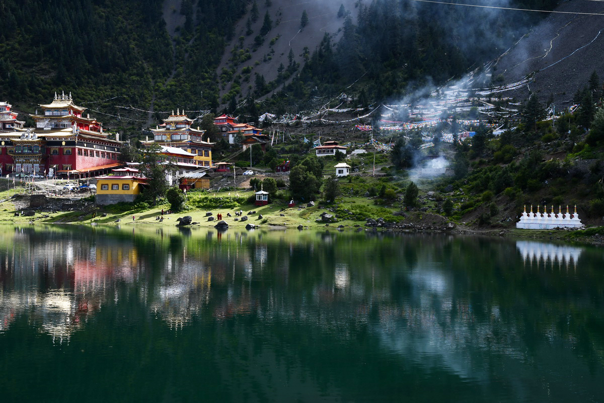
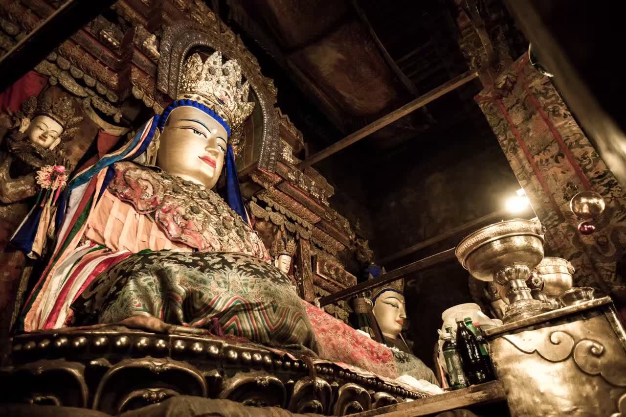
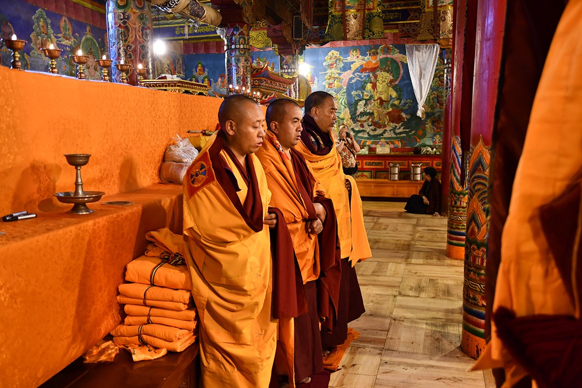
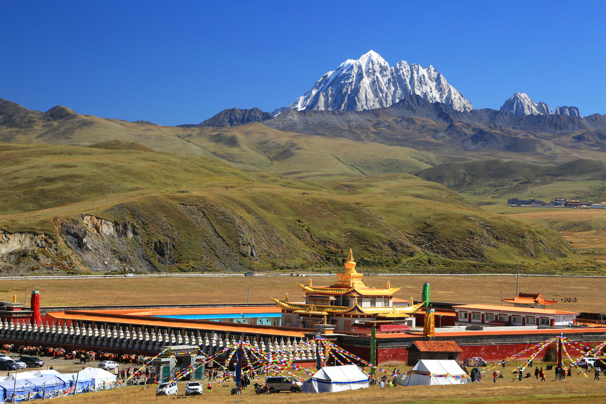
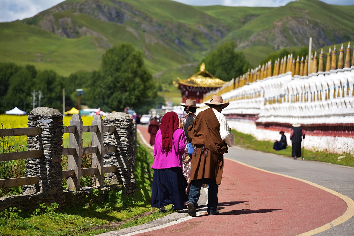
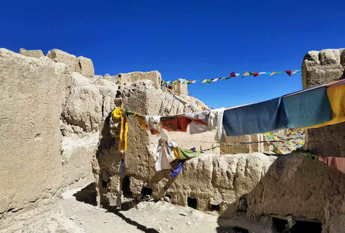
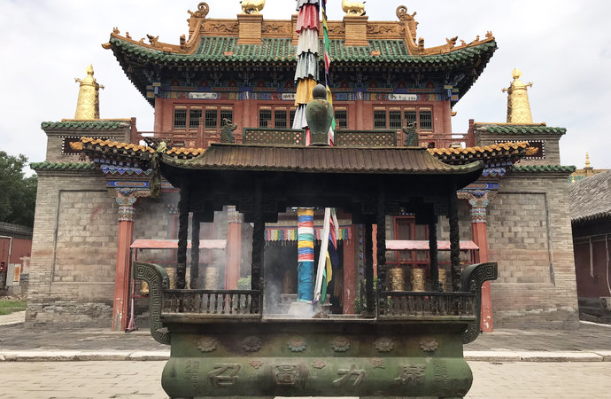
When you are standing in front of the Huiyuan Monastery, you may be surprised to find that such an isolated monastery with such a simple appearance is related to some of the most influential moments in Tibetan history. The Huiyuan Monastery belongs to the Gelug sect of Tibetan Buddhism and, in terms of its architecture, it follows the typical Tibetan Buddhist monastery style. You may get the feeling that the Huiyuan Monastery is a simplified version of the Drepung Monastery, but it incorporates some royal architectural features.

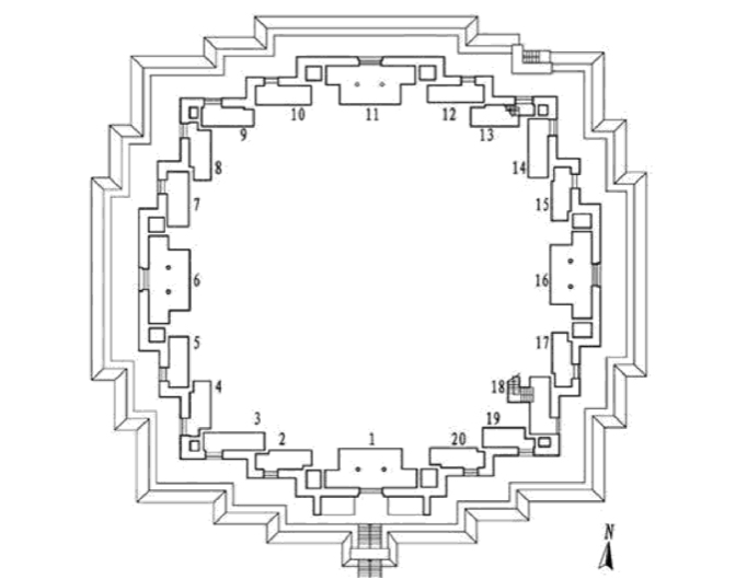
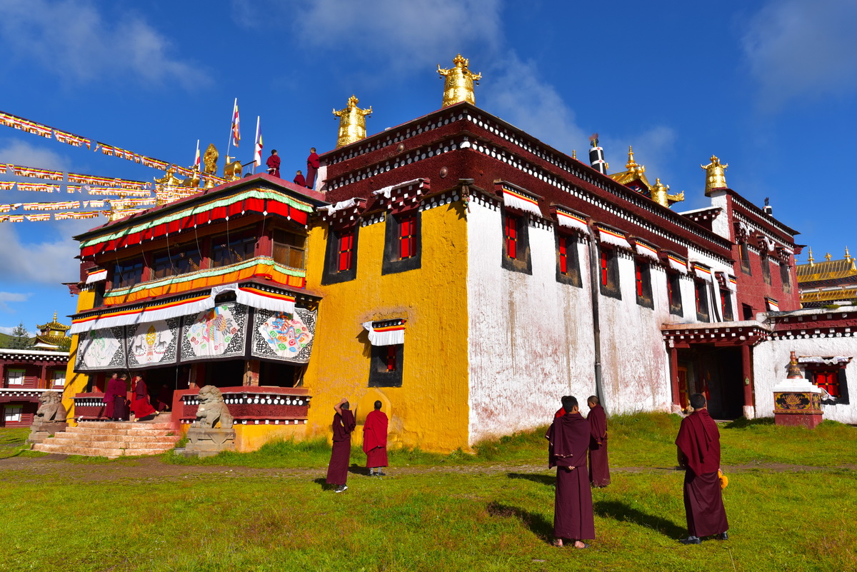
The monastery is located in the county of Daofu within the Garzê Tibetan Autonomous Prefecture. The entire complex covers a colossal area of around 83 acres and contains more than one thousand rooms. According to a typical monastery’s layout, the main structures are the Buddha Hall, the studying area for the monks, and the monks’ dormitories. Alongside these main structures, the Huiyuan monastery has something extra special, the steles pavilion, which is home to five steles that date back to the Qing Dynasty (1644-1911).

The 7th Dalai Lama Kelzang Gyatso lived within the Huiyuan Monastery for seven years. In 1735, the Yongzheng Emperor sent his own brother, Prince Guo, to help Kelzang Gyatso return to Lhasa. During his time at the monastery, Prince Guo wrote a long poem that described the local life and culture, which was made into a stele. However, it was destroyed during the Cultural Revolution (1966-1976). 

The significance of the Huiyuan Monastery didn’t end up when Kelzang Gyatso left. Over one hundred years later, fate would shine on the monastery yet again, as the 11th Dalai Lama Khedrup Gyatso was born near the Huiyuan Monastery. In response to this fortuitous event, the Qing court bestowed an honour known as the “Nine Dragons and Nine Lions” on  the monastery. “Nine Dragons” refers to the Qing court, while “Nine Lions” represents the Kashag [3]of Tibet. Visitors can find the “Nine Dragons and Nine Lions” on the wall outside of the main hall.

During its long and venerable history, the Huiyuan Monastery was supported directly by the royal family of the Qing Dynasty. The buildings and Buddhist art in the monastery, however, were tragically damaged during the Cultural Revolution. In 1982, the government provided grants to the complex so that they could be repaired. 

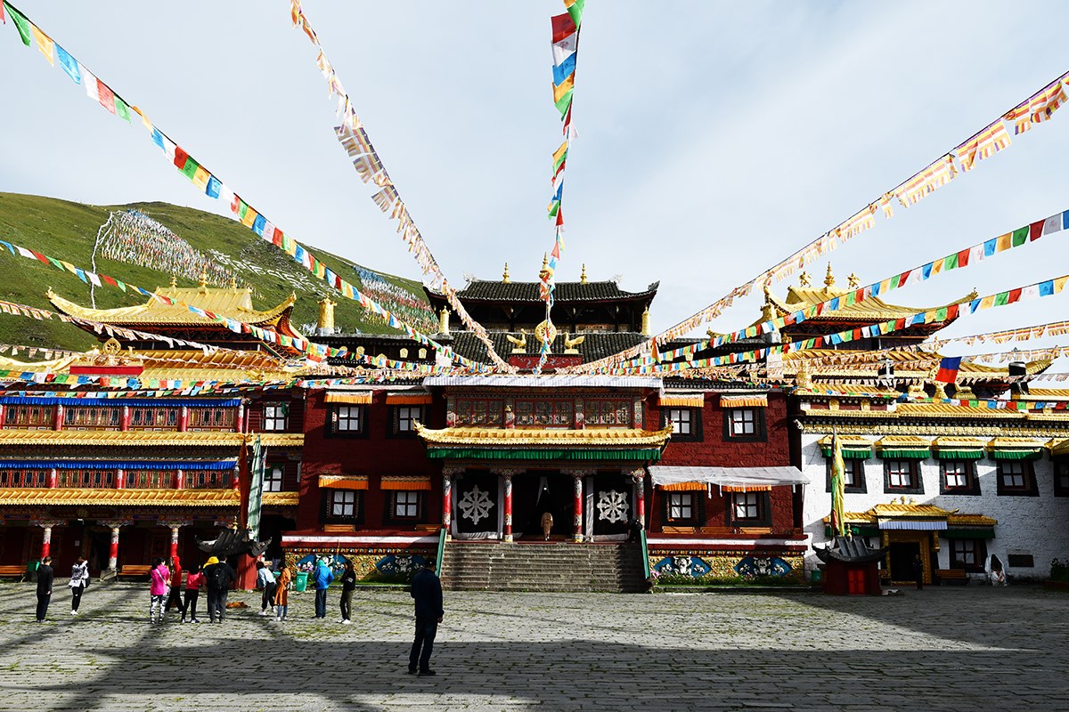
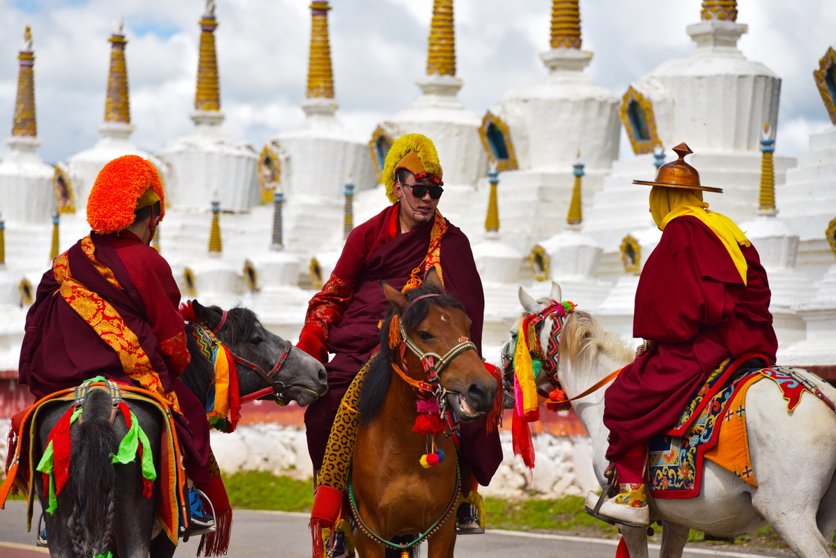
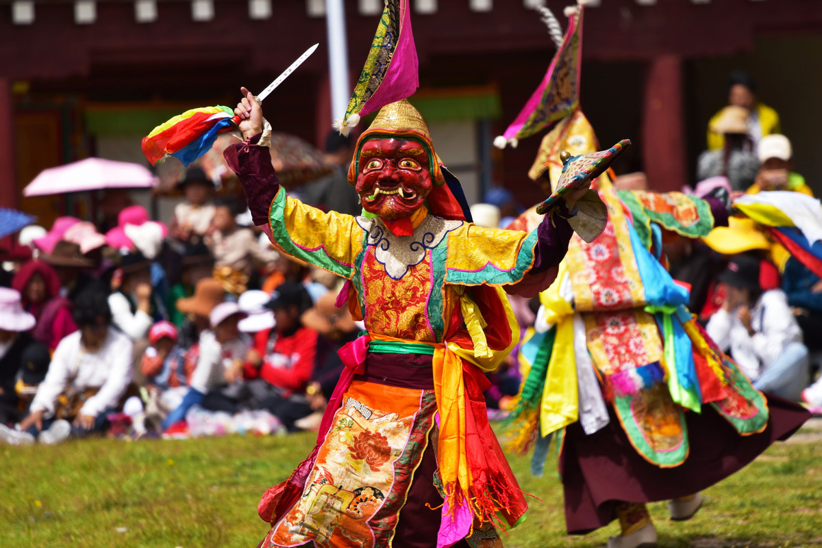
Every year, from the 1st to the 7th of June according to the Tibetan Calendar, a prayer ceremony and other religious activities are held in the Huiyuan Temple. Collectively, these festivities are known as the Mask Dance Festival. 

On the first day, the monks who inhabit the temple will dance in gorgeously decorative dress, but without their iconic masks. The next day is dedicated entirely to the prayer ceremony, where worshippers pray for blessings and a brighter future. On the third day, the local people and monks will burn incense and make sacrifices to the gods in the hopes that their homes will be protected from future disasters. On the fourth day, the monks don their traditional dress again, along with their iconic masks, and perform the mask dance, which is known as the Cham Dance. From the 5th through to the final 7th day, there are horse racing events and other folk activities.

1) The Khoshut Khanate was a kingdom located on Tibetan Plateau, which ruled the area from 1642 to 1717.

2) The Dzungar Khanate (1634-1755) was an Inner Asian khanate ruled by the Oirat Mongolians.

3) The Kashag was the governing council of Tibet from 1721 right through until the 1950s.

Make your dream trip to the Huiyuan Monastery come true on our travel:

Explore the Mystery of Tibetan Culture Festival by Festival

The Ruins of the Guge Kingdom

Hidden deep within the rocky mountains, the ruins of the Guge Kingdom continue to tell their story. This  cluster of relics made up of ancient palaces and temples are all that remains of the once illustrious Guge Kingdom. Thanks to the dry climate and cool weather, these earthen structures have been beautifully well-preserved for hundreds of years.The murals and other artistic works found throughout the complex demonstrate just how prosperous the kingdom had been in its heyday.

In 842 AD, a ruler by the name of Langdarma, who served as the ninth emperor of the Tibetan Empire, was assassinated by a monk. Rather than mourning the loss of their father, his two sons immediately began a civil war in order to seize the throne. In the end, it was the son born by his first wife who emerged victorious and gained control of the central kingdom based in Lhasa. The son from his second wife, who was named Namde Ösung, lost the war and fled to the eastern territories. However, this regime faced many challenges and was characterized by its instability. In 930 AD, the grandson of Namde Ösung, who was known as Nyi Ma Mgon, decided he wanted to expand his territory and set out to conquer new land. He chose 100 soldiers to go with him and together they headed towards western Tibet.

They arrived at the holy Manasarovar Lake, which shimmers in sapphire-hued splendor at the base of the sacred Mount Kailash. From there, Nyi Ma Mgon conquered the prefecture of Ngari and established his own kingdom. He set the capital in the city of Guge.  

Nyi Ma Mgon divided his territory among his three sons. The eldest son took control of Ladakh, which was known as the Kingdom of Lakes. The second son Bkra Shis Mgon received the rocky Guge Kingdom. His third son was awarded Puhrang, which was surrounded by lofty snow-capped mountains.

Bkra Shis Mgon’s eldest son Srong Nge took the throne on his father’s death. He was a devout Buddhist and this influenced much of his reign. He sent monks to India so that they could study Buddhism in more depth, he built the Tholing Monastery, and he finally stepped down as ruler to become a monk, passing the throne on to his younger brother. From then onwards, he was known by his religious name of Ye Shes ‘Od.

According to legend, Ye Shes ‘Od started a war with a neighbouring nation ruled by an ethnic group known as the Karluks,  in order to get enough gold so that he could invite a well-known Indian Buddhist religious leader named Atiśa to visit his kingdom. His plan, however, ended up backfiring horrible, as he lost the war and was captured! The leader of the Karluks promised to release him if he converted to Islam.  As you can probably guess, Ye Shes ‘Od refused the offer. Instead, he accepted the leader’s second conditional offer, which was to buy his freedom with a pile of gold that was the same height as him! When the time came to make good on the offer, Ye Shes ‘Od nobly told his people that he would rather that they use the gold to invite Atiśa to the kingdom. In the end, Ye Shes ‘Od died in prison and never made it back to his home. When Atiśa heard this story, he was so moved that he visited the Guge Kingdom in 1042 and taught Buddhism there for 3 years.  From then onwards, Buddhism enjoyed a golden era in Guge.

Hundreds of years later, in 1624, a Jesuit preacher named António de Andrade arrived in Guge. The King at the time was amazed by Andrade’s teachings and allowed him to build a chapel, where he conducted his missionary work. While the King was pleased with his decision, the Buddhists living in Guge certainly were not and it earned the ire of the Chief Lama, who also happened to be the King’s brother! Chief Lama called on more and more people to become monks in his monastery, while the king asked them to abandon Buddhism. The King, however, did have a good reason for doing this. For many years, the Guge Kingdom had been menaced by the hostile Kingdom of Ladakh. The King recognized that he needed more soldiers, not more monks.

A revolt eventually took place in 1630, and the chaos allowed Ladakh forces to infiltrate Guge. Tsaparang was under siege for months before the King finally surrendered. The royal family and the preachers were captured. This marks the end of the 700-year-long Guge Kingdom.

Nowadays, all that remains of the once illustrious Guge are a cluster of ruins, which include more than 400 rooms, 58 forts, 28 pagodas, 4 temples, 3 tombs, 1 armoury, and some other caves. The whole town is on a hill that is about 300 meters high. The ruins can be divided into three parts: the palace is on the top, the temples are in the middle, and the residential buildings are at the bottom. The rooms are connected by a complicated underground tunnel system.

Restoration of relics was completed in 2016, transforming the Guge Ruins into a living museum. Alongside admiring the magnificent ruins themselves, visitors are also able to see some of the stunning Buddhist art that the kingdom was once famous for, particularly the murals within the four temples. 

Explore more about the mysterious Guge Kingdom on our travel:

Explore Untouched Wildness on Our Full Circuit of Tibet

Xilituzhao Temple

Inner Mongolia may be known as the ancient birthplace of rugged horsemen and fearsome warriors, but its official religion is one marked by peace and tranquillity. The enduring influence of Tibetan Buddhism can be seen throughout the region in the form of elaborate monasteries, colourful prayer flags, and vibrant religious ceremonies. Located in Inner Mongolia’s capital of Hohhot, Xilituzhao Temple is one such spiritual gem. It is dedicated to the Gelugpa or “Yellow Hat” sect of Tibetan Buddhism and was originally built in 1585 during the Ming Dynasty (1368-1644) for the 3rd Dalai Lama, although it had to be reconstructed toward the end of the Qing Dynasty (1644-1912) following a disastrous fire. It may be overshadowed by its larger neighbour, Dazhao Temple, but it is by no means the underdog!  

Its architecture is a unique blend of traditional Han Chinese and Tibetan features, reflecting the culturally diverse nature of Hohhot. After all, it doesn’t get much more multi-ethnic than a Mongolian city in China following a Tibetan religion! The temple itself is a typically symmetrical complex, with various side halls, storehouses, pagodas, and towers surrounding the central halls. A large and intricately carved archway leads into the complex, where you’ll be met with Da Dian Hall. In front of the hall, a monument written in four different languages attests to the multicultural character of this historic site. 

Its exterior decorations and the colourfully glazed tiles of its interior walls are markedly Tibetan in style, setting this building apart from others in the complex. The hall is further split into two parts: the Buddha Worshipping Hall, which was tragically damaged during a fire; and the Sutra Hall, which is in comparatively good condition. Not far from Da Dian Hall, the Lama Pagoda looms over the complex at 15 metres (49 ft.) in height and is entirely crafted from clear white marble.  

“Xilitu” translates to mean “Holy Seat” in Mongolian and refers to the fact that, since 1735, Xilituzhao Temple has been the residence of the Grand Living Buddha, who serves as the main authority on all Buddhist religious activities in Hohhot. While the temple is a popular tourist attraction, it is still an active house of worship and is currently home to the 11th Grand Living Buddha, along with numerous other monks. Throughout the year, it plays host to a number of religious activities, conferences, and festivals. Even at the grand old age of 432, it seems this venerable temple is still a long way from retirement!

Yang Pass

During the early Han Dynasty (206 BC–220 AD), the western border of the empire was ceaselessly invaded and terrorised by the fearsome Xiongnu people. These hardy nomads were both feared and despised by the Han Chinese, who regarded them as their arch nemeses. Rather than meet the formidable Xiongnu warriors in battle, many of the Han rulers chose to marry off their daughters to Xiongnu leaders in a feeble attempt to broker peace. Yet it seemed that even the most beautiful maidens weren’t enough to quell the Xiongnu people’s desire for the fertile land that lay within Emperor’s territory! This was all set to change in 141 BC, when the valiant Emperor Wu rose to power. 

He abolished this cowardly policy and replaced it with his own strategic military agenda. In 121 BC, fierce counterattacks led by the celebrated military general Huo Qubing eventually drove the Xiongnu troops out of the west and allowed Emperor Wu to secure the western frontier. In order to cement this victory, the Emperor established two vital fortifications: Yumen Pass and Yang Pass. By strengthening the border and helping to prevent further invasions from the Xiongnu, they became the most significant passes along the western section of the Great Wall. Located within the narrow Hexi Corridor, approximately 70 kilometres (43 mi) from Dunhuang, Yang Pass was once a military fortress beyond compare.

During the Tang Dynasty (618-907), it welcomed the return of the illustrious monk Xuanzang, whose fabled pilgrimage to the west was eventually immortalised in the Chinese classic Journey to the West by Wu Cheng’en. The name “Yang” literally translates to mean “Sun”, but is actually in reference to its location south of Yumen Pass. This is derived from the fact that, due to the geography of the region, the sun shone in the south for most of the day, so the word “sun” became synonymous with the word “south”. However, in spite of its fortuitous past and cheerful name, it seems that Yang Pass suffered from a much maligned reputation. 

Both Yumen Pass and Yang Pass served as major trading posts along the Silk Road and acted as gateways to the mysterious Western Regions. Yang Pass swiftly became associated with the grief of parting, as it was often the place where people would see their loved ones off before they left the country on long journeys. In fact, the image of Yang Pass as a place of sorrow became so ingrained in Chinese culture that it featured frequently in Chinese literature, most notably in the Tang Dynasty poet Wang Wei’s “Seeing Yuan’er Off on a Mission to Anxi”. In the final line, Wang beseeches Yuan’er by saying: “Oh, my dear friend, let’s have one more cup of wine; out west beyond Yang Pass, old friends there’ll be none”. 

This poem went on to inspire the “Three Variations of Yang Pass”, a classical farewell song from the Tang Dynasty that has become one of the most famous pieces of Chinese music. The term “three variations” refers to the fact that the song must be sung three times, either partially or wholly, with some changes added each time. The earliest surviving version dates back to the Ming Dynasty (1368-1644), although the most popular is based on a score developed during the late Qing Dynasty (1644-1912). It seems oddly fitting that, like a noble swan song, this tragic melody would rise to popularity around the same time that Yang Pass fell into obscurity.

The decline of the Silk Road during the Song (960-1279) and Ming dynasties meant that Yang Pass gradually became obsolete and was eventually abandoned completely. It once was linked to Yumen Pass by a 64-kilometre (40 mi) stretch of wall, interspersed every 5 kilometres (3 mi) by a grand beacon tower. Nowadays, most of Yang Pass is buried under the shifting sands of the unforgiving desert. All that remains is a small section of wall and a single beacon tower measuring just 5 metres (16 ft.) in height. In 2003, the Yang Pass Museum was opened and features nearly 4,000 ancient Han Dynasty artefacts, paintings, and exhibitions about the history of this venerable gateway. It was built to imitate what the pass would have looked like in its heyday, complete with its own gate tower, general’s office, and barracks. In fact, it’s so well-designed that it could almost pass for the real thing!

The Lop Desert

Extending from the eastern edge of the Tarim Basin right through to the city of Korla, the Lop Desert is an almost perfectly flat expanse of barren sands. There are three major depressions dotted throughout the desert that were once mighty lakes: the Lop Nur Basin, the Kara-Koshun Basin, and the Taitema Lake Basin. In ancient times, these formed the terminal lakes of the Tarim-Konque-Qarqan river system. This lake system was a constant source of confusion and frustration to explorers, as changes in the course of the Tarim River would cause the lakes to change position. In fact, Lop Nur was nicknamed the “Wandering Lake” because, like a wayward bachelor, it struggled to find a place and settle down! 

Tragically, due to human intervention, the lakes of the Lop Desert have long dried up, but they once played a focal historical role in the development of the region. The capital of the ancient Loulan Kingdom was established near to Lop Nur sometime during the 2nd century BC and swiftly became an oasis city of paramount importance. When the kingdom fell under Chinese control during the 1st century BC, it was renamed Shanshan, but was unfortunately abandoned at some point during the 7th century AD. The site would remain hidden for over a thousand years, until it was rediscovered by the Swedish explorer Sven Hedin in 1899.

His excavation efforts revealed a number of houses and yielded several Chinese manuscripts from the Jin Dynasty (265-420), but the most magnificent discovery was yet to come. During the 20th century, Chinese archaeologists began excavating the area and came across a series of cemeteries. When the ancient graves were opened, they found mummies and burial items that had been beautifully preserved thanks to the extreme dryness of the desert climate. Among them was the “Beauty of Loulan”, who was so-named because of her long hair, soft skin, and peaceful expression. What makes the Beauty of Loulan and her neighbouring mummies so special is that their features are almost fully intact, in spite of the fact that they died over 3,000 years ago! Many of these mummies were of Indo-European origin and are believed to be a lost people known as the Tocharians.

When properly excavated, the earlier settlements near Lop Nur contained more primitive items, such as Mesolithic stone tools, basketry, bows, arrows, the horns of animals, simple jewellery, and fragments of copper. The later settlements were characterised by more advanced signs of civilization, including a canal, a dome-shaped Buddhist stupa[1], and the home of a Chinese official. According to historical records, Lop Nur boasted a length and breadth of roughly 120 to 160 kilometres (76 to 99 mi) during the Han Dynasty (206 BC–220 AD), but had already shrunk considerably by start of the Qing Dynasty (1644-1912). The building of dams by Chinese garrisons during the 20th century sounded the death knell for the lake, as it slowly withered into a salty marsh. Nowadays it is nothing more than a dried-up basin covered in a thick crust of salt. 

The desiccation of its native lakes, coupled with daytime temperatures that can reach 50 °C (122 °F), means that the Lop Desert is particularly hostile to life. The plethora of freshwater mollusc shells, the extensive belts of dead poplar trees, and the myriad beds of wilted reeds that rest within the wind-etched furrows of towering yardangs[2] are all that remain of what was once a series of verdant oases. When Sven Hedin travelled to the desert during the late 19th century, he witnessed solitary tigers prowling, packs of roving wolves, and groups of wild boar. Nowadays, the only large mammal that can survive in this barren wasteland is the hardy Bactrian camel, which ekes out a meagre living by feeding on the poplar forests and tamarisk shrubs that line the northern edge of the desert. From devastating sandstorms and lofty yardangs to barren salt flats and the blazing heat of the sun, the Lop Desert is an alien landscape that must be navigated with the utmost care.  

Notes:

[1]  Stupa: A hemispherical structure with a small interior designed for storing Buddhist relics and for private meditation.

[2] Yardang: A yardang is a type of landform that results from severe weathering over a period of approximately 700,000 years, where wind and rain strip all of the soft material from the rocks and leave only the hard material behind. Yardangs have characteristically wide bottoms that gradually taper off towards the top, giving them an appearance similar to the hull of a boat, although there are huge variations in their size and shape.  

Maling River Gorge

Carved into the rock over millions of years by the surging Maling River, the Maling River Gorge is about 75 kilometers (47 mi) long and has an average depth of between 200 to 400 metres (656-1312 ft.). Encompassed within its grandeur, you’ll find 18 beaches, 20 bends in the river, 30 deep ponds, over 60 bays, and more than 100 waterfalls. It is renowned throughout China for its myriad of Karst rock formations and its plethora of breathtaking waterfalls, which lend the region an ethereal quality. In-keeping with this fairytale aesthetic, calcium deposits on the cliff-faces sparkle in a variety of colours and are said to appear like elegant tapestries lining the gorge. Many of the waterfalls within the gorge are at least 100 metres (328 ft.) in height and cascade down the Karst rock-face with a captivating grace.

While taking a cruise or rafting down the river may seem like the obvious choice to make the most out of your trip, visitors can also hike along the gorge thanks to plank walkways that have been built halfway up the cliffs on both sides, which offer a closer view of the stunning rock formations peppered throughout the cliff-face. Arguably the most beautiful and famous attractions on offer with the Maling River Gorge are the Pearl Waterfall and the Rainbow Waterfall.

The Pearl Waterfall is so-named because it is located on a high cliff, meaning that its droplets are often dispersed by the wind and give the appearance of sparkling pearls floating in the air. By contrast, the Rainbow Waterfall is actually made up of a series of eight waterfalls that all cascade down nearby cliff-faces. Since they are all within such close proximity to one another, the area surrounding their base is frequently shrouded with mist and the splashing water can cause rainbows to appear when the sun is shining.

When it comes to rafting, the waters within the gorge are considered reasonably gentle, so don’t expect white-water rapids. While battling rapid waters may be exciting, you should never forget the wise words of the ancient Chinese proverb: “Water can not only float a boat, it can also sink it.” It is a great place, however, for those who are not familiar with rafting and want to give it a try. The only exception is the section of the river from Zhaojiadu to Wanfeng Lake, which is extremely dangerous and therefore only open to professional rafters, not the general public.

The gorge itself actually belongs to a much larger attraction known as the Maling River Gorge Scenic Area, which covers a colossal area of 450 square kilometres (174 sq. mi). Alongside the magnificent gorge, the scenic area includes a variety of natural gems, including the captivating Forest of Ten Thousand Peaks and the mysterious Wanfeng Lake. The region also bears great historical significance and once served as one of the ancient seats of human civilization. This venerable history is attested to by the 240-million-year-old Mesozoic Triassic “Guizhou Dragon” fossils that were found there and caves, such as Cat Cave and Zhangkou Cave, which bear signs of primitive human activity. In terms of more recent history, the scenic area is home to a group of tombs dating back to the Han Dynasty (206 BC-220 AD) and it was even crossed by Chairman Mao during the Long March (1934-1935).

The area has also been inhabited by the Bouyei people for over 300 years and remains a stronghold of Bouyei culture. There are a number of Bouyei ethnic minority villages that can be found within the scenic area, particularly in the western part of the Forest of Ten Thousand Peaks, known as Xifenglin or “West Peak Forest.” These villages serve as perfect resting points within the scenic area and are the ideal place to engage with authentic Bouyei culture.

Join a travel with us to explore more about Maling River Gorge:

Explore the Fantastical Karst Landforms of Southwest China