Mount Everest

At 11:30am on May 29th 1953, New Zealand-born Edmund Hillary and Nepali Sherpa Tenzing Norgay embraced each other at the top of the world. Climbing a colossal 8,850 metres (29,035 ft.), they had achieved something that many had tried but all had failed before them; they had conquered Mount Everest, the tallest mountain in the world and the highest point on planet Earth. Its Tibetan name of Chomolungma means “Goddess Mother of the World”, while its Sanskrit name of “Sagarmatha” means “Peak of Heaven”. Located on the border between Nepal and the Tibet Autonomous Region of China, Mount Everest is the highest peak along the Himalayas and has been regarded by local people as a sacred place for centuries.

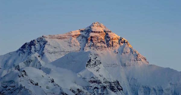
The mountain was originally known as Peak XV, but in 1865 it was named after Sir George Everest, British surveyor general of India from 1830 to 1843. It is composed of multiple layers of rock that have folded back on themselves, most notable of which is the Yellow Band, a limestone formation visible just below the summit. With its three-sided pyramidal shape, the summit is described as having three “faces”: the North Face and the East Face, which rise above Tibet; and the Southwest Face, which is located in Nepal. From base to summit, its slopes are covered in shimmering glaciers, such as the Kangshung Glacier to the east and the Khumbu Glacier to the west. Both the Rong River in Tibet and the Lobujya River in Nepal originate from glaciers on Everest’s lofty heights. 

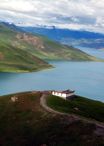
Generally speaking, temperatures on Mount Everest are sub-zero year-round, with highs reaching only −19 °C (−2 °F) and lows plummeting to between −36 °C (−33 °F) and −60 °C (−76 °F). Since the peak is so high that it reaches the lower limit of the jet stream, it can be buffeted by sustained winds rushing at over 160 kilometres (100 mi) per hour. At the summit and on the upper slopes, lack of oxygen, powerful winds, and extremely cold temperatures preclude the development of any plant or animal life. Hostile though it may be, the valleys below the mountain are inhabited by Tibetan-speaking peoples, most well-known of which are the Sherpas.

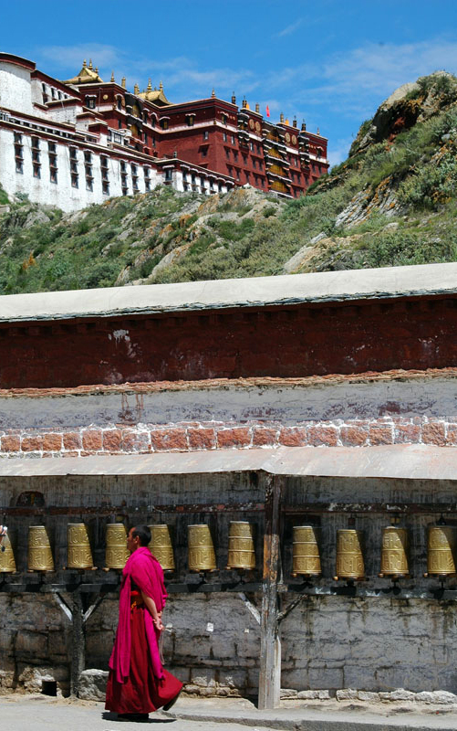
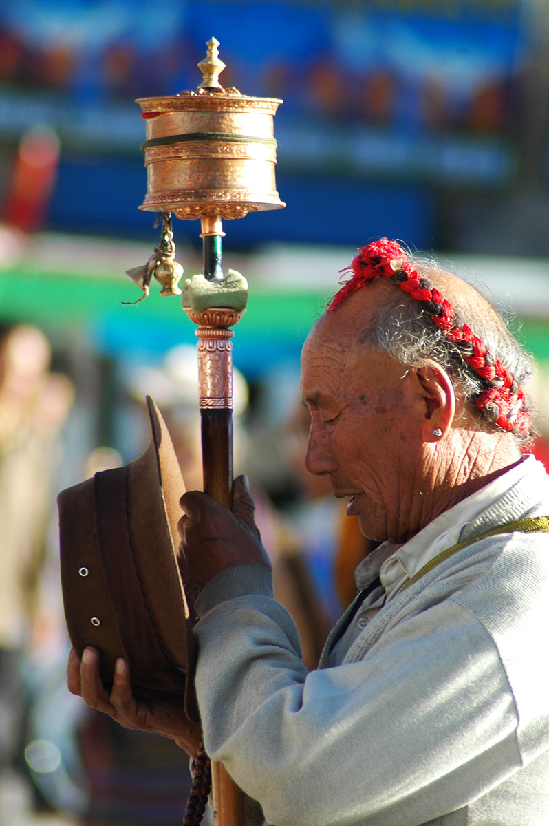
The Sherpas live in villages at elevations of up to 4,270 metres (14,000 ft.), many of which are found in the Khumbu Valley of Nepal. Traditionally they were livestock farmers who lived a seminomadic lifestyle on the frozen mountain slopes, but they’ve since adopted a far more lucrative trade. After years of living in such close proximity to the world’s highest mountain range, the Sherpas are uniquely acclimatised to high altitudes. When British expeditions on Mount Everest began during the early 20th century, they soon found highly paid work as surveyors, guides, and porters. As Everest became increasingly more commercialised, they have come to financially depend on the tourism and climbing expeditions that it attracts.

For those brave or foolish enough to try and scale this snowy behemoth, there are two main hiking routes: one that follows the southeast ridge in Nepal, and the other that runs along the north ridge in Tibet. The southeast route is largely considered to be easier, so it is the more frequently used, although bear in mind that “easier” is a relative term! Everest represents arguably the most challenging and dangerous climb in the world, with altitude sickness, fatigue, inclement weather, and powerful winds all contributing to the deaths of numerous hikers. As of 2016, over 200 people have tragically lost their lives while trying to summit the mountain. 

In fact, the weather on Everest is so harsh that there are only two brief time periods when an ascent is possible: between April and May, before the monsoon; and for a few weeks in September, after the monsoon. While adverse weather conditions certainly contribute to the difficult of Everest, worse still by far are the extreme effects that the high altitude has on the human body. Once climbers ascend past the 7,600-metre (25,000 ft.) mark, they enter what’s colloquially referred to as the “Death Zone”. In this area, punishingly low temperatures can lead to frostbite on any part of the body that is exposed and the oxygen levels are so low that the human body essentially starts to die.

As the body desperately tries to obtain more oxygen, rapid breathing and high pulse rates inevitably lead to exhaustion. During the more advanced stages, oxygen deprivation or hypoxia leads to poor sleep, an inability to digest food, and confused thinking that often results in impaired decision making. In a desperately unsafe environment where you need your wits to be at their sharpest, the last thing you want is an addled brain! To combat this, most hikers use supplemental bottled oxygen breathed through masks. So great are these debilitating effects that it takes most climbers an average of 12 hours to walk the distance of under 2 kilometres (1 mi) from South Col to the summit.

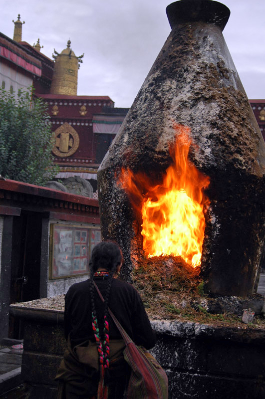
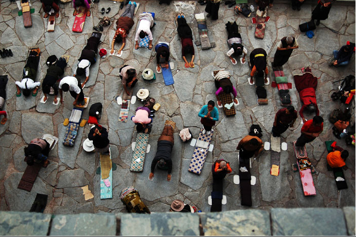
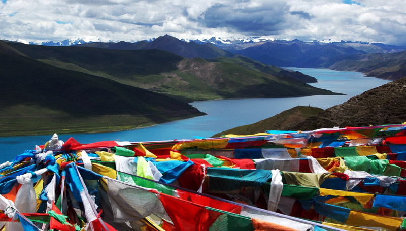
In spite of these challenges, people continue to flock to Everest in ever increasing numbers. In 1988, fewer than 200 people summited the mountain but, by 2003, that figure had exceeded 1,200. As if climbing the tallest mountain in the world wasn’t quite thrilling enough, some people have even been known to snowboard, ski, paraglide, and BASE jump down it! While the mountain certainly attracts its fair share of adrenaline junkies, the Rongbuk Monastery at its northern base continues to be a focal site of pilgrimage for the locals. At an altitude of 5000 metres (16,404 ft.), it is the highest temple in the world. So, if you’re planning on praying for safe passage up the mountain, the monastery closest to the heavens is undoubtedly your best bet!

Zhengzhou

Resting on the southern bank of the Yellow River, the provincial capital of Zhengzhou represents the historical, cultural, and commercial heart of Henan province. While it may not be one of the most well-known cities in China, it is ranked as one of the Eight Great Ancient Capitals thanks to archaeological discoveries that were made in the region during the 1950s. Evidence found in the surrounding area proves that not only was it settled during the Neolithic Period (c. 8500-2100 BC), but that Zhengzhou was once a walled city dating all the way back to the Shang Dynasty (c. 1600-1046 BC).

Researchers believe it may have been the ancient Shang capital of Ao and it represents a treasure trove of Shang Bronze Age cultural relics. Over 3,500 years ago, this city would have been the site where artisans developed the first primitive forms of porcelain and bronze smelting. A green ceramic glazed pot that was unearthed in Zhengzhou is believed to be the oldest example of porcelain in the country. In short, you could almost say it put the china in China! The city was largely abandoned during the 13th century BC but remained occupied during the Zhou Dynasty (c. 1045-256 BC), as is demonstrated by the presence of Zhou tombs in the region.  

It is widely believed that the area then became the fief of a family surnamed Guan and, during the 6th century BC, was named Guancheng or “City of Guan” for this reason. It wasn’t until 605 AD, during the Sui Dynasty (581-618), that it was finally named Zhengzhou. It rose to prominence during the Sui, Tang (618-907), and early Song (960-1279) dynasties, when it became the terminus along the New Bian section of the Grand Canal[1]. This was the main conduit via which grain was transported from southern China to the westward capitals of Luoyang and Chang’an (modern-day Xi’an), as well as to the armies along the northern frontiers. However, during the late Song Dynasty, Zhengzhou was plunged into irrelevance when the capital was moved eastward to Kaifeng. 

Nowadays, the city is a bustling metropolis, bearing little resemblance to the primeval capital it once was. However, its most popular tourist draw remains the Shang Dynasty Ruins in the downtown area, where visitors continue to marvel at the mud-brick city walls that have stood for over 3,000 years. Many of the valuable items that were unearthed at the site, such as rare bronzes, jade articles, and porcelain wares, have been relocated to the Henan Museum in the northern part of the city. One of the museum’s greatest treasures is a rare ivory sculpture of a cabbage, complete with its own vividly carved insects. At this museum you’ll be sure to talk of many things, of cabbages and kings!  

Another of Zhengzhou’s most important historical sites, the Erqi Memorial Tower, is located in the city centre. This 14-storey double tower commemorates the railway workers involved in the Erqi Strike, which took place on February 7th 1923. While it towers in at an impressive 63 metres (207 ft.) in height, it is no match for the city’s mammoth 388-metre (1,273 ft.) tall Zhongyuan Tower. Although it is primarily used as a television tower, it comes complete with its own observation deck and 200-guest revolving restaurant. The third and fourth floors of the observation deck are blanketed in the world’s largest panoramic painting, which is 18 metres (59 ft.) in height and 164 metres (538 ft.) in length. To put that into perspective, that’s approximately 6 times the height of an African elephant and 33 times the length of an anaconda!

Once you’ve finished exploring the city, there are a number of spectacular UNESCO World Heritage Sites nearby that are sure to tempt you. About 80 kilometres (50 mi) southwest of downtown Zhengzhou, Mount Song rises up in the centre of the province. It is heralded as one of China’s Five Great Mountains, and is the home of the venerated Shaolin Temple. Famed as the birthplace of Chinese Kung-Fu, the Shaolin Temple and its accompanying Pagoda Forest are a must-see for any martial arts enthusiast. Just be sure not to get on anyone’s bad side; you never know who might be a Kung-Fu master!

Note:

[1] The Grand Canal: It is the longest canal in the world and starts in Beijing, passing through the provinces of Hebei, Shandong, Jiangsu, and Zhejiang before eventually terminating in the city of Hangzhou. It links the Yellow River to the Yangtze River and the oldest parts of it date back to the 5th century BC, although most of its construction took place during the Sui Dynasty (581-618).  

The Juyan Lake Basin

Nestled deep within the barren expanse of the Gobi Desert, Juyan Lake was once a focal oasis along the ancient Silk Road. It is located within the fertile Ejin Banner of Inner Mongolia, not far from the border with Mongolia proper. In ancient times, its strategic importance meant that, from the Han Dynasty (206 BC–220 AD) onwards, it was guarded by a military frontier town named Juyan. Its significance was twofold: its bountiful waters could provide sustenance for the nearby garrisons along the Great Wall; and having control of it meant the northern nomads could not prosper from it. If the lake had been left undefended, it would have provided an ideal route through which to invade China from the north. The lake was held in such high esteem that it was even visited by the Italian explorer Marco Polo during the Yuan Dynasty (1271-1368)!

Unfortunately, as the old saying goes, all good things are doomed to come to an end. Due to environmental changes, the western section of the lake dried up in 1961, and the eastern section followed suit in 1992. This caused a major crisis in the region and the government was forced to take action to protect the oasis. Their tireless work meant that the eastern section eventually reappeared in 2005, although it is now more of a wetland than a lake. Nowadays it is known as the Juyan Lake Basin and covers an area of approximately 10,000 square kilometres (3,900 sq. mi). Surrounded by mountain ranges on all sides, this fertile valley represents a verdant paradise hidden away in the hostile desert. 

The Taklamakan Desert


With a name that is thought to mean “Place of Ruins” or “Place of No Return”, the Taklamakan Desert doesn’t appear to have garnered the friendliest reputation! That being said, another interpretation of the name states that it means “Desert Under the Mountains,” which sounds far less ominous. Extending over a vast area of approximately 337,000 square kilometres (130,000 sq. mi), it represents the largest desert in China and the sixteenth largest in the world. To put that into perspective, it is nearly the size of Germany and over twice the size of England! It is bounded by the Kunlun Mountains to the south, the Pamir Mountains and the Tian Shan Mountains to the west and north, and the Gobi Desert to the east.

Historically, branches of the Silk Road skirted around its northern and southern edges, but travellers generally sought to avoid crossing this barren wasteland directly. Since little water was available along these routes, these wanderers depended on thriving oasis towns such as Kashgar, Marin, Niya, Kuqa, Gaochang, Turpan, Loulan, and Dunhuang, which were supported by melted snow trickling down from the nearby mountains. Due to desertification, the drying-up of water sources, and the eventual obsolescence of the Silk Road, many of these towns were tragically abandoned and lost to the sands of time. While they are no longer able to support human settlement, these ruins have offered up a myriad of archaeological treasures that imply Tocharian, Hellenistic, Indian, and Buddhist influences in the region.

The greatest discovery was made in the late 1980s, when archaeologists uncovered several well-preserved mummies, many of which were over 4,000 years old! Some of them demonstrated Caucasian features and were wearing European twill fabrics, acting as a testament to the early links between Europe and Asia. The most likely explanation is that these people were traveling along the Silk Road from Europe to China, but unfortunately succumbed to an untimely death and were buried in the desert. In fact, after making expeditions to the Taklamakan, famous explorers such as Xuanzang, Aurel Stein, Albert von Le Coq, Sven Anders Hedin, and Langdon Warner have all attested to its treacherous nature.

Unlike other deserts in China, the Taklamakan Desert is unrelentingly hostile and is virtually devoid of any vegetation throughout its barren expanse. During summer, temperatures can rise to 40 °C (104 °F), while in winter they plummet to around −20 °C (−4 °F). In short, this desert is known for blowing hot and cold! During the spring, as north, northwesterly, and northeasterly winds are channelled into the desert and meet near its centre, they can produce sandstorms as powerful as hurricanes. No wonder ancient travellers chose to give this desert a wide berth!

The strong winds and shifting sands largely prevent any vegetation from growing, but there are sparse clumps of desert plants in the depressions between sand dunes and along the edge of the desert itself. Tough thickets of tamarisk, nitre bushes, and reeds can be found between the dunes, while the desert fringes are able to support a wider range of species, including desert poplars, olive trees, camelthorn, and saltworts. This means the periphery of the desert is capable of sustaining a handful of animal species, such as gazelles, wild boars, wolves, foxes, Siberian deer, wild camel, bats, tufted larks, and Tarim jays. In turn, the sand dunes provide a home for rabbits, gerbils, field mice, jerboas, and even hedgehogs!

Lhasa

Resting atop the lofty Nyainqêntanglha Mountains at an altitude of over 3,600 metres (11,800 ft.), Lhasa represents one of the highest cities in the world. Its name literally translates to mean “Land of the Gods”, which shouldn’t come as too much of a surprise since it’s nearly touching the heavens! As the holy land of Tibetan Buddhism, this 1,300-year-old city has been a pilgrimage site for centuries and its breath-taking monasteries reflect a long religious tradition. It is home to the Potala Palace, the Jokhang Temple, and the Norbulingka, three of the finest UNESCO World Heritage Sites in western China.

The history of Lhasa is a complicated and fascinating one, as it oscillated between being a centre of political power and a spiritual place of unparalleled significance. During the 7th century, a man named Songtsän Gampo established the Tibetan Empire (618–842) and set Lhasa as his imperial capital. With a glorious kingdom at his behest, it was time to start building a palace fit for a king! In 637, he began construction of the Potala Palace, which was named after Mount Potalaka, the legendary abode of the bodhisattva[1] Avalokiteśvara according to the Buddhist faith.

Yet Songtsän Gampo wasn’t content to live in this lavish palace alone. He contracted alliance marriages with Princess Bhrikuti of the Nepalese Licchavi Kingdom (c. 400–750 AD) and Princess Wencheng of the Han Chinese Tang Dynasty (618-907) in 639 and 641 respectively. It was Princess Bhrikuti who supposedly converted him to Buddhism. After all, love is the great motivator! Each of these princesses gifted him two magnificent statues: Bhrikuti gave him a statue of Akshobhya[2] Buddha; and Wencheng brought him a breath-taking statue of Shakyamuni[3] Buddha. In order to house these wonderful gifts, he built the Jokhang Temple and the Ramoche Temple in 641. This was a golden time for Lhasa, where it thrived as a religious and political capital. 

Unfortunately, all good things come to an end! During the 9th century, the city suffered extensive damage under the reign of Langdarma as the monarchy slowly began to collapse. Sacred sites were destroyed, temples were desecrated, and the empire was left fragmented. From then right up until the ascension of the 5th Dalai Lama in the 17th century, Lhasa remained a political nobody in the Tibetan region. However, as time went on, the importance of its religious sites started to be recognised. 

During the 15th century, three large monasteries dedicated to the Gelugpa or Yellow Hat sect of Tibetan Buddhism were built in the city by a monk named Je Tsongkhapa and his disciples. These three monasteries, known as Ganden, Sera, and Drepung respectively, helped elevate Lhasa as the recognised centre of Tibetan Buddhism. While Lhasa was fast becoming the spiritual core of Tibet, the politics of the country were about to become intertwined with religion. After a long and harrowing era of civil wars, the 5th Dalai Lama, Ngawang Lobsang Gyatso, unified Tibet and became its independent leader. 

In 1642, he moved his administration to Lhasa and the city once again found itself simultaneously the political and religious centre of the country. With the city thriving as it had done before, the Potala Palace was rebuilt and the Jokhang Temple was greatly expanded. From 1648 onwards, the Potala Palace was used by the Dalai Lama as a winter retreat, while the Norbulingka served as his summer palace. Like the divine lotus, Lhasa was enjoying a second spiritual flowering! Much of the traditional architecture you’ll find in Lhasa today was constructed during this time. 

By the end of the 17th century, Lhasa had transformed into a bustling marketplace, where Mongol, Chinese, Muscovite, Armenian, Kashmiri, Nepalese, and Northern Indian traders all met to sell or exchange their valuable goods. Much of its economy depended on its historic trade routes, which represented the convergence of China, India, Nepal, and Bhutan. Nowadays this archaic pastime is largely a novelty, and the city’s economy is mainly based on tourism.

While the Potala Palace, the Jokhang Temple, and the Norbulingka are undoubtedly the city’s main draws, there are plenty of other magnificent attractions on offer in Lhasa. The eastern part of the city, known as the Barkhor, is brimming with Tibetan architecture and culture, while the western section is significantly more ethnically Han Chinese in its character. Since the eastern section contains the Jokhang Temple, it is not uncommon to still see Tibetan people immersed in a kora within the narrow streets of the Barkhor, oftentimes spinning a prayer wheel as they walk.

Notes:

[1] Bodhisattva: The term literally means “one whose goal is awakening”. It refers to a person who seeks enlightenment and is thus on the path to becoming a Buddha. It can be applied to anyone, from a newly inducted Buddhist to a veteran or “celestial” bodhisattva who has achieved supernatural powers through their training. 

[2] Akshobhya: According to Buddhist scripture, Akshobhya is one of the Five Wisdom Buddhas and represents consciousness as an aspect of reality. He is the embodiment of “mirror knowledge”, which states that the mind should be like a mirror: empty yet luminous, holding all the images of space and time yet untouched by them. 

[3] Shakyamuni: One of the titles of Gautama Buddha, the central figure and founder of the Buddhist faith. It is derived from the place named Sakya, which is where he was born.

Make your dream trip to Lhasa come true on our travel:  Explore Untouched Wilderness on Our Full Circuit of Tibet

Zhangjiajie National Forest Park

The landscape of the Zhangjiajie National Forest Park has attracted admiration throughout the world, in part thanks to its inclusion in James Cameron’s cinematic epic Avatar. Yet there’s far more to these incredible mountains than what you may have seen on the silver screen! Before they became cinematic superstars, they served as the inspiration for countless Chinese paintings and have been immortalised in the works of several Chinese masters. While the park’s iconic pillars look similar to the Karst mountains of southern China, they are actually made of quartzite-sandstone and are the result of physical rather than chemical erosion. Over time, expanding ice and plants growing on the cliff-face have caused intense weathering, which has resulted in the strange rock formations that we see today.

The park itself is rather confusingly part of a larger attraction known as the Wulingyuan Scenic Area, which is comprised of four national parks within close proximity that contain these special landforms. Collectively, these four parks were designated as an UNESCO World Heritage Site in 1992. The Zhangjiajie National Forest Park actually predates the Wulingyuan Scenic Area, however, as it was established in 1982 and is recognised as the first national forest park in China. The term “Zhangjiajie” literally translates to mean “Home of the Zhang Family” and refers to a military general called Zhang Liang, who served during the Han Dynasty (206 BC-220 AD) and after whom the prefecture-level city of Zhangjiajie was named in honour of his achievements.

Embedded deep within the subtropical forests of northwestern Hunan province, the Zhangjiajie National Forest Park is home to a dizzying collection of 243 peaks and over 3,000 sandstone pinnacles, which naturally dominate the landscape. When the early morning mist gathers around these colossal columns, it appears as though they are floating in mid-air, which is what inspired the floating Hallelujah Mountains in the film Avatar. In fact, one of these mountains has even been named after its mythical movie counterpart!

The 1,080-metre (3,540 ft.) high Southern Sky Column was official renamed the “Avatar Hallelujah Mountain” in 2010. This is indeed a case of art imitating life, and then life imitating art! The Avatar Hallelujah Mountain can be found in a section of the park known as Yuanjiajie, which offers breath-taking panoramic views of the surrounding mountains and thus ranks as the most popular part of the park. In order to reach Yuanjiajie, visitors can either hike to the top, which takes about 2 hours, or they can take the spectacular Bailong Elevator, which takes around 2 minutes. Be forewarned, however, that the line for the Bailong Elevator can be up to 2 hours long, meaning you won’t necessarily save time! 

Rising to a staggering height of 326 metres (1,070 ft.), the Bailong or “Hundred Dragon” Elevator is the tallest outdoor elevator in the world and is actually made up of three separate glass elevators, which can each carry 50 people at a time. To put that into perspective, this set of glass elevators can transport over 2,000 people to the peak of the mountain every hour! These elevators aren’t for the faint of heart, as they are covered almost entirely in transparent class and offer a dizzying view of the ascent to the top of Yuanjiajie.

Alongside the Bailong Elevator and the Avatar Hallelujah Mountain, Yuanjiajie’s final claim to fame is known as the First Bridge Under Heaven. This unusual bridge is unlike any other in the world, as it has been formed by the natural weathering of the rock. With a length of around 20 metres (66 ft.) and a width of roughly 3 metres (10 ft.), this spectacular stone bridge connects two separate peaks and sits at a dizzying height of nearly 400 metres (1,312 ft.). Once you see how high up it is, however, you may find that crossing it is a bridge too far! 

Once you’ve finished climbing to impossible heights, you can take a leisurely stroll along Golden Whip Stream, which is a brook that can be found at the base of the mountains. The stream is just over 7 kilometres (4 mi) in length and makes for a pleasant 2-hour hike, during which time you can marvel at the towering pinnacles that surround you. While seeing the panoramic view from the top of Yuanjiajie will undoubtedly take your breath away, the view from the bottom of the mountains is certainly no less magnificent. Be forewarned, however, that the area around the stream is inhabited by wild macaques, so be sure not to monkey around or you might attract some unwanted attention!

The Jokhang Temple

As the spiritual heart of Lhasa and the holiest house of worship in Tibet, the Jokhang Temple is unceasingly buffeted by waves of pilgrims eager to prostrate themselves in its courtyards, spin its prayer wheels, and chant within its venerable halls. Although it is technically maintained by the Gelugpa or Yellow Hat sect, it currently accepts worshippers from all branches of Buddhism. Its undeniable historical significance and continuing cultural importance to the region meant it was designated a UNESCO World Heritage Site in 2000, alongside the nearby Potala Palace and the Norbulingka. With its intricate mixture of Indian, Tibetan, and Nepalese features, it is an architectural gem beyond compare.  

The temple was originally built in 652 by Songtsän Gampo, founder of the Tibetan Empire (618–842). However, the nature of its construction is shrouded in mystery. Countless legends surround the sacred site, the most prevalent of which is that, in ancient times, the Tibetan people believed that Tibet rested on the back of a wild demoness known as a srin ma. Whenever the King tried to build the temple, it would miraculously collapse overnight and they’d have to begin construction again. It was apparently the King’s second wife, Princess Wencheng of the Han Chinese Tang Dynasty (618-907), who discovered that it was in fact the demoness thwarting their attempts to propagate Buddhism throughout the region. 

In order to halt her evil schemes, the King was required to build twelve temples: four on the frontiers, four in the outer areas, and four in central Tibet. Finally, the last temple had to be built over the site of a lake, which was said to be the demoness’ heart. Using 1,000 goats to carry soil from nearby mountains, the lake was filled and the Jokhang Temple was built in its place, subjugating the demoness once and for all. Another legend recounts how the King reputedly tossed his ring and promised to build a temple wherever it landed. It landed in a lake and, like the mighty Excalibur, a white stupa[1] emerged from beneath the crystal clear waters, over which the temple was built.

A far more likely explanation is that the temple was built to house the statue of Akshobhya[2] Buddha which the King’s first wife, Princess Bhrikuti of the Nepalese Licchavi Kingdom (c. 400–750 AD), brought with her as part of her dowry. Not to be outdone, Princess Wencheng presented the King with a far more valuable gift, one that is still revered as the holiest idol in Tibet. It was a statue of Shakyamuni[3] Buddha, but not just any statue. This statue, known as the Jowo Shakyamuni or the Jowo Rinpoche, was supposedly carved at the behest of the Buddha himself, and is one of only three such statues that the historical Buddha permitted to have made during his lifetime. 

This life-sized 1.5-metre (5 ft.) tall statue depicts the Buddha at age 12 and was gifted by the King of Magadha (modern-day Bihar and Bengal, India) to Emperor Taizong of the Tang Dynasty before being used as Princess Wencheng’s dowry in 641. Glittering in the light, it is cast from precious metals and bedecked with a constellation of jewels. The statue was originally housed in the Ramoche Temple, but was moved to the Jokhang Temple on the death of Songtsän Gampo for security reasons. In fact, the Jokhang Temple was initially known as the Tsuklakang or “House of Religious Science”, but was renamed the Jokhang or “Temple of the Jowo” in honour of this statue!

From 756 to 797, during the reign of Trisong Detsän, the King’s minister became particularly hostile towards the spread of Buddhism in Tibet, so the statue had to be hidden. When the 5th Dalai Lama, Ngawang Lobsang Gyatso, unified Tibet and became its independent leader during the 17th century, the temple and Lhasa as a whole enjoyed a golden era of spirituality. Although the temple was expanded greatly during this time, much of the original 7th century structure has been remarkably well-preserved. 

The temple itself is a four-storey timber structure with a distinctive golden top. From the main square, one can view the entire complex. There are two steles[1] in the square, one recording an alliance between the King of Tibet and the Emperor of the Tang Dynasty, and the other engraved with hygiene tips on how to prevent the spread of smallpox. Even in ancient times, the government had a way to issue health and safety warnings! In the eastern section of the complex, a row of votive lights form a dimly lit path leading to the main hall. 

At over 1,300 years of age, the Buddha Hall is the oldest building in the complex. It is where the sacred Jowo Shakyamuni statue is currently housed, and also contains magnificent gilded statues of Songtsän Gampo, Princess Bhrikuti, and Princess Wencheng. A number of chapels surround the main hall, all dedicated to various deities and bodhisattvas[5] in the Buddhist canon. Thick with the smell of incense and illuminated only by flickering candles, a labyrinth of secluded corridors are the only paths connecting the halls and chapels of the complex. Outside, the doors and roofs are bedecked with glorious golden engravings, from docile deer flanking the Dharma wheel to monstrous dragons guarding the eaves. 

When it comes to worship, there are three pilgrimage circuits in Lhasa: the Lingkhor, which encircles the city’s sacred district; the Barkhor, which circumvents the Jokhang Temple; and the Nangkor, a ritual corridor within the Jokhang Temple that surrounds the statue of Jowo Shakyamuni. Every day, hundreds of pilgrims perform a kora[6] around each of these three circuits while prostrating themselves, chanting sacred mantras, or spinning prayer wheels. For this reason, the temple is closed to tourists in the morning and reserved solely for pilgrims. While the temple’s historic importance is part of its allure, witnessing the devotion that the locals continue to have for their faith is the real key to the Jokhang Temple’s magic. 

Notes:

[1] Stupa: A hemispherical structure with a small interior designed for storing Buddhist relics and for private meditation.

[2] Akshobhya: According to Buddhist scripture, Akshobhya is one of the Five Wisdom Buddhas and represents consciousness as an aspect of reality. He is the embodiment of “mirror knowledge”, which states that the mind should be like a mirror: empty yet luminous, holding all the images of space and time yet untouched by them.

[3] Shakyamuni: One of the titles of Gautama Buddha, the central figure and founder of the Buddhist faith. It is derived from the place named Sakya, which is where he was born.

[4] Stele: An upright stone slab or pillar that bears an inscription and usually marks a burial site, like a tombstone.

[5] Bodhisattva: The term literally means “one whose goal is awakening”. It refers to a person who seeks enlightenment and is thus on the path to becoming a Buddha. It can be applied to anyone, from a newly inducted Buddhist to a veteran or “celestial” bodhisattva who has achieved supernatural powers through their training.  

[6] Kora: A kora is both a type of pilgrimage and a meditative practice in Tibetan Buddhism. The practitioner performs a kora by making a clockwise circumambulation around a sacred site or object, typically as part of a pilgrimage, ceremony, celebration, or ritual. In some instances, it is used as a broader term to describe the entire pilgrimage experience.

Make your dream trip to the Jokhang Temple come true on our travel:  Explore Untouched Wilderness on Our Full Circuit of Tibet

The Potala Palace

Rising majestically atop the Marpori or Red Mountain at an altitude of 3,750 metres (12,300 ft.), the Potala Palace ranks as the highest ancient palace in the world. Towering 100 metres (300 ft.) above the city of Lhasa, it simply can’t be missed, and represents one of the most breath-taking sights in a city resplendent with the finest architecture Tibet has to offer. Its historical significance as both a political and religious icon in Tibet meant it was designated a UNESCO World Heritage Site in 1994. If you’re making the dizzying climb to the Roof of the World, a visit to the Potala Palace should be virtually compulsory.  

The palace’s spiritual importance is embodied in its name, which is derived from Mount Potalaka, the legendary abode of the Buddhist bodhisattva[1] Avalokiteśvara. In fact, the palace itself rests on one of three main hills known as the “Three Protectors of Tibet”: Chokpori Mountain, which represents the bodhisattva Vajrapani; Pongwari Mountain, which signifies Manjusri; and Marpori Mountain, which symbolises Avalokiteśvara. Located on a prime piece of spiritual real estate, it was practically destined to be a sacred site!

The palace was initially constructed in 637 by Songtsän Gampo, the first ruler of the Tibetan Empire (618–842). Tragically, when the Tibetan Empire collapsed, the palace was destroyed during the ensuing civil wars. It remained in ruins until the 17th century, when the 5th Dalai Lama, Ngawang Lobsang Gyatso, unified Tibet and became its independent leader. When the 5th Dalai Lama moved his capital to Lhasa, a spiritual adviser named Konchog Chophel pointed out that the site of the previous Potala Palace would make an ideal seat of government, since its elevated position offered it protection and it was situated near to the Buddhist monasteries of Drepung and Sera.

In 1645, construction of the present palace began and, within three years, the White Palace had been completed. From 1690 to 1694, it was expanded to include the magnificent Red Palace. Overall, over 7,000 labourers and 1,500 artisans were required to complete this mammoth task! The end result was a glorious 13-storey high palace encompassing over 1,000 rooms and decorated with countless murals, painted scrolls, sculptures, statues, porcelain wares, intricately woven carpets, silk curtains, and fine objects of silver and gold. However, don’t be fooled into thinking the Potala Palace is just a pretty face! Its libraries contain a boundless collection of valuable sutras[2] and historical documents.  

In the northwest corner, you’ll find two chapels that preserve parts of Songtsän Gampo’s original palace. These are the Saint’s Chapel and the Dharma Cave, both regarded as some of the holiest sites in the palace. The Saint’s Chapel contains a glittering jewel encrusted statue of Avalokiteśvara and an ominous dark passageway that leads to the Dharma Cave, where Songtsän Gampo himself supposedly meditated and pursued his study of Buddhism. This sacred cave is bedecked with images of Songtsän Gampo, along with his wives, Princess Bhrikuti of the Nepalese Licchavi Kingdom (c. 400–750 AD) and Princess Wencheng of the Han Chinese Tang Dynasty (618-907). 

The White Palace, made up of the two white-washed wings on either side of the crimson Red Palace, once served as the seat of the Tibetan government and the main residence of the Dalai Lama. From the 18th century onwards, it was used only as a winter palace, as the newly built Norbulingka functioned as the summer palace. If the White Palace represented the political element of the Potala Palace, then the Red Palace was its spiritual core. 

A central, yellow-painted courtyard separates the living quarters of the White Palace from the Red Palace, which was completely devoted to religious study and prayer. It houses numerous chapels, shrines, and sacred statues, but its most prized articles are undoubtedly the tombs of eight Dalai Lamas. For this reason, it remains a pilgrimage site of unparalleled importance to Tibetan Buddhists. Each of the tombs is encased in a sacred golden stupa[3], inlaid with glittering jewels and smooth gemstones. 

The most impressive of these is undeniably the tomb of the 5th Dalai Lama, which is over 14 metres (49 ft.) in height. To put that into perspective, it’s nearly five times the size of an African elephant! Sparkling in the pale morning light, the tomb is gilded entirely in gold and studded with over 18,000 jewels, including diamonds, pearls, and a myriad of other precious gems. Faced with such a colossal treasure, you might find it a little harder to channel your inner monk and loosen your attachment to material things!

Notes:

[1] Bodhisattva: The term literally means “one whose goal is awakening”. It refers to a person who seeks enlightenment and is thus on the path to becoming a Buddha. It can be applied to anyone, from a newly inducted Buddhist to a veteran or “celestial” bodhisattva who has achieved supernatural powers through their training.  

[2] Sutra: One of the sermons of the historical Buddha.

[3] Stupa: A hemispherical structure with a small interior designed for storing Buddhist relics and for private meditation.

Make your dream trip to the Potala Palace come true on our travel:  Explore Untouched Wilderness on Our Full Circuit of Tibet

Yamdrok Lake

At the southern foot of the lofty Himalayan mount range lies Yamdrok Lake, one of the three holy lakes of Tibet, alongside Namtso Lake and Lake Manasarovar. Surrounded as it is by snowy climes, it appears like a deep blue sapphire embedded in a sea of pearls. This colossal freshwater lake was formed by melted snow trickling down from the nearby mountains. According to legend, Tibetans believe that the lake was once a goddess who transformed herself, and therefore it is a popular site for pilgrimage. Devout Buddhists will visit the lake, sometimes every year, to walk around its perimeter, an impressive feat which takes an average of 7 days! It is believed that, by performing this ritual, you wash away your sins and are more likely to experience good fortune in the future.

Yet the lake’s spiritual importance doesn’t end there. Yamdrok Lake has been used for decades to help Tibetans find the Dalai Lama. After a Dalai Lama passes away, the senior monks are left with the arduous task of finding the boy who harbours the reincarnated soul of the Dalai Lama and is therefore the next Dalai Lama. They gather on the banks of the lake to chant and pray before throwing a hada[1] and other sacred items into the lake. By peering into the water, they are supposedly offered a reflection of the specific location where the Dalai Lama’s soul currently resides. In short, Yamdrok Lake functions as a sort of holy GPS! 

Situated 100 kilometres (62 mi) northeast of Lhasa and 90 kilometres (56 mi) west of a town named Gyantse, the lake’s remote location makes it tough to reach, but this is undoubtedly part of its bucolic charm. Its unusual shape, which gives it the appearance of a scorpion when viewed from above due to its two long “arms”, means it’s difficult to estimate its size, although the official surface area is listed at 638 square kilometres (246 sq. mi). Like gems scattered throughout its expanse, the lake is dotted with countless islands that serve as resting places for a myriad of bird species. During autumn and winter, thousands of birds migrate to the lake to nest, making it a veritable bird-watching hotspot. 

Near to the lake’s edge, it is not uncommon to see locals tending to their yaks or walking their Tibetan mastiffs, animal species that have been integral to the development of Tibetan agriculture. Within the lake itself, a large population of freshwater fish has earned the lake the nickname “the treasure trove of Tibet”. Most Tibetans won’t eat the fish, as they believe they are the embodiment of their ancestors’ souls, but thriving fish farms on the lake regularly transport their goods to restaurants throughout Tibet. So you might want to avoid eating any fish dishes near to the lake, or risk accidentally dining on Great Aunt Gladys! 

On a peninsula jutting into the lake, the Samding Monastery is the only Tibetan monastery to be headed by a woman. What makes this house of worship so unique is that it’s not a nunnery, meaning the female abbot presides over a community of male monks, as well as female nuns. This female abbot is known as the Samding Dorje Phagmo, who is considered to be the tulku[2] of the goddess Vajravārāhī. Not only is she considered to be the highest female incarnation in Tibetan Buddhism, she is also the third highest ranking person in the religion’s hierarchy after the Dalai Lama and the Panchen Lama. 

About 7 kilometres (4 mi) west of the monastery, the small town of Nagarze is the perfect place to stay if you’re planning on visiting the lake. With its plethora of family-run guesthouses and traditional restaurants, it offers visitors a glimpse of authentic Tibetan culture. However, no trip to the lake would be complete without first stopping on Kampala Pass, where you’ll be treated to a breath-taking panoramic view of the lake from above. Far in the distance, towering in at over 7,200 metres (23,600 ft.), the snow-capped Mount Noijin Kangsang creates the ideal backdrop for a truly unforgettable moment. 

Notes:

[1] Hada: A hada is a narrow strip of silk or cotton that is used by Mongolian and Tibetan people as a greeting gift. Although it has little monetary value, in a nomadic culture it carries deep symbolic value, as everything must be carried on one’s person and therefore must be deemed worthy to take up precious limited space.

[2] Tulku: A tulku is the re-incarnation of a deceased master of Tibetan Buddhism. Each time an old tulku dies, senior monks are charged with locating the young person who harbours their re-incarnated soul. The Dalai Lama is the most well-known example of a tulku

Make your dream trip to the Yamdrok Lake come true on our travel:  Explore Untouched Wilderness on Our Full Circuit of Tibet

The Western Xia Tombs

Rising like gigantic beehives in the Gobi Desert, the Western Xia Tombs are something of a historical anomaly. Their unusual shape has earned them the nickname the ‘Oriental Pyramids’. Resting on the eastern slope of the Helan Mountains, just 35 kilometres (22 mi) from the provincial capital of Yinchuan, they represent one of the last known remnants of a lost kingdom. When the illustrious Tang Dynasty (618-907) collapsed, a nomadic people known as the Tanguts took control of Ningxia, Gansu province, eastern Qinghai province, northern Shaanxi province, northeastern Xinjiang, southwest Inner Mongolia, and southernmost Outer Mongolia. They ruled the region under the Western Xia Dynasty (1038-1227) for nearly 200 years, before Genghis Khan and his Mongolian horde conquered them in 1227. 

The complex, which is made up of 9 imperial mausoleums and 254 subordinate tombs, represented the final resting place of the Western Xia kings and royal family members. Taking up over 49 square kilometres (19 sq. mi) of space, it is one of the largest imperial burial sites in China. To put that into perspective, it’s over 16 times the size of the city of London! Since its discovery in 1972, over 17,000 square metres (180,000 sq. ft.) of the complex has been excavated so far and the findings serve as some of the only information historians have about the Tangut people. 

The tombs are arranged on a north-south axis in a very specific layout that was patterned after the celestial bodies. In many ways, they were designed to resemble the Song Dynasty (960-1279) Tombs in Gongyi County of Henan province, in that they adopted the zhao-mu burial system. According to this system, zhao is the father, mu is the son, and the grandson becomes zhao again. The left side of the complex is dedicated to the zhao burials, while the right side is dominated by mu tombs. 

The architecture of the buildings is also a hectic mixture of traditional Song, Buddhist, and Tangut features. Tiered tomb walls, high towers, funerary objects, stone statues, and delicate inscriptions have all given researchers an invaluable insight into the ethnic features of the Tangut people and the cultural significance of the Western Xia Dynasty. Many of the steles[1] contain inscriptions detailing the achievements of the kings resting in each mausoleum. From these and other inscriptions, historians have discovered that the platform in the west was used for sacrificial offerings, while the 23-metre (75 ft.) tall earth pile behind it was once a solid pagoda. 

Not only that, but these inscriptions show that Mausoleum No. 3 most likely belonged to Li Yuanhao, who was Western Xia’s first official king under the imperial name Jingzong. Many of the relics unearthed from his tomb, including fabulous works of art and stunning sculptures, are currently on display at the Western Xia Museum, which is located near to the entrance of his tomb. It’s the ideal place to learn more about this mysterious kingdom, shrouded as it is by the annals of time. 

Note:

[1] Stele: An upright stone slab or pillar that bears an inscription and usually marks a burial site, like a tombstone.