The Lop Desert

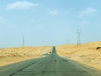
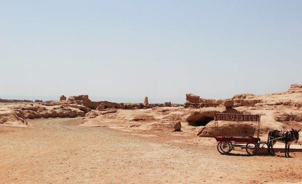
Extending from the eastern edge of the Tarim Basin right through to the city of Korla, the Lop Desert is an almost perfectly flat expanse of barren sands. There are three major depressions dotted throughout the desert that were once mighty lakes: the Lop Nur Basin, the Kara-Koshun Basin, and the Taitema Lake Basin. In ancient times, these formed the terminal lakes of the Tarim-Konque-Qarqan river system. This lake system was a constant source of confusion and frustration to explorers, as changes in the course of the Tarim River would cause the lakes to change position. In fact, Lop Nur was nicknamed the “Wandering Lake” because, like a wayward bachelor, it struggled to find a place and settle down! 

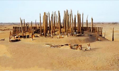
Tragically, due to human intervention, the lakes of the Lop Desert have long dried up, but they once played a focal historical role in the development of the region. The capital of the ancient Loulan Kingdom was established near to Lop Nur sometime during the 2nd century BC and swiftly became an oasis city of paramount importance. When the kingdom fell under Chinese control during the 1st century BC, it was renamed Shanshan, but was unfortunately abandoned at some point during the 7th century AD. The site would remain hidden for over a thousand years, until it was rediscovered by the Swedish explorer Sven Hedin in 1899.

His excavation efforts revealed a number of houses and yielded several Chinese manuscripts from the Jin Dynasty (265-420), but the most magnificent discovery was yet to come. During the 20th century, Chinese archaeologists began excavating the area and came across a series of cemeteries. When the ancient graves were opened, they found mummies and burial items that had been beautifully preserved thanks to the extreme dryness of the desert climate. Among them was the “Beauty of Loulan”, who was so-named because of her long hair, soft skin, and peaceful expression. What makes the Beauty of Loulan and her neighbouring mummies so special is that their features are almost fully intact, in spite of the fact that they died over 3,000 years ago! Many of these mummies were of Indo-European origin and are believed to be a lost people known as the Tocharians.

When properly excavated, the earlier settlements near Lop Nur contained more primitive items, such as Mesolithic stone tools, basketry, bows, arrows, the horns of animals, simple jewellery, and fragments of copper. The later settlements were characterised by more advanced signs of civilization, including a canal, a dome-shaped Buddhist stupa[1], and the home of a Chinese official. According to historical records, Lop Nur boasted a length and breadth of roughly 120 to 160 kilometres (76 to 99 mi) during the Han Dynasty (206 BC–220 AD), but had already shrunk considerably by start of the Qing Dynasty (1644-1912). The building of dams by Chinese garrisons during the 20th century sounded the death knell for the lake, as it slowly withered into a salty marsh. Nowadays it is nothing more than a dried-up basin covered in a thick crust of salt. 

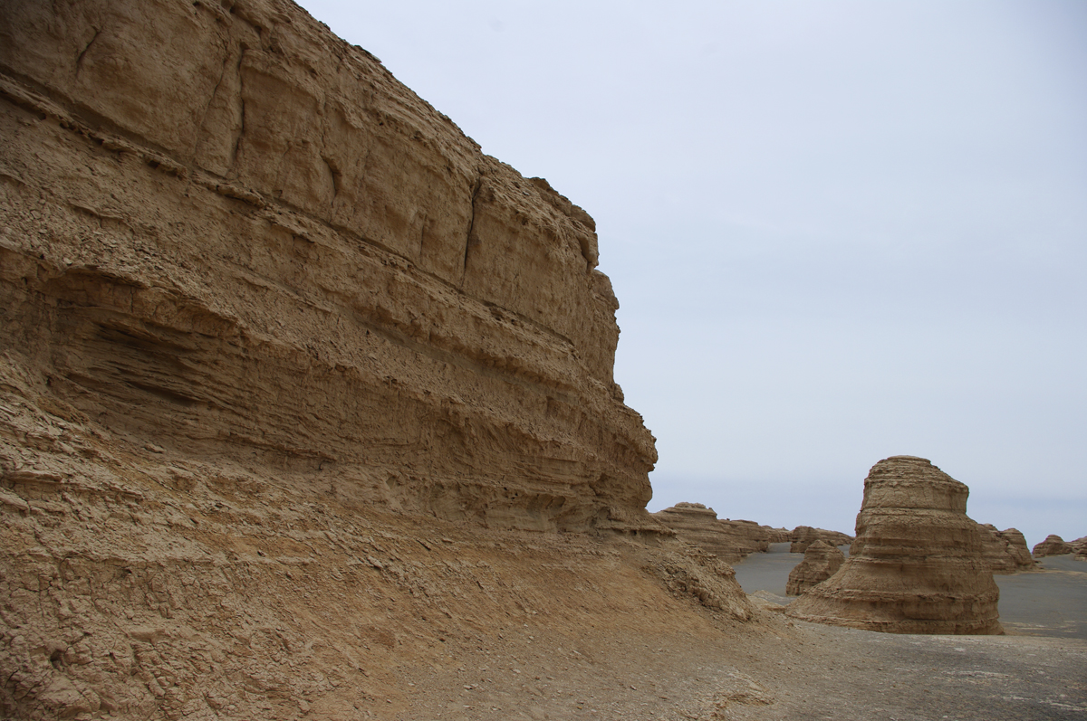
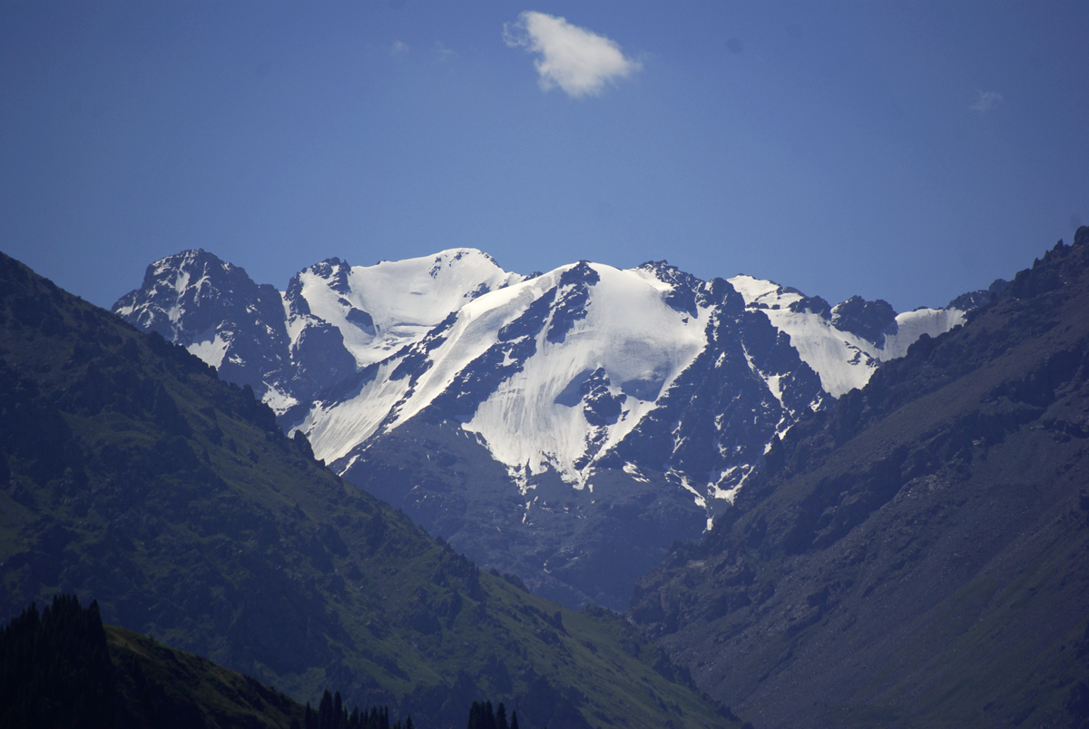
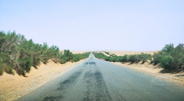
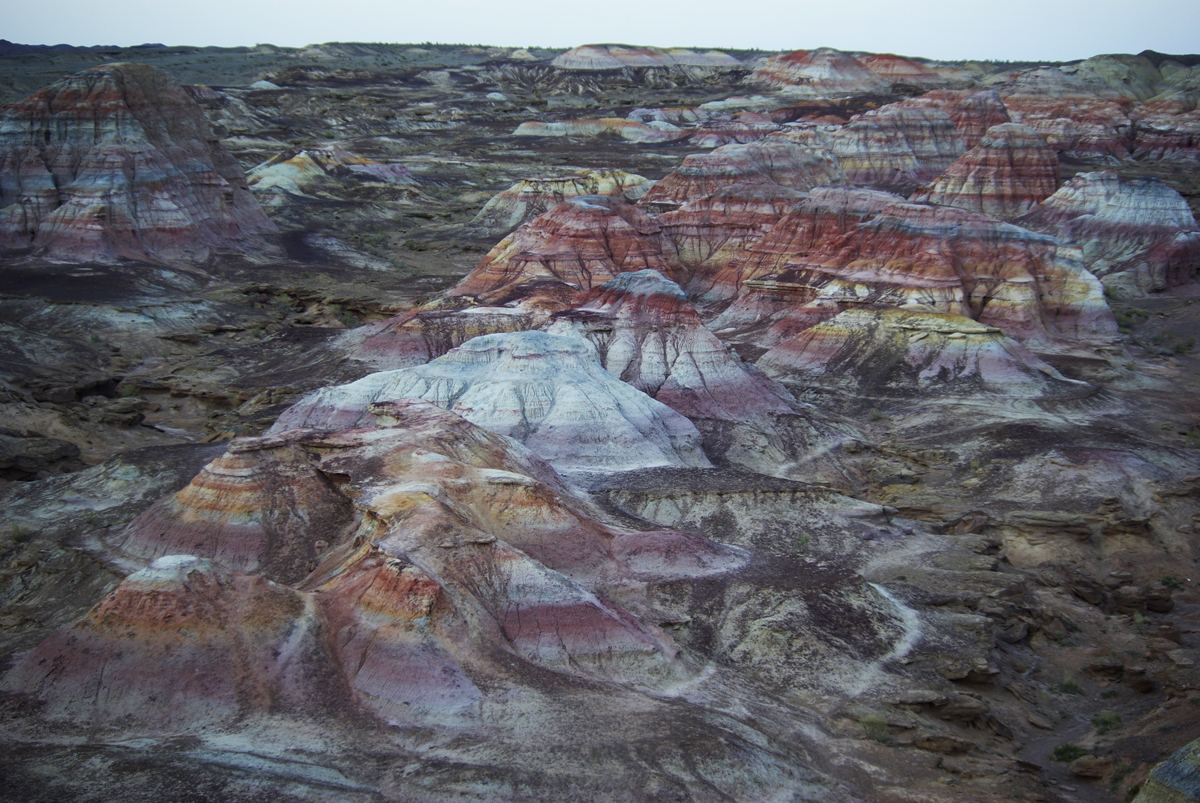
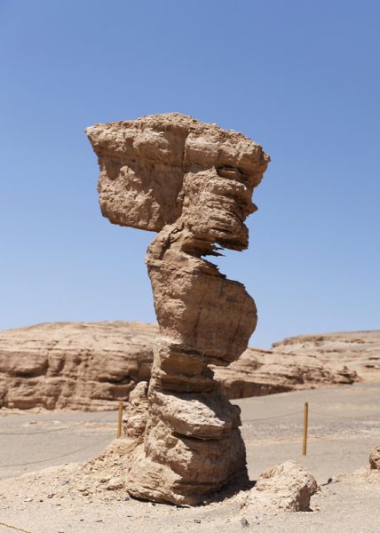
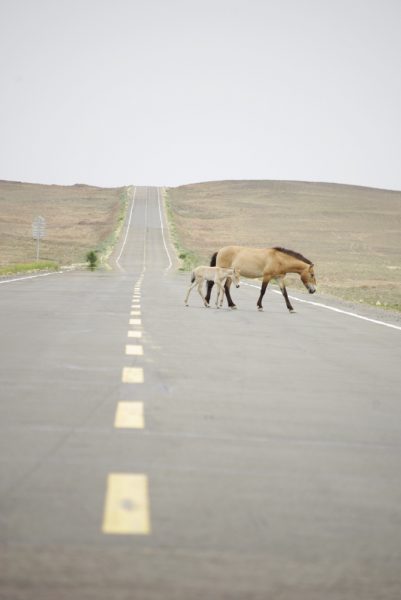
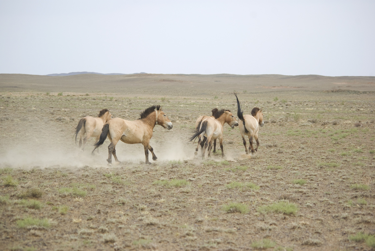
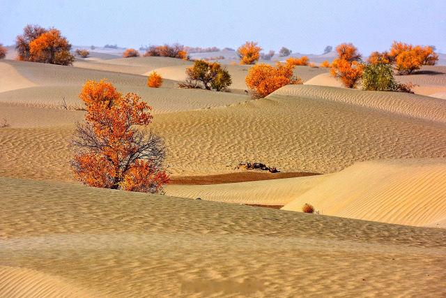
The desiccation of its native lakes, coupled with daytime temperatures that can reach 50 °C (122 °F), means that the Lop Desert is particularly hostile to life. The plethora of freshwater mollusc shells, the extensive belts of dead poplar trees, and the myriad beds of wilted reeds that rest within the wind-etched furrows of towering yardangs[2] are all that remain of what was once a series of verdant oases. When Sven Hedin travelled to the desert during the late 19th century, he witnessed solitary tigers prowling, packs of roving wolves, and groups of wild boar. Nowadays, the only large mammal that can survive in this barren wasteland is the hardy Bactrian camel, which ekes out a meagre living by feeding on the poplar forests and tamarisk shrubs that line the northern edge of the desert. From devastating sandstorms and lofty yardangs to barren salt flats and the blazing heat of the sun, the Lop Desert is an alien landscape that must be navigated with the utmost care.  

Notes:

[1]  Stupa: A hemispherical structure with a small interior designed for storing Buddhist relics and for private meditation.

[2] Yardang: A yardang is a type of landform that results from severe weathering over a period of approximately 700,000 years, where wind and rain strip all of the soft material from the rocks and leave only the hard material behind. Yardangs have characteristically wide bottoms that gradually taper off towards the top, giving them an appearance similar to the hull of a boat, although there are huge variations in their size and shape.  

The Kalamaili Nature Reserve

Stretching from the Ulungur River in the north to the Tian Shan Mountains in the south, the Kalamaili Nature Reserve is one of the largest of its kind in China. It covers a colossal area of more than 14,000 square kilometres (5,405 sq. mi), making it nearly twice the size of Yellowstone National Park in the USA! That being said, its location deep within the Gobi Desert means it doesn’t look like your average nature reserve. There are no bubbling brooks, lush meadows, or towering forests here; only barren sands, hardy desert shrubs, and the looming Kalamaili or “Black Mountains”, which cut through the heart of the reserve and lend it its name. 

These mountains are ancient, dating back to a time when the Kalamaili Reserve was once a verdant paradise. Millions of years ago, they were buried by a vast ocean that covered most of western China. As the ocean receded, tectonic forces pushed a rock basin upwards and formed the mountain range we see today. Where formerly it was submerged under a sea of water, now it is fittingly surrounded by a sea of sand. When the range was formed, the climate was much warmer and far more humid. Small lakes dotted throughout its expanse provided the perfect environment for gymnosperms and ferns to thrive.

During the Triassic and Jurassic Periods, these small pockets of vegetation blossomed into ancient forests and provided a habitat for one of earth’s most enduringly fascinating inhabitants: the dinosaurs. Nowadays all that is left are their desiccated bones, tossed among the shards of petrified wood and blackened rocks that form the mountain range. As the climate in the region became more arid over time, plant species were gradually squeezed out, until only the hardiest could survive in this dry expanse of sand. Every year, the only respite that the reserve receives is a smattering of winter snow and seasonal rain, which accumulates into small salt-spring pools. 

These pools are essential to the survival of plant and animal life in the Kalamaili. Hostile though the reserve may seem, it is populated by over 280 animal species, including the Mongolian wild ass, goitered gazelle, Eurasian wolf, red fox, Argali sheep, and Bactrian camel. It is a case of quality over quantity; the reserve is only able to support around 30,000 animals, meaning the diversity of species is far greater than the density. The reserve’s most famous inhabitant is also one of its rarest: the elusive Przewalski’s horse. 

The horse is named after the Russian officer and biologist Nikolai Przhevalsk, who led a secret expedition into the Dzungarian Basin in 1876 and discovered the wild horses just north of the Kalamaili Mountains. He sent specimens back to Europe, but the species wouldn’t be named until 1881. In a sad twist of fate, by the time the Przewalski’s horse was officially recognised, it had simultaneously become the last known wild horse in Eurasia. In its heyday, it dominated the Kalamaili, with herds of these hardy wild horses coursing across the desert steppe. However, as is so often the case, the expansion of human settlements into the area drove the horses out and their population rapidly plummeted.

No more than a century after they had been discovered, the Przewalski’s horse had gone extinct in China. It wasn’t until 2001 that the Kalamaili would once again hear the thundering of hooves, when the Xinjiang Forestry Department decided to reintroduce a group of 27 Przewalski’s horses into the reserve. Their efforts were largely successful and nowadays there are over 100 horses thriving in the reserve. With their robust frames, square-shaped heads, and coarse hair, they are distinctly different from their domesticated cousins.

Alongside its status as a haven for wild ungulates, the Kalamaili Nature Reserve is an important stopover on the migratory route of numerous bird species, such as golden eagles and saker falcons. Some will stop merely to eat before taking off on another long flight, while others will settle for the season and stay to breed. Like the birds that nest here every year, the Kazakh nomads move from the alpine meadows of the Altai Mountains in the fall and take up residence in the southern Kalamaili during the winter, where the weather is milder and the snow cover is thinner. Until late March to early April, they will remain in their winter tents and graze their livestock on the grasses of the craggy mountains. Where before humans caused so much devastation, nowadays the Kalamaili is a place where man and nature live in harmony. 

The Taklamakan Desert


With a name that is thought to mean “Place of Ruins” or “Place of No Return”, the Taklamakan Desert doesn’t appear to have garnered the friendliest reputation! That being said, another interpretation of the name states that it means “Desert Under the Mountains,” which sounds far less ominous. Extending over a vast area of approximately 337,000 square kilometres (130,000 sq. mi), it represents the largest desert in China and the sixteenth largest in the world. To put that into perspective, it is nearly the size of Germany and over twice the size of England! It is bounded by the Kunlun Mountains to the south, the Pamir Mountains and the Tian Shan Mountains to the west and north, and the Gobi Desert to the east.

Historically, branches of the Silk Road skirted around its northern and southern edges, but travellers generally sought to avoid crossing this barren wasteland directly. Since little water was available along these routes, these wanderers depended on thriving oasis towns such as Kashgar, Marin, Niya, Kuqa, Gaochang, Turpan, Loulan, and Dunhuang, which were supported by melted snow trickling down from the nearby mountains. Due to desertification, the drying-up of water sources, and the eventual obsolescence of the Silk Road, many of these towns were tragically abandoned and lost to the sands of time. While they are no longer able to support human settlement, these ruins have offered up a myriad of archaeological treasures that imply Tocharian, Hellenistic, Indian, and Buddhist influences in the region.

The greatest discovery was made in the late 1980s, when archaeologists uncovered several well-preserved mummies, many of which were over 4,000 years old! Some of them demonstrated Caucasian features and were wearing European twill fabrics, acting as a testament to the early links between Europe and Asia. The most likely explanation is that these people were traveling along the Silk Road from Europe to China, but unfortunately succumbed to an untimely death and were buried in the desert. In fact, after making expeditions to the Taklamakan, famous explorers such as Xuanzang, Aurel Stein, Albert von Le Coq, Sven Anders Hedin, and Langdon Warner have all attested to its treacherous nature.

Unlike other deserts in China, the Taklamakan Desert is unrelentingly hostile and is virtually devoid of any vegetation throughout its barren expanse. During summer, temperatures can rise to 40 °C (104 °F), while in winter they plummet to around −20 °C (−4 °F). In short, this desert is known for blowing hot and cold! During the spring, as north, northwesterly, and northeasterly winds are channelled into the desert and meet near its centre, they can produce sandstorms as powerful as hurricanes. No wonder ancient travellers chose to give this desert a wide berth!

The strong winds and shifting sands largely prevent any vegetation from growing, but there are sparse clumps of desert plants in the depressions between sand dunes and along the edge of the desert itself. Tough thickets of tamarisk, nitre bushes, and reeds can be found between the dunes, while the desert fringes are able to support a wider range of species, including desert poplars, olive trees, camelthorn, and saltworts. This means the periphery of the desert is capable of sustaining a handful of animal species, such as gazelles, wild boars, wolves, foxes, Siberian deer, wild camel, bats, tufted larks, and Tarim jays. In turn, the sand dunes provide a home for rabbits, gerbils, field mice, jerboas, and even hedgehogs!

Turpan

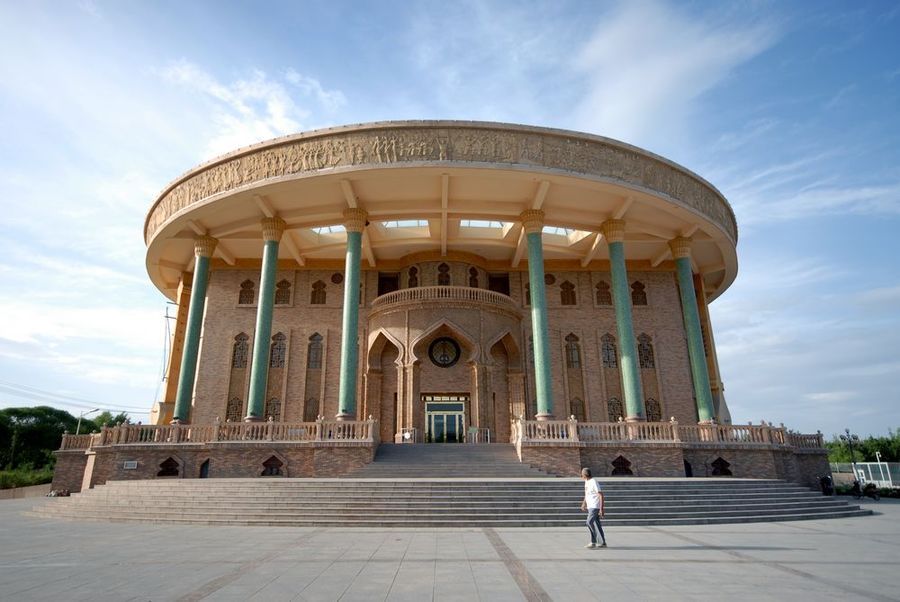
The city of Turpan, also known as Turfan, lies about 180 kilometres (112 mi) southeast of the regional capital of Ürümqi, on the northern edge of the deep Turpan Depression. The Bogda Mountains, an eastern extension of the Tian Shan Mountains, rest to the north, while Qoltag Mountain rises to the south. Its unusual location means its climate is pretty unique, with long hot summers and cold brief winters.

On average, temperatures can range from −7 °C (18 °F) in January to 32 °C (90 °F) in July, but extremes of an icy cold −28 °C (−20 °F) in winter and a swelteringly hot 48 °C (119 °F) in summer are surprisingly common. The long hours of sunshine and characteristic dry heat have earned Turpan the grand title of the “Flaming Continent”. So skip the tanning beds, because you won’t be needing them in this sunny city!

The city’s 570,000-strong-population appear to take the heat in their stride, and most of them belong to the Uyghur ethnic minority. In fact, though at a glance the terrain may appear to be harsh and unforgiving, Turpan actually rests at the centre of a fertile oasis and was once an important trade centre along the northern branch of the Silk Road. Proof that you should never judge a book by its cover, or a city by its weather!

Historically speaking, the area surrounding Turpan has been inhabited for over two thousand years. Originally, during the Han Dynasty (206 BC–220 AD), it belonged to the Gushi Kingdom, later to be known as the Jushi and Cheshi Kingdom. The capital of the Cheshi Kingdom, a city known as Jiaohe, came under the control of the Han court during the 1st century, but the entire region was eventually annexed by the Gaochang Kingdom during the 6th century.

In 640, during the Tang Dynasty (618-907), the region was conquered by Emperor Taizong and Turpan became one of China’s frontier towns, flourishing as a stopover for merchants, monks, and other travellers on their way to the west. By the 13th century, the region had come under Mongolian control and Turpan enjoyed its greatest period of commercial prosperity. Yet the higher you go, unfortunately the further you have to fall!

Tragically, when Mongol rule collapsed, the Turpan Depression was divided into three independent states and the area wasn’t properly united until the Qing Dynasty (1644-1912). During this recovery period, Turpan suffered greatly during the wars between the Qing imperials and the resident Dzungar people. During the 18th century, a new city known as Guang’an was built next to the old Muslim city of Turpan and this eventually became the site of modern-day Turpan.

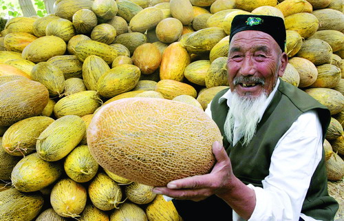
Nowadays the abundant sunshine and high temperatures in the city mean that it’s the ideal place for growing several types of fruit, particularly grapes and melons. The Grape Valley is just 11 kilometres (7 mi) northeast of Turpan and has produced the best grapes in the country for over 1,000 years, earning it the nickname “Green Pearl City”. It boasts over 13 varieties of grape, which visitors are welcome to admire and, occasionally, sample!

Aside from the sumptuously sweet fruit, the scorching heat in Turpan has other benefits. Sand Therapy is a practice that dates back over hundreds of years and involves burying people in 50 °C (122 °F) to 60 °C (140 °F) sand in order to treat various ailments, including rheumatism and skin disease. There is even a Sand Therapy Centre in the northwest of the city, which is immensely popular with locals and tourists alike.

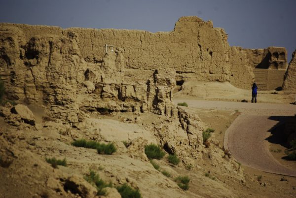
Yet perhaps Turpan’s greatest claim to fame is its prestigious heritage and the historical relics that surround it. The Jiaohe Ruins are located in Yarnaz Valley, just 10 kilometres (6 mi) west of the city, and date back over 2,300 years. They are considered one of the most well-preserved ruins of an earthen city in the world and were made a UNESCO World Heritage Site in 2014.

This heritage site also includes the ruins of Gaochang, another ancient city located at the foot of the Flaming Mountains about 46 kilometres (29 mi) southeast of Turpan. It was once another major city along the Silk Road and was initially built during the 1st century BC. Mummies of both Caucasian and Mongolian ancestry have been found in the Astana Tombs just 4 kilometres (2.5 mi) north of Gaochang and may indicate that it was one of the first multi-ethnic cities in the world.

Not far from these ancient ruins, the Bezeklik Thousand Buddha Caves are a set of cave grottos dating back to between the 5th and 14th centuries. As Buddhism was one of the first religions to be introduced to the area via the Silk Road, Xinjiang witnessed the earliest development of this style of cave art in China. Of the 83 original caves in this complex, only 57 remain and most of these date back to between the 10th and 13th centuries.

About 10 kilometres (6 mi) to the east of Turpan, the Flaming Mountains rise up in the sandy desert. Their unusual name is derived from the burnished red colour of their bedrock, which gives the mountains the appearance of being aflame when hit with direct sunlight. With summer temperatures regularly reaching in excess of 50 °C (122 °F), these mountains are widely considered the hottest spot in China and certainly live up to their fiery name!

Join a travel with us to explore more about TurpanExplore the Silk Road in China

Gaochang Ruins

The Gaochang Ruins were once the site of an ancient oasis city built on the northern edge of the unforgiving Taklamakan Desert. They are located at the foot of the Flaming Mountains, about 46 kilometres (29 mi) southeast of Turpan, and have miraculously survived for over 2,000 years. They were incorporated into the Silk Road UNESCO World Heritage Site in 2014 and, thanks to renovations and preservation projects, have since enjoyed a much deserved facelift! Though they may not be in as good a condition as the Jiaohe Ruins, which are about 40 kilometres (25 mi) to their west, they still maintain a certain inimitable charm.

The city was built during the 1st century BC and was ruled by the Cheshi (Jushi) Kingdom, until they surrendered control of the area to the Han Dynasty (206 BC–220 AD) around about 50 BC. It played a focal role as one of the main trade hubs and oasis towns along the Silk Road, making it a prized asset that the Han court was keen to protect. It became the capital of the Gaochang Kingdom (531-640) during the 6th century but returned to Chinese control in 640, when it was conquered by Emperor Taizong of the Tang Dynasty (618-907). However, this would prove to be short-lived as the Tang court was forced to withdraw its military forces from the area in 755. Like a property in Central London, Gaochang’s prime location meant it was incredibly valuable and hotly contested!

By 803, the Uyghur ethnic group had taken control of the city and it became part of the Kingdom of Qocho (856-1335). In 1209 this kingdom came under the suzerainty of Genghis Khan and eventually became part of the Yuan Dynasty (1271-1368), but was seized by a rival Mongolian kingdom known as the Chatagai Khanate from 1275 to 1318. When the Yuan Dynasty eventually collapsed, the trade route that ran through Gaochang was disrupted and war broke out between the Mongolians and the Uyghurs. This warfare greatly damaged the city and this, coupled with the disruption of trade, led to the city being gradually abandoned.

Although the city was left in bad shape, much of the additional destruction happened long after it was deserted. Initially Muslims from outlying areas destroyed many of the Buddhist frescos within the city that depicted human or animal forms, believing them to be blasphemous. Then, over a period of time, local farmers took wall paintings from the temples and soil from the walls of the earthen buildings, as they made good fertiliser. So remember, if you happen to sample any of the locally grown vegetables, you’re quite literally enjoying the taste of Gaochang!

It wasn’t until the late 19th century that the archaeological value of the region was discovered, and soon archaeologists from across the globe flocked to the area to marvel at the ruins. Many of the relics excavated in Gaochang are now scattered throughout museums in London, Berlin, St. Petersburg, and other far-flung cities, but many more still remain within the city’s dilapidated walls.

In its heyday, the city boasted an impressive population of approximately 30,000 people and was undoubtedly one of the livelier towns along the Silk Road. Its colossal earthen walls once towered in at over 11 metres (38 ft.) in height and it was separated into three parts: the outer city, the inner city, and the palace city. The inner city was protected by a secondary inner wall, which has since vanished, but large portions of the outer wall still remain. The palace city at Gaochang’s northernmost point was once arguably its most magnificent edifice, but now contains only the massive cornerstones of the ruined imperial palace.

On top of being a centre for trade, it was once an important religious site and, during the Tang Dynasty, it became one of the foremost Buddhist cities. In 630, while on his pilgrimage to India, the renowned monk Xuanzang even gave lectures there. At one time, the city was host to numerous monasteries, including a Confucian college and a Nestorian church, and over 3,000 monks made a home within its walls. Nowadays all that remains of this illustrious heritage are the ruins of two major temples in the southern part of the outer city. The temple in the southwest still has remnants of a gate, a courtyard, a sermon hall, a sutra[1] depository, and the monks’ living quarters, while the temple in the southeast only consists of a tower and a series of well-preserved murals.

Mummies recovered from the Astana Tombs, just 4 kilometres to the north of the ruins, were discovered to be of both Caucasian and Mongolian descent, which suggests that Gaochang may have been one of the oldest multi-ethnic and multi-religious cities in China. Murals in the nearby Bezeklik Thousand Buddha Caves also depict both Central Asian and Chinese monks. So who knows, you might recognise your great-great-great-great-great-grandfather in one of the frescos!


1. Sutra: One of the sermons of the historical Buddha.


Other Customs of Uyghur Ethnic Minority

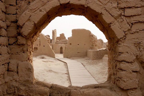
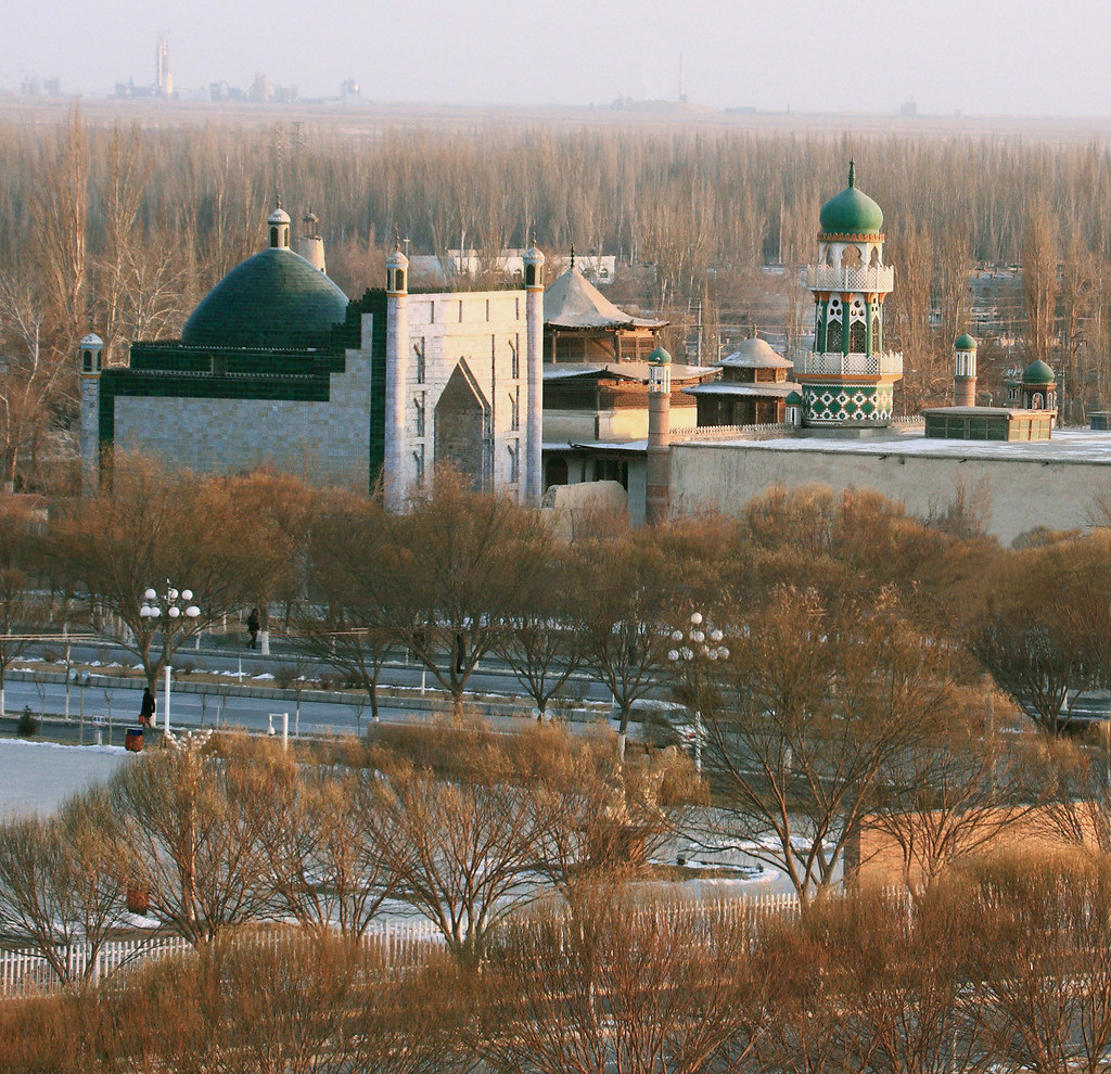
The customs and taboos of the Uyghur ethnic minority have been informed primarily by their rich history and their pious belief in Islam. When receiving guests, the host will typically offer them the best seats, treat them to some tea or milk, and then provide them with some small snacks, such as dried fruit or sweetmeats. If you are offered a drink, be sure to take the cup with both hands as this is a sign of courtesy. The same applies if you are being offered a gift.

When dinner is ready to be served, the host will bring a kettle of water and invite the guests to wash their hands. This is because many Uyghur signature dishes, such as zhuafan or “hand rice”, are eaten with the hands or using a piece of naan bread rather than with cutlery. It is important to note that you should never place the naan bread upside down while eating it. According to their Islamic faith, Uyghurs are forbidden from eating pork and they also cannot eat any animal that has not been killed by a butcher in the traditional halal way.

When it comes to dining etiquette, it is considered extremely rude for a guest to fiddle with the food in their dish, put back any food that they’ve taken, or leave some food in their bowl. If any food is dropped during the meal, the guest should quietly pick it up and wrap it in a tissue. Once the meal is finished, the elderly members of the household will lead the group in a profound act of worship known as a Dua[1]. Guests should remain in their seats and try to stay as still as possible during the Dua.

[1]Dua: The term “dua” is an Arabic word that roughly translates to mean “supplication” or “invocation”. Within the Islamic faith, it is an act of worship whereby the worshipper calls out to Allah and expresses their devotedness to him.

Join a travel with us to discover the Culture of Uyghur Ethnic Minority: Explore the Silk Road in China

The Tian Shan Mountains

In Chinese, “Tian Shan” literally translates to mean “Heavenly Mountain” or “Mountain of Heaven”. With its glittering snow-capped peaks, sparkling lakes, and emerald-hued forests, this mountain range certainly lives up to its name! Stretching for over 2,500 kilometres (1,500 mi) across Central Asia, it crosses the countries of China, Kazakhstan, Kyrgyzstan, and Uzbekistan. Its diverse landscape, rich biodiversity, and cultural significance meant it was inscribed by UNESCO as a World Heritage Site in 2013.

According to the folk religion of Tengrism, the mountain range is a profoundly sacred place and its second highest peak, the 7,010-metre (23,000 ft.) high Khan Tengri, literally means “King of the Heavens”. Its highest point, known as Jengish Chokusu or “Victory Peak”, towers in at a height of 7,439 metres (24,406 ft.), meaning it is just 1,406 metres (4,613 ft.) shy of Mount Everest and the 60th tallest mountain the world. Together they are classed as the two most northerly peaks over 7,000 metres (23,000 ft.) in the world. It might not be the greatest claim to fame, but they will forever be the Kings in the North!

Since the mountain range is one of the longest in Central Asia, it is often separated into a number of smaller ranges for the purpose of ease, including the Barkol Mountains near the city of Hami and the Borohoro Mountains just south of Ürümqi. Within China, it is bounded by the Dzungarian Basin to the north and the Tarim Basin to the south, meaning it forms a natural dividing line within the region of Xinjiang. The mountain range is home to one of Xinjiang’s most popular and celebrated attractions: Tianchi or Heavenly Lake. Resting within a valley on the northern slope of Bogda Peak, this alpine lake is formed from melted snow trickling down from the icy tips of the mountains. Its crystal clear waters reflect the snow-capped peaks above it and the emerald-hued spruces that surround it, creating a breath-taking tableau.

The mountain range’s ethereal beauty is reflected in the many legends about it, as it is rumoured to be the home of the peach tree of immortality, which is fiercely guarded by the Chinese folk deity Xiwangmu or “Queen Mother of the West”. Magical peaches may be the stuff of myth, but the lower slopes are blanked in ancient forests formed of wild walnut, pistachio, apricot, and apple trees. While you may not discover the secret to everlasting life, a trip to the Tian Shan Mountains is sure to be fruitful!

Depending on the altitude, the forests alternate between hardy steppes and lush meadows, with dense clutches of maple trees, junipers, aspens, birches, poplars, and numerous other species. Mixed grasses and wildflowers blanket the alpine meadows on the northern slopes, while the southern slopes are characterised by much sparser vegetation. Wolves, bears, wild boars, foxes, ermines, badgers, mountain goats, deer, and mountain sheep all roam these forests, but the range’s prized inhabitant is far more elusive: the rare and critically endangered snow leopard. Mountaineers who work as guides on the mountain range say they’re lucky to catch a glimpse of this mysterious creature even once in a lifetime!

A myriad of China’s ethnic minorities inhabit the region surrounding the Tian Shan Mountains, including the Uyghurs, the Kyrgyz, the Kazakhs, the Mongols, and the Uzbeks. Alongside the majesty of the mountains, many of the Uyghur, Kyrgyz, and Kazakh settlements have become tourist attractions in of themselves, with crowds of visitors flocking there every year to witness traditional festivals, sample local cuisine, and enjoy their unique cultures. From lively horse races to outdoor lamb roasts, a trip to the Tian Shan Mountains would be simply incomplete without a stay in one of these vibrant settlements.

We will meet the the Tian Shan Mountains on the travel: Explore the Silk Road in China

Hami

hami01

Alternately known as Kumul and historically as Yiwu, Hami is a city of many names! Not only was it once a major trading hub along the northern branch of the Silk Road, it represented the main gateway from which one would leave China and enter the western regions (modern-day Xinjiang). Its strategic importance meant that it was frequently fought over by warring dynasties, and its location at the confluence between ancient China and Central Asia saw it develop under the combined influence of Han Chinese and Uyghur Muslim culture.

The oldest known reference to Hami dates back to the 1st millennium BC, when the city was named Cumuḍa and was occupied by the Yuezhi people. Realising its potential as an oasis and trade hub, the Han Chinese swiftly occupied it and the Han Dynasty (206 BC–220 AD) transformed it into a military stronghold named Yiwu in 73 AD. The Han Chinese ran a lucrative business from the city, using the fertile land to grow food to supply nearby troops and passing trade caravans. Its value was soon recognised by others and, throughout the late Han Dynasty, it would frequently change hands between the Han Chinese and the nomadic Xiongnu people. Relics from this ancient time, including several well-preserved mummies, are currently exhibited at Hami Museum.

During the 9th century, it came under the control of the Uyghur people, but was in turn conquered by the Mongolians during the 13th century. It was during this time that the city was visited by the famous Italian explorer Marco Polo, who knew it under the name Camul. When the Mongol-led Yuan Dynasty (1271-1368) fell to the Ming Dynasty (1368-1644), it was annexed by Gunashiri, a descendant of Chagatai Khan, who founded his own small kingdom called Qara Del but who ultimately answered to the Ming imperials as a vassal state. By the late 17th century, it had been conquered by the Kumul Khanate (1696–1930), although it remained a vassal of the Qing Dynasty (1644-1912) and eventually the Republic of China (1912-1949). In short, Hami was passed around more often than a hot potato!

Hami melonNowadays it is famed for the sweetness and quality of its locally grown fruit. In fact, the muskmelons that come from Hami are held in such high esteem that the Chinese name for this type of melon is simply “hamigua (哈密瓜) or “Hami melon”. To the city’s north lie the Tian Shan Mountains, while its east and west are flanked by hostile desert. Like a flower blooming in the barren sands, this is what makes Hami and its fertile terrain so special.

The region is served by an arid continental climate, with extreme differences between summer and winter. July temperatures can easily exceed 26 °C (80 °F), but plummet to around −10 °C (13 °F) in January. Vast differences in even daytime and night-time temperatures have given rise to the local saying: “People in Hami wear a fur-lined jacket in the morning and very thin clothes at noon, while at night they eat melons around a warm stove”. In this city, the locals are always blowing hot and cold!

Tombs of the Uyghur Kings of HamiThe ancient Tombs of the Uyghur Kings of Hami lie approximately 2 kilometres (1 mi) south of the city proper. This grand mausoleum was built in 1840 and honours the Uyghur kings who ruled over the region during the Qing Dynasty, along with members of their royal families. The tombs are largely constructed in a traditional Islamic style, although they retain some uniquely Chinese features. The most prominent is the tomb of King Boxier, the 7th King of Hami, which towers in at 18 metres (59 ft.) in height.

From spooky tombs to singing sands, Hami is located just 70 kilometres (43 mi) from Mingsha Hill. “Mingsha” or “Singing Sands” Hill is actually a collection of tall sand dunes that boast a fascinating natural phenomenon. When people slide down from the hilltop, the reverberation of the shifting sands produces a strange sound that makes it seem as though the dunes are singing. According to one rather morbid legend, these sounds are the plaintive wails of the female military general Fan Lihua and her 72 soldiers, whose corpses were buried under the sand. So be sure to watch where you step, or the singing sand dunes might have you screaming!


The Tarim Basin

The Tarim Basin may seem like a simple geographical phenomenon, but there’s more to it than meets the eye. Covering an area of approximately 1,020,000 square kilometres (390,000 sq. mi), it stretches over more than half of Xinjiang’s territory and is often referred to as Nanjiang or “Southern Xinjiang”, with the northern half of the region being known as Dzungaria or Beijiang. To put that into perspective, it is nearly twice the size of Spain and three times the size of Germany! Its northern boundary is marked by the Tian Shan Mountains, its southern boundary is skirted by the Kunlun Mountains, and its centre is dominated by the hostile Taklamakan Desert.

Historically, the region was known as Altishahr, which translates to “Six Cities” in the language of the Uyghur people. This was in reference to ancient oasis cities such as Kashgar and Turpan, which rested on the outskirts of the Tarim Basin and played a focal role as trading hubs along the Silk Road. The area may seem inhospitable now, but a startling archaeological discovery proved that it was once a cradle of civilisation. At the beginning of the 20th century, famed explorers such as Sven Hedin, Albert von Le Coq, and Aurel Stein ventured into the basin and recounted how, in their quest to unearth historical relics, they’d uncovered a number of desiccated bodies. They would soon come to be known as the Tarim Mummies, and would play an invaluable role in discovering the history of the region.

tarim xiaoheThe vast majority of the mummies were found either on the eastern end or the southern edge of the Tarim Basin. The oldest date back to approximately 1800 BC and, more fascinating still, they are of Caucasoid origin. The extremely arid climate of the desert means the bodies have been beautifully preserved. For example, the famed “Cherchen Man” still boasts his locks of luscious red hair, in spite of having died over 3,000 years ago; the “Witches of Subeshi”, who passed away sometime between the 4th or 3rd century BC, can still be seen with their black felt conical hats; another body found in Subeshi betrays the first potential signs of surgery, as an incision in his abdomen has been sewn up with horsehair; and several bodies have clearly visible tattoos.

The mummies share a number of physical features, including elongated bodies, angular faces, recessed eyes, and blond, brown, or red hair, which are all associated with the Caucasian ethnic group. Modern-day genetic testing appears to confirm this conclusion, since many of the ethnic groups that are native to Xinjiang, such as the Uyghurs, Kazakhs, and Kyrgyz, exhibit both East Asian and Caucasian DNA. Many researchers have speculated that the Tarim Mummies may belong to the Tocharian ethnic group, which were described as having full beards, red or blond hair, deep-set blue or green eyes, and long, aquiline noses. While many of the mummies are now displayed in museums throughout Xinjiang, the mystery they leave behind continues to both plague and delight historians.

In its time, the Tarim Basin has fostered the growth of numerous ancient kingdoms, including the Loulan, the Kucha, and the Khotan. Alongside the Silk Road, it was these multifarious kingdoms that facilitated the dissemination of culture from Central Asia and India into China, most notably the introduction of Buddhism and Islam. Unfortunately the native rivers were deeply temperamental and changes to their course would cause lakes to move, which in turn would necessitate alterations in the routes of the Silk Road. Imagine trying to navigate all of those road closures without a satnav!

The greatest example of this was the desertion of the middle route, which was established during the Han Dynasty (206 BC–220 AD) and ran through the centre of the Tarim Basin towards the lake of Lop Nur. The gradual desiccation of the lake led to the decline of the oasis city Loulan and the collapse of the Loulan Kingdom, which in turn forced travellers to abandon this route from the 6th century onwards. The Tarim Basin was a place of blessing and curse, simultaneously welcoming certain ethnic groups and causing devastation to others.

From the 7th century until the late 8th century, it was a hotly contested region, frequently changing hands between the Tang Dynasty (618-907) and the rival Tibetan Empire (618–842). With so many valuable trade routes, it seemed everyone wanted a piece of the Tarim Basin! By the 9th century, the collapse of the Uyghur Khaganate (744–840) resulted in hundreds of Uyghur immigrants flooding into the region. While researchers believe the Uyghurs were still predominantly Buddhist at this point, Islam was introduced and became the dominant religion when the Muslim Turkic peoples of the Kara-Khanid Khanate (840–1212) conquered the western Tarim Basin at the start of the 11th century. It wasn’t until 1884, under the Qing Dynasty (1644-1912), that Dzungaria and the Tarim Basin were finally combined to form Xinjiang. To this day, they remain two distinct regions with their own cultures, histories, and unique personalities!

The Gurbantünggüt Desert

Gurbantünggüt Desert

Ranking behind the expansive Taklamakan Desert, the Gurbantünggüt Desert is the second largest desert in China. It spreads over a colossal area of 50,000 square kilometres (19,000 sq. mi), making it nearly four times the size of Death Valley in the USA! Resting within the Dzungarian Basin in the northern reaches of Xinjiang, it is located to the east of the Manasi River and to the south of the Ulungur River. Throughout the barren sands are interspersed deep oases where over 100 different desert plant species flourish, including magnificent virgin forests made up of desert poplars and saxaul trees. These hardy plants are only provided with rainwater once per year, when the annual snow falls in winter and melts in spring. They add a touch of greenery to the hostile landscape and provide grazing for the wild Mongolian gazelles.

A chain of cities, the largest of which is Xinjiang’s capital of Ürümqi, forms a well-populated strip along the southern edge of the desert. These cities were once major trading hubs along the ancient Silk Road and were able to survive thanks to glacier-fed streams flowing down from the Tian Shan Mountains. At its northwestern edge, the desert is skirted by the Irtysh–Karamay–Ürümqi Canal, an ingenious system that is currently being constructed with the aim of transferring water from the Irtysh River to the arid regions of northern and central Xinjiang. The eastern branch of the canal runs directly across the centre of the desert until it finally reaches the Tian Shan Mountains.

Gurbantünggüt Desert02The western part of the desert was once dominated by salt lakes, although tragically many have disappeared due to the impact of human activities. While the Ailik Lake remains, the Manas Lake dried up long ago. Water is of paramount importance in this scorched desert, particularly when you consider that it is the remotest point of land from any sea or ocean on earth! At its centremost point, it is over 2,600 kilometres (1,600 mi) from the nearest coastline. To put that into perspective, that is nearly twice the length of the United Kingdom!

In spite of its location, the climate of the desert is markedly temperate compared to China’s other sandy behemoths, such as the inhospitable Taklamakan Desert. It is mainly made up of fixed and semi-fixed sand ridges but, unlike other deserts in the region, it does not boast any mega-dunes or dunes of notable height. Instead, it stretches out endlessly towards the horizon, the sands rippling and undulating like some great heaving beast in the sweltering sun.