Lake Poyang

Lake Poyang03

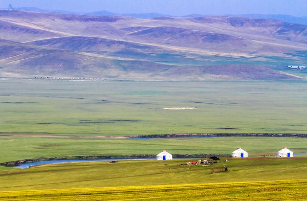
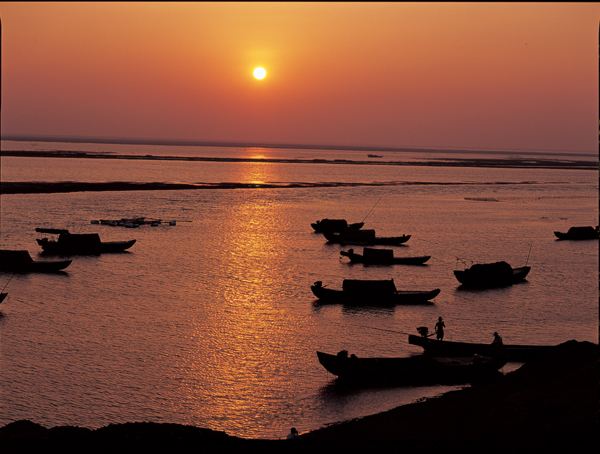
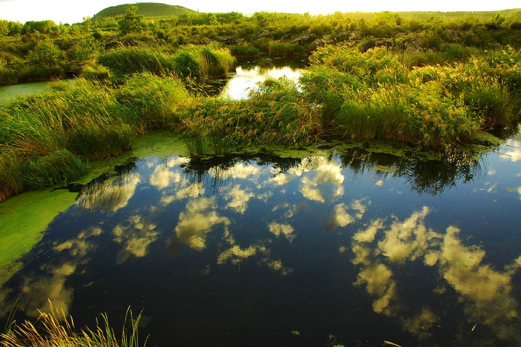
Fed by the rippling Gan River that cuts through Jiangxi province, Lake Poyang is the largest freshwater lake in China. Or at least most of the time it is! In fact, the “lake” is actually a system of lakes and swamps that are subject to change throughout the seasons, fluctuating in size dramatically depending on the weather conditions. In winter, the entire area transforms into a dense marsh, crisscrossed with waterways and speckled with verdant hills. In summer, when the region floods due to heavy rain, these hills become islands and the lake swells to its full grandeur.

Tragically, its size has drastically decreased in recent years due to drought and the construction of the Three Gorges Dam. To put it into perspective, the provincial capital of Nanchang once rested on the shores of the lake, but is now 24 kilometres (15 mi) away from it! In spite of this unfortunate change, the lake remains an important habitat for migratory birds and over half a million birds take refuge on its shores every year.

During winter, it becomes home to over 90% of the planet’s Siberian crane population. The Siberian crane is one of the most critically endangered species in the world, with their population dwindling to approximately 3,000 individuals. Since they mate for life and typically live for upwards of 30 years, they have become symbols of longevity and prosperity in Chinese culture. With their pure white feathers and elegant long legs, it’s unsurprising that these delicate creatures draw crowds of bird-watchers to Lake Poyang every year.

Lake Poyang01Researchers have surmised that the lake was formed sometime around the year 400, when the Yangtze River switched to a more southerly course, causing the Gan River to back up and form Lake Poyang. Tragically this triggered mass flooding in Poyang County and Haihun County, forcing innumerable people to abandon their homes and relocate to Wucheng Township (modern-day Yongxiu County). However, as the old saying goes, every cloud has a silver lining! Thanks to this sudden influx of people, Wucheng grew to become one of the wealthiest and most prominent townships in Jiangxi province, which spawned the local phrase: “Drowning Haihun County gives rise to Wucheng Township”.

Yet this isn’t the lake’s only historical claim to fame. It was also the site of the epic Battle of Lake Poyang, which represented one of the greatest naval battles in Chinese history. On the fall of the Yuan Dynasty (1271-1368), numerous rebel groups sought to seize control of the throne, the most powerful of which were the Ming, the Han, and the Wu. In 1363, the Han leader Chen Youliang besieged the city of Nanchang with his formidable navy of tower ships.

In response, the Ming leader Zhu Yuanzhang sent his naval forces, which were smaller but also more nimble. After six harrowing days of fighting on the lake, the Ming achieved a glorious victory, which all but cemented their position as the leading rebel group. Five years later, Zhu finally took power and established the Ming Dynasty (1368-1644) under the title the Hongwu Emperor.

Alongside these historical events, legends abound regarding the lake and its many scenic spots. One such legend recounts why Dagu Hill, a small island nestled in the lake’s clear blue waters, resembles a giant shoe. Many years ago, it’s said that a young fisherman named Hu Qing lived on the hill. One day, he was fishing on the lake when he came across a box containing a beautiful pearl. On his way home that day, he saw a young girl dressed in green, who was softly weeping. He asked her what was wrong, and she told him that she had lost her precious pearl. Without a second thought, he returned the pearl to her and went on his way.

Lake Poyang 02The next day, Hu was once again fishing on the lake when a huge storm eclipsed the shore. He knew he was in grave danger. As he fought the storm, he suddenly saw a maiden dressed in green holding a glowing pearl. Using the light of the pearl, he was able to navigate his way safely back to shore. The girl explained that she was actually a fairy named Da Gu, but she had been exiled to earth because she had violated the holy rules of heaven. As with all good fairy-tales, Hu and Da Gu fell madly in love and got married. However, it seems happily ever after wasn’t in the cards for them!

The Jade Emperor learned that Da Gu had married a mortal man and sent his army to capture her. Meanwhile, a vicious overlord named Sheng Tai had become captivated by Da Gu’s beauty and wanted to make her his own. As the Jade Emperor’s army captured Da Gu and began carrying her back to heaven, she looked down and saw her husband being tortured by Sheng and his cronies. In a desperate attempt to save him, she slipped off one of her shoes. As it fell to earth, it transformed into a huge piece of rock, crushing Sheng’s men and saving Hu. This rock supposedly forms the shoe-like cliff that makes Dagu Hill so unique!

Nowadays, the hill is a popular tourist spot, offering panoramic views of the glistening lake and boasting the magnificent Heaven Flower Palace. That being said, the mystical forces at play on Lake Poyang aren’t always quite so benevolent! Known as China’s “Bermuda Triangle”, the waters surrounding Laoye Temple on the lake’s northern shore are notorious as a place of supernatural activity. On April 16th 1945, a Japanese troop ship and its 20 sailors vanished without a trace while sailing on the lake. Over a period of 30 years, more than 200 boats have mysteriously sunk in these waters, never to be seen again. So, if you’re taking a trip to the temple, be sure to stay on the shore!


Hami

hami01

Alternately known as Kumul and historically as Yiwu, Hami is a city of many names! Not only was it once a major trading hub along the northern branch of the Silk Road, it represented the main gateway from which one would leave China and enter the western regions (modern-day Xinjiang). Its strategic importance meant that it was frequently fought over by warring dynasties, and its location at the confluence between ancient China and Central Asia saw it develop under the combined influence of Han Chinese and Uyghur Muslim culture.

The oldest known reference to Hami dates back to the 1st millennium BC, when the city was named Cumuḍa and was occupied by the Yuezhi people. Realising its potential as an oasis and trade hub, the Han Chinese swiftly occupied it and the Han Dynasty (206 BC–220 AD) transformed it into a military stronghold named Yiwu in 73 AD. The Han Chinese ran a lucrative business from the city, using the fertile land to grow food to supply nearby troops and passing trade caravans. Its value was soon recognised by others and, throughout the late Han Dynasty, it would frequently change hands between the Han Chinese and the nomadic Xiongnu people. Relics from this ancient time, including several well-preserved mummies, are currently exhibited at Hami Museum.

During the 9th century, it came under the control of the Uyghur people, but was in turn conquered by the Mongolians during the 13th century. It was during this time that the city was visited by the famous Italian explorer Marco Polo, who knew it under the name Camul. When the Mongol-led Yuan Dynasty (1271-1368) fell to the Ming Dynasty (1368-1644), it was annexed by Gunashiri, a descendant of Chagatai Khan, who founded his own small kingdom called Qara Del but who ultimately answered to the Ming imperials as a vassal state. By the late 17th century, it had been conquered by the Kumul Khanate (1696–1930), although it remained a vassal of the Qing Dynasty (1644-1912) and eventually the Republic of China (1912-1949). In short, Hami was passed around more often than a hot potato!

Hami melonNowadays it is famed for the sweetness and quality of its locally grown fruit. In fact, the muskmelons that come from Hami are held in such high esteem that the Chinese name for this type of melon is simply “hamigua (哈密瓜) or “Hami melon”. To the city’s north lie the Tian Shan Mountains, while its east and west are flanked by hostile desert. Like a flower blooming in the barren sands, this is what makes Hami and its fertile terrain so special.

The region is served by an arid continental climate, with extreme differences between summer and winter. July temperatures can easily exceed 26 °C (80 °F), but plummet to around −10 °C (13 °F) in January. Vast differences in even daytime and night-time temperatures have given rise to the local saying: “People in Hami wear a fur-lined jacket in the morning and very thin clothes at noon, while at night they eat melons around a warm stove”. In this city, the locals are always blowing hot and cold!

Tombs of the Uyghur Kings of HamiThe ancient Tombs of the Uyghur Kings of Hami lie approximately 2 kilometres (1 mi) south of the city proper. This grand mausoleum was built in 1840 and honours the Uyghur kings who ruled over the region during the Qing Dynasty, along with members of their royal families. The tombs are largely constructed in a traditional Islamic style, although they retain some uniquely Chinese features. The most prominent is the tomb of King Boxier, the 7th King of Hami, which towers in at 18 metres (59 ft.) in height.

From spooky tombs to singing sands, Hami is located just 70 kilometres (43 mi) from Mingsha Hill. “Mingsha” or “Singing Sands” Hill is actually a collection of tall sand dunes that boast a fascinating natural phenomenon. When people slide down from the hilltop, the reverberation of the shifting sands produces a strange sound that makes it seem as though the dunes are singing. According to one rather morbid legend, these sounds are the plaintive wails of the female military general Fan Lihua and her 72 soldiers, whose corpses were buried under the sand. So be sure to watch where you step, or the singing sand dunes might have you screaming!


The Tarim Basin

The Tarim Basin may seem like a simple geographical phenomenon, but there’s more to it than meets the eye. Covering an area of approximately 1,020,000 square kilometres (390,000 sq. mi), it stretches over more than half of Xinjiang’s territory and is often referred to as Nanjiang or “Southern Xinjiang”, with the northern half of the region being known as Dzungaria or Beijiang. To put that into perspective, it is nearly twice the size of Spain and three times the size of Germany! Its northern boundary is marked by the Tian Shan Mountains, its southern boundary is skirted by the Kunlun Mountains, and its centre is dominated by the hostile Taklamakan Desert.

Historically, the region was known as Altishahr, which translates to “Six Cities” in the language of the Uyghur people. This was in reference to ancient oasis cities such as Kashgar and Turpan, which rested on the outskirts of the Tarim Basin and played a focal role as trading hubs along the Silk Road. The area may seem inhospitable now, but a startling archaeological discovery proved that it was once a cradle of civilisation. At the beginning of the 20th century, famed explorers such as Sven Hedin, Albert von Le Coq, and Aurel Stein ventured into the basin and recounted how, in their quest to unearth historical relics, they’d uncovered a number of desiccated bodies. They would soon come to be known as the Tarim Mummies, and would play an invaluable role in discovering the history of the region.

tarim xiaoheThe vast majority of the mummies were found either on the eastern end or the southern edge of the Tarim Basin. The oldest date back to approximately 1800 BC and, more fascinating still, they are of Caucasoid origin. The extremely arid climate of the desert means the bodies have been beautifully preserved. For example, the famed “Cherchen Man” still boasts his locks of luscious red hair, in spite of having died over 3,000 years ago; the “Witches of Subeshi”, who passed away sometime between the 4th or 3rd century BC, can still be seen with their black felt conical hats; another body found in Subeshi betrays the first potential signs of surgery, as an incision in his abdomen has been sewn up with horsehair; and several bodies have clearly visible tattoos.

The mummies share a number of physical features, including elongated bodies, angular faces, recessed eyes, and blond, brown, or red hair, which are all associated with the Caucasian ethnic group. Modern-day genetic testing appears to confirm this conclusion, since many of the ethnic groups that are native to Xinjiang, such as the Uyghurs, Kazakhs, and Kyrgyz, exhibit both East Asian and Caucasian DNA. Many researchers have speculated that the Tarim Mummies may belong to the Tocharian ethnic group, which were described as having full beards, red or blond hair, deep-set blue or green eyes, and long, aquiline noses. While many of the mummies are now displayed in museums throughout Xinjiang, the mystery they leave behind continues to both plague and delight historians.

In its time, the Tarim Basin has fostered the growth of numerous ancient kingdoms, including the Loulan, the Kucha, and the Khotan. Alongside the Silk Road, it was these multifarious kingdoms that facilitated the dissemination of culture from Central Asia and India into China, most notably the introduction of Buddhism and Islam. Unfortunately the native rivers were deeply temperamental and changes to their course would cause lakes to move, which in turn would necessitate alterations in the routes of the Silk Road. Imagine trying to navigate all of those road closures without a satnav!

The greatest example of this was the desertion of the middle route, which was established during the Han Dynasty (206 BC–220 AD) and ran through the centre of the Tarim Basin towards the lake of Lop Nur. The gradual desiccation of the lake led to the decline of the oasis city Loulan and the collapse of the Loulan Kingdom, which in turn forced travellers to abandon this route from the 6th century onwards. The Tarim Basin was a place of blessing and curse, simultaneously welcoming certain ethnic groups and causing devastation to others.

From the 7th century until the late 8th century, it was a hotly contested region, frequently changing hands between the Tang Dynasty (618-907) and the rival Tibetan Empire (618–842). With so many valuable trade routes, it seemed everyone wanted a piece of the Tarim Basin! By the 9th century, the collapse of the Uyghur Khaganate (744–840) resulted in hundreds of Uyghur immigrants flooding into the region. While researchers believe the Uyghurs were still predominantly Buddhist at this point, Islam was introduced and became the dominant religion when the Muslim Turkic peoples of the Kara-Khanid Khanate (840–1212) conquered the western Tarim Basin at the start of the 11th century. It wasn’t until 1884, under the Qing Dynasty (1644-1912), that Dzungaria and the Tarim Basin were finally combined to form Xinjiang. To this day, they remain two distinct regions with their own cultures, histories, and unique personalities!

Wudalianchi Global Geopark

Wudalianchi 01

Imagine, hundreds of years ago, hearing a thunderous crack rend the air and watching in horror as ash plumed into the sky, blocking out the sun. This was the terrifying reality for the people of Wudalianchi County in Heilongjiang province when, from 1719 to 1721, a sequence of volcanic eruptions sent shockwaves throughout this otherwise peaceful region. As lava rushed up to the surface and snaked its way across the land, it formed two large volcanoes: Mount Laohei and Mount Huoshao. In the process, hardened lava blocked a section of the nearby Amur River, forming a series of five interconnected lakes.

Wudalianchi 03The beauty of these lakes, coupled with the fourteen volcanoes and countless volcanic landforms nearby, meant it was designated by UNESCO as a Global Geopark in 2004. In fact, this scenic area is so integral to the region that its name and the county’s name of “Wudalianchi” literally translates to mean the “Five Conjoined Pools”. While most natural disasters leave behind a trail of destruction and devastation, these volcanic eruptions ended up producing one of the finest natural attractions in China!

The five great lakes, known as Lotus Lake, Yan Mountain Lake, White Dragon Lake, Crane Chirping Lake, and Ruyi Lake, have names equally matching their grandeur. Among them are littered frozen lava cascades, surreal lava stalactites, eerie lava passages, belching fumaroles[1], strangely shaped lapilli[2], and smooth volcanic bombs[3]. These bizarre formations were all produced over millions of years as a result of volcanic activity. After all, with fourteen volcanoes in the vicinity, things are bound to get a little heated! Mount Laohei remains the most popular of the volcanoes and, at a staggering 516 metres (1693 ft.) in height, is also the largest. Evidently sometimes size does matter!

With its shimmering lakes, towering volcanoes, and bizarre lava formations, you’d think Wudalianchi Global Geopark would be a haven for geologists and hikers. Yet many of its visitors are after more than just a glimpse at its natural beauty. According to local legend, over one hundred years ago a young herder from the Daur ethnic minority named Galasangbaiyin lived near Wudalianchi. As with all good folktales, he fell madly in love with a slave girl called Aqimeige. However, when the herd owner discovered their secret affair, he thrashed Galasangbaiyin and locked him in the stables. In a fit of desperation, Aqimeige stole a horse, placed her unconscious lover on its back, and attempted to make her escape.

As she rode away, the herd owner shot her with a poisoned arrow and she fell from the horse, dragging Galasangbaiyin with her. Together they both plunged into a nearby spring and found, to their surprise, that the cool water miraculously cured their wounds. To mark this unbelievable event, Galasangbaiyin inscribed the words “medical spring” on the rock beside it, and Daur herders would swarm to it to take advantage of its healing powers. No one knows exactly which spring is the fabled “medical spring”, but nowadays South Spring, North Spring, South Washing Spring, and Bubbling Spring are all celebrated for their supposed healing properties. Thousands of tourists flock here every year in order to drink or bathe in their waters, hoping to cure whatever ails them.

After some physical healing, you may be in the mood for some spiritual healing. Believe it or not, this volcanic territory, rich with fire and brimstone, is home to a Buddhist temple! If being surrounded by volcanoes wasn’t unique enough, Zhongling Temple is actually nestled deep within Mount Yaoquan’s once fiery volcanic crater. So prepare to get lost on a scenic ride through the lava fields, feel revitalised in the healing springs, or discover more about volcanic landforms at the Wudalianchi Global Geopark Museum. This natural wonderland is simply erupting with tempting possibilities!

[1] Fumarole: An opening in or near a volcano through which hot sulphurous gases emerge.

[2] Lapilli: Lapilli are rock fragments that have been ejected from a volcano during an eruption.

[3] Volcanic bomb: A volcanic bomb is a mass of molten rock that is ejected from a volcanic during an eruption and cools into a solid fragment before it hits the ground. They are typically over 64 millimetres (2.5 in) in diameter.

The Hecang Ruins

Hecang relics 01

Hidden deep within the Gobi Desert, approximately 20 kilometres (12 mi) from Yumen Pass and 60 kilometres (37 mi) from Dunhuang, the 2,000-year-old remains of Hecang Fortress were designed never to be found. Its north and south are shielded by tall sand dunes, while the nearby Shule River once supplied it with water in this otherwise barren territory. Only when you are close enough does the fortress suddenly appear from behind the mounds of sand. In ancient times, this secrecy was necessary, as Hecang Fortress served as a military warehouse from the Han Dynasty (206 BC–220 AD) onwards. It was a vital lifeline for soldiers working tirelessly along the Great Wall to keep China safe from invasion, and thus it was a major target for the country’s military opponents.

Hecang relics02From 104 BC right through until 420 AD, the former military warehouse was used to store grains, clothes, hay, military equipment, and a myriad of other supplies that were transported from nearby oasis towns. The fortress originally consisted of three depots that were divided by two earthen walls, which towered in at 43 metres (141 ft.) in height and stretched for over 130 metres (427 ft.) in length. At equal intervals, a myriad of triangular holes punctuate the walls and were originally designed to aerate the building in the arid desert heat. Nowadays the fortress is a popular tourist attraction in the area, although be forewarned: you should pack your own lunch, because you won’t find any delicious treats stored inside of its walls!


Join a travel with us to explore more about Hecang RuinsExplore the Silk Road in China

Wunü Mountain City

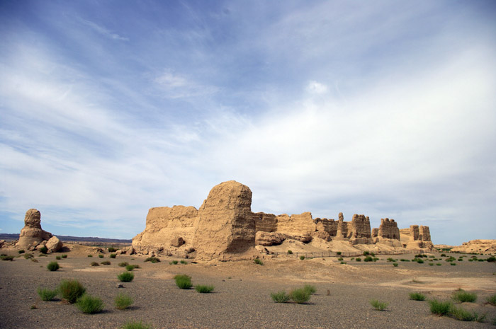
Hidden high within the Wunü Mountains of Huanren County in Liaoning province, Wunü Mountain City is one of the last known remnants of the Korean-led Goguryeo Kingdom (37 BC–668 AD). As a place of invaluable historical significance, it was designated a UNESCO World Heritage Site in 2004. Until 668 AD, the Goguryeo Kingdom was the largest of the three kingdoms into which ancient Korea was divided. Little historical records remain regarding the kingdom and its origin is shrouded in mystery, resulting in a chaotic mixture of fact and myth.

Historians believe it was founded in 37 BC by a prince named Jumong from the Kingdom of Buyeo (c. 200 BC–494 AD), who was enthroned as King Dongmyeong or the “Holy King of the East”. Talk about a fancy job title! According to legend, he was the son of Hae Mosu of Buyeo and Yuhwa, who was the daughter of the river god Habaek. The river god did not approve of Hae Mosu, so he drove Yuhwa away to the Ubal River, where she met and became the concubine of King Geumwa of Eastern Buyeo (86 BC–410 AD).

However, Yuhwa was already pregnant, and she promptly gave birth to an egg! King Geumwa tried desperately to destroy the egg and even attempted to feed it to animals, but they instead protected it. Eventually, he returned it to Yuhwa and from it hatched a baby boy, who was named Jumong or “Skilled Archer”. In the interest of literally living up to his name, Jumong went on to become an archer of unparalleled talent! After being driven away by his jealous step-brothers Daeso and Yongpo, he managed to establish a territory spanning most of the Korean Peninsula and parts of northeastern China, known in ancient times as Manchuria. It was here that he founded his kingdom and constructed his first imperial capital, Wunü Mountain City.

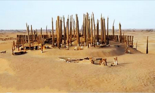
The unusual cuboid shape of the Wunü Mountains and its sheer vertical cliffs made it nearly impermeable to any kind of attack, which protected the capital from opposing armies. Deep within the valley, a treacherous 938-metre (3,077 ft.) long zigzagging earthen road was the only way in or out. Since it was so difficult to reach, many historians argue that the Goguryeo King and nobility would not normally reside there, but would instead use it as a shelter during times of war. Even during peak times, the city could only accommodate about 100 people at most.

Wunü Mountain City represents a perfect blend of manmade structures and nature. It swiftly became the archetypal mountain city of its time, being imitated by numerous cultures thereafter thanks to its virtually impenetrable defences. During its entire history, it was never once successfully invaded or captured by enemy forces. Even when the Goguryeo capital was transferred from Wunü to Guonei City (modern-day Ji’an, Jilin province), it remained an important transportation hub and was continuously added to.

The main peak of the Wunü Mountains is over 800 metres (2,600 ft.) high, and its near flat top stretches for 1,500 metres (4,921 ft.) from south to north and 300 metres (984 ft.) from east to west. The ruins of the city itself are mainly located on the eastern slope and on a small plateau at the peak. While the cliff-faces were exploited for defence, the city was also surrounded by a stone wall on its east and southeast sides, which was punctuated by three gates. All of the constructions in the city were built by wedging stones, which did not decay like bricks or tiles. Thanks to this archaic method, the remains of the imperial palace, city walls, military barracks, watchtowers, houses, and warehouses can still be seen today, many of them dating back over 2,000 years ago!

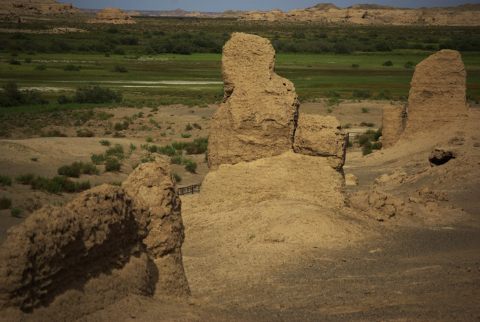
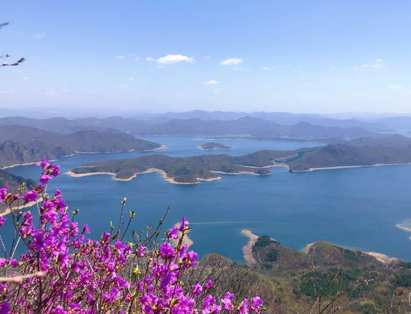
Alongside these ancient structures, archaeologists have unearthed iron arrowheads, fragments of armour, and a pair of iron shackles from what was believed to be the military barracks. A nearby observation platform was once used to give the local soldiers a wider field of vision, but nowadays is the ideal place to soak in stunning panoramic views of the surrounding countryside and the Huanren Reservoir, the largest reservoir in Liaoning province.

On the mountain range, there are two water sources that once supplied the city. One lies on the western side of the city centre and is known as Heavenly Pool. This rectangular stone pool is 12 metres (39 ft.) long, 5 metres (16 ft.) wide, and approximately 2 metres (7 ft.) deep. The other source, known as Yinwa Cove, is situated on the eastern side of the mountain and is actually connected to the mouth of a natural spring. Regardless of the season, these two wells never dry up and supply drinking water throughout the year. Wunü Mountain City may have been remote, but it certainly didn’t lack in modern amenities!

The Gurbantünggüt Desert

Gurbantünggüt Desert

Ranking behind the expansive Taklamakan Desert, the Gurbantünggüt Desert is the second largest desert in China. It spreads over a colossal area of 50,000 square kilometres (19,000 sq. mi), making it nearly four times the size of Death Valley in the USA! Resting within the Dzungarian Basin in the northern reaches of Xinjiang, it is located to the east of the Manasi River and to the south of the Ulungur River. Throughout the barren sands are interspersed deep oases where over 100 different desert plant species flourish, including magnificent virgin forests made up of desert poplars and saxaul trees. These hardy plants are only provided with rainwater once per year, when the annual snow falls in winter and melts in spring. They add a touch of greenery to the hostile landscape and provide grazing for the wild Mongolian gazelles.

A chain of cities, the largest of which is Xinjiang’s capital of Ürümqi, forms a well-populated strip along the southern edge of the desert. These cities were once major trading hubs along the ancient Silk Road and were able to survive thanks to glacier-fed streams flowing down from the Tian Shan Mountains. At its northwestern edge, the desert is skirted by the Irtysh–Karamay–Ürümqi Canal, an ingenious system that is currently being constructed with the aim of transferring water from the Irtysh River to the arid regions of northern and central Xinjiang. The eastern branch of the canal runs directly across the centre of the desert until it finally reaches the Tian Shan Mountains.

Gurbantünggüt Desert02The western part of the desert was once dominated by salt lakes, although tragically many have disappeared due to the impact of human activities. While the Ailik Lake remains, the Manas Lake dried up long ago. Water is of paramount importance in this scorched desert, particularly when you consider that it is the remotest point of land from any sea or ocean on earth! At its centremost point, it is over 2,600 kilometres (1,600 mi) from the nearest coastline. To put that into perspective, that is nearly twice the length of the United Kingdom!

In spite of its location, the climate of the desert is markedly temperate compared to China’s other sandy behemoths, such as the inhospitable Taklamakan Desert. It is mainly made up of fixed and semi-fixed sand ridges but, unlike other deserts in the region, it does not boast any mega-dunes or dunes of notable height. Instead, it stretches out endlessly towards the horizon, the sands rippling and undulating like some great heaving beast in the sweltering sun.


Mount Emei

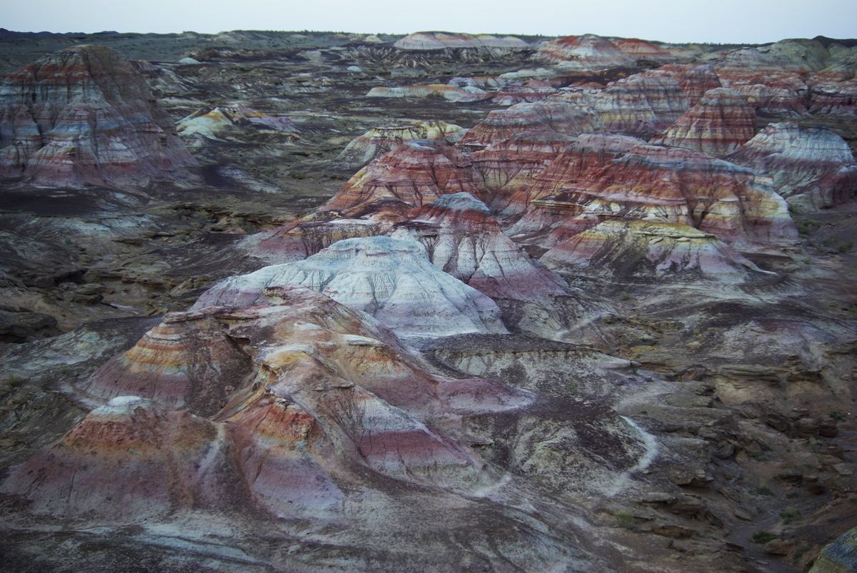
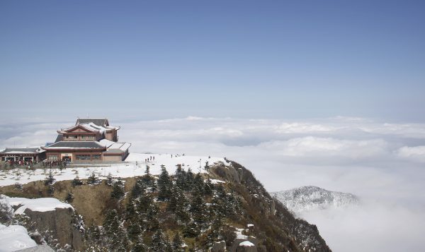
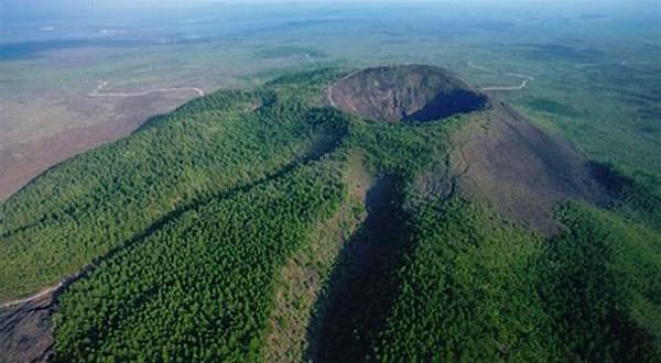
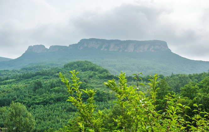
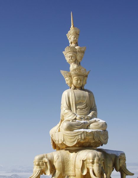
Mount Emei, or “Delicate Eyebrow Mountain”, is so-named because its two major peaks face one another and supposedly resemble the lofty brows of a classical Chinese beauty. The name itself may raise a few eyebrows, but Mount Emei’s unparalleled natural beauty is sure to win the admiration of even the most sceptical tourist! It is classed as one of the Four Sacred Mountains of Chinese Buddhism and its cultural significance, coupled with its spectacular scenery, meant it was designated a UNESCO World Heritage Site in 1996, along with the nearby Leshan Giant Buddha. Reaching a staggering elevation of 3,099 metres (10,167 ft.) at its peak, it is the tallest of the Four Sacred Mountains.

Archaeological evidence indicates that the slopes of Mount Emei may have been settled as early as 10,000 years ago, although the first temple wasn’t built there until the 1st century AD. Originally it was a Taoist retreat, but sometime around the 3rd century it became known as a sacred Buddhist mountain and was the first place in China where a Buddhist temple was built. It is traditionally believed to be the bodhimaṇḍa, or place of enlightenment, of the bodhisattva[1] Samantabhadra, known in Chinese as “Puxian”. For over 2,000 years, this misty mountain has been regarded as a special and intensely holy place.

As time went on, numerous temples and other religious buildings were erected across the mountain’s vast expanse. Nowadays it boasts over 30 temples, ten of which are of particular historical note. However, it seems Mount Emei might be directly facing some serious competition! On a hillside opposite the mountain, the Leshan Giant Buddha looms over the confluence the Minjiang, Dadu, and Qingyi rivers. At a colossal 71 metres (233 ft.) in height, it is the tallest pre-modern statue in the world and is nearly twice the size of Christ the Redeemer in Brazil!

This Buddha may be big, but it’s not quite big enough to completely overshadow its mountainous neighbour. Blanketed in a diverse range of vegetation, from subtropical to subalpine forests, Mount Emei is undoubtedly a feast for the eyes. Some of its trees are over 1,000 years old, matched in age only by its ancient temples. These temples blend seamlessly into their natural surroundings, demonstrating the perfect marriage between man and nature. The most famous of these are Baoguo Temple, Wannian Temple, Qingyin Pavilion, and the Golden Summit.

Baoguo Temple was built during the 16th century, and is widely regarded as the centre of Buddhist activities on the mountain. It is perhaps most famous for the engraved stone slab that hangs above its gate, on which its name was written by the Kangxi Emperor of the Qing Dynasty (1644-1912). However, other major highlights of the temple include its serene gardens, library of sutras[2], and decorative porcelain statue of Buddha.

Unfortunately this statue somewhat pales in comparison to the 7.85 metre-high (26 ft.) bronze statue of Samantabhadra  riding  an elephant that can be found in Wannian Temple, which weighs a stunning 62 tons. In a bizarre twist of fate, it actually weighs over 8 times as much as an actual African elephant! It was commissioned on imperial order during the Song Dynasty (960-1279), although the temple itself was founded sometime during the 4th century. To this day, no one knows exactly how such a hefty statue was transported up the mountain.

Located in the middle section of the mountain, Qingyin Pavilion is a complex of pavilions, towers, and platforms that date from the 6th century onwards. It is crisscrossed by the rushing Black Dragon River and White Dragon River, so-named because their waters are dark green and ivory white respectively. The complex’s architecture is particularly breath-taking, but tragically not enough to make Qingyin Pavilion the mountain’s star attraction. That accolade is solely reserved for the Golden Summit.

The Golden Summit rests at an elevation of 3,077 metres (10,095 ft.) and its name is derived from the small bronze temple at its peak. As if that wasn’t impressive enough, there is also a 48-metre (157 ft.) tall bronze statue of Samantabhadra near the temple, which weighs over 600 tons! While this may not be the mountain’s actual summit, it’s the ideal place to soak in the scenery and experience the Four Great Spectacles of Mount Emei: the sunrise, the sea of clouds, the rays of Buddha, and the sacred lamps. While the sunrise and the sea of clouds are reasonably self-explanatory, the last two natural phenomena are unique features of Mount Emei.

The rays of Buddha occur about 14 times every year and can only be seen when the area is thick with clouds. If you look out into the clouds at the right moment, the refracting light will make it appear as though your shadow is surrounded by a circle of colourful light, much like a rainbow. Similarly, on some dark nights at the summit after it has been raining, you might see flashing lights in the mountain valleys, providing there is no moon in the sky. These fabulous illuminations have been nicknamed the sacred lamps. However, even without these flashing lights, a trip to Mount Emei is sure to dazzle you!

[1] Bodhisattva: The term literally means “one whose goal is awakening”. It refers to a person who seeks enlightenment and is thus on the path to becoming a Buddha. It can be applied to anyone, from a newly inducted Buddhist to a veteran or “celestial” bodhisattva who has achieved supernatural powers through their training.

[2] Sutra: One of the sermons of the historical Buddha.

Khara-Khoto

black city 01

As wind whips the sand dunes across the Gobi Desert, the once illustrious Khara-Khoto or “Black City” is slowly being buried by sand. According to local rumour, it is inhabited only by ghosts and demons. Yet it wasn’t always a place of desolation and death. The city was founded by the Tangut people in 1032 as the capital of their Western Xia Dynasty (1038–1227) and soon rose to become a thriving trade hub. The fortified city was captured by Genghis Khan in 1226 but, far from being lost, it actually thrived under Mongol rule. During the Mongol-led Yuan Dynasty (1271-1368), it expanded to three times its original size and was even visited by the intrepid explorer Marco Polo, who referred to it by its Tangut name of Etzina. The Tangut people, though subservient to the Mongolians, were able to enjoy a life of peace for a further 150 years under their rule.

However, as the Yuan Dynasty began to collapse, disaster loomed on the horizon. After a crushing defeat at Jiayu Pass in Gansu province, the Mongolians were driven out of China by the armies of the Ming Dynasty (1368-1644). Many of the Mongolian troops made it to Khara-Khoto and were able to settle there, as the Ming army chose to concentrate on returning order to the provinces of China rather than pursue them. While the Ming Dynasty consolidated its power in China, the Mongolian armies waited on the outskirts and greedily eyed the possibility of conquering the country again. By 1372, Mongolian troops had begun massing at Khara-Khoto with the eventual aim of reinvading China. It was this bold move that would seal their fate.

black city 03No one knows exactly how Khara-Khoto fell, but local legend states that Ming troops laid siege to the city in that same year. The city was so well-fortified that they were unable to take it by military force, so instead resorted to far more cunning tactics! They found a way to divert the nearby Ejin or “Black” River, which was the city’s only water source. By denying it this precious lifeblood, the Ming troops choked the city without ever needing to set foot inside of its walls. As their gardens and wells began to dry up, the people of Khara-Khoto realised that they must make a terrible choice: die of thirst, or face the Ming soldiers in combat.

A Mongol military general named Khara Bator supposedly became so crazed by this plight that he murdered his wife and children before committed suicide, although another version of the rumour states that he made a breach in the northwestern corner of the city wall and escaped through it. Upon either his demise or his escape, the remaining Mongolian soldiers tried to hold out within the fortress. When the Ming armies finally attacked, they slaughtered the soldiers like cattle. Thereafter, the city was permanently abandoned and fell to ruin. It would be another 600 years before someone would finally uncover this ancient metropolis from beneath the dusty sand.

When Russian explorers Grigory Potanin and Vladimir Obruchev heard rumours that an ancient city lay somewhere downstream along the Ejin River, it sparked the interest of the Asiatic Museum (now the Institute of Oriental Studies) in St. Petersburg. In 1907, they promptly launched a new Mongol-Sichuan expedition under the command of Pyotr Kuzmich Kozlov. Within a year, Kozlov had discovered the Khara-Khoto ruins and obtained permission to dig in the site from a local Torghut lord named Dashi Beile, in exchange for a free dinner and a gramophone!

balck city 02During his initial excavation, he uncovered over 2,000 books, scrolls, and manuscripts in the forgotten Tangut language, including a Chinese-Tangut dictionary titled Pearl in the Palm. These treasures were sent back to St. Petersburg, along with Buddhist statues, texts, and woodcuts that were found in a stupa¹ outside of the city walls. Over time, further excavations would produce thousands more manuscripts, daily items, and works of religious art, and the site would even be visited by famous archaeologists such as Aurel Stein and Langdon Warner. While these precious relics have all been carefully housed in museums across the globe, Khara-Khoto remains open for any visitor daring enough to wander its haunted ruins.

Nowadays all that is left of this venerable city are the 9-metre (30 ft.) high ramparts, the 4-metre (12 ft.) thick outer walls, a 12-metre (39 ft.) high pagoda shaped like an upturned bowl, an assortment of crumbling mud houses, and the remnants of what appears to be a mosque on the outskirts of the city walls. With the Ejin River largely dried up and the sand dunes constantly moving on the wind, navigating the desert surrounding the city is treacherous and must be done with extreme care. If you’re feeling particularly brave, you can pitch a tent and stay overnight. Only then might you witness the fuel-less flames that burn for hours, the balls of light dancing in the desolate dark, and the sounds of raucous banging from unknown sources as the ghosts of Khara-Khoto welcome you to their humble home!


Stupa: A hemispherical structure with a small interior designed for storing Buddhist relics and for private meditation.

The Hulunbuir Grasslands

As one of the largest prairies in China, the Hulunbuir Grasslands represent some of the finest patches of untouched wilderness in the country. With over 3,000 rivers, 500 lakes, countless woodlands, and vast meadows making up its expanse, the grasslands are a treasure trove of natural beauty and wonder. Aside from the Greater Khingan Mountains stretching from its north to its south, the area is markedly flat and provides virtually endless views of its lush greenery. Many diverse ethnic groups call this verdant paradise home, from the Mongolians and the Han Chinese to the Manchu and the Daur people.

The grasslands themselves are named after two lakes that lie at their centre: Lake Hulun in the north; and Lake Buir in the south. Lake Hulun is the larger of the two, while Lake Buir lies partially within Inner Mongolia but predominantly in Mongolia proper. A dazzling local legend recounts the origin of these two lakes. There once was a brave Mongolian tribe who boasted a famous couple: a beautiful girl named Hulun, who was renowned for her skill at singing and dancing; and a strong boy named Buir, who was celebrated for his talent at riding and shooting a bow.

One day, a demon came to the prairie and threatened the safety of their tribe. The couple fought against the demon until the girl, realising they could not defeat it in combat, transformed into a lake and drowned the demon. By sacrificing herself, she saved the entire tribe. The boy Buir was so distraught at the loss of his love that he too turned into a lake. In short, rather than crying a river, he wept a lake! This is how the two matching lakes of Hulun and Buir came to be.

Pearl white yurts are dotted throughout the jade-hued grasslands, where farmers while away their leisure hours in the serenity of nature. Nowadays, while the grasslands and lakes continue to be popular tourist attractions, they are mainly used for grazing livestock and farming. Their vast fields abound in horses, sheep, cattle, cashmere goats, and even camels! In fact, the grasslands are held in such high esteem that any produce from the region, such as meat, milk, leather, or wool, is highly sought after. The low level of pollution in the area means that many Chinese people regard animal products from Hulunbuir as “purer” than those from anywhere else.

The region’s northerly location makes it warm and pleasant in the summer, but cold and snowy in the winter. During the summer, the grass looks as green as emeralds and the meadows are awash with a blanket of multi-coloured wildflowers. Visitors can spend blissful days galloping across the plains on horseback, riding camels, taking a tour on a horse-drawn cart, or paddling a boat out into one of the lakes. On festivals or special occasions, wrestling, archery, and horse racing competitions are held throughout the day. In the evening, the smell of traditional roasted lamb wafts on the air and people gather around crackling bonfires as the sun goes down. Even in ancient times, this place was renowned for its beauty and was immortalised in a Chinese poem, which describes it thusly: “The sky is blue, and the grass is boundless; when the long grass bows in the wind, suddenly the horses and sheep will appear”.