Qinghai

Qinghai is located far to the northwest and is the fourth largest province in China. Yet, with a population of just 5.2 million, it is the third least populated province in the country. To put that into perspective, it covers an area larger than the country of France but only has about a thirteenth of the population. So, if you fancy some serious alone time, Qinghai is the place to be! It is named after the resident Qinghai Lake, the largest lake in China, but is occasionally referred to by its alternate name of Kokonor.

It is bordered by Gansu in the northeast, Xinjiang in the northwest, Sichuan in the southeast, and the Tibet Autonomous Region in the southwest. This, coupled with its location on the Qinghai-Tibet plateau, means it has long been a melting pot for various nomadic cultures. Nowadays, though the Han people still represent the majority, the province is home to 37 of China’s recognised ethnic minorities, with large constituencies of Tibetan, Hui, Tu, Mongol, and Salar people. With 5 out of its 8 prefectures being designated as Tibetan autonomous regions, the province itself is noticeably dominated by Tibetan culture.

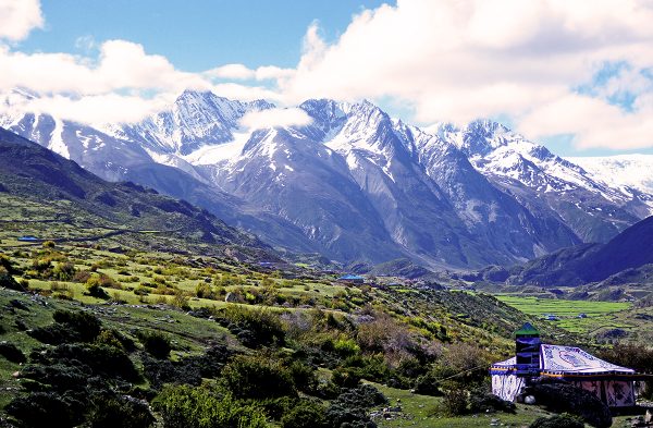
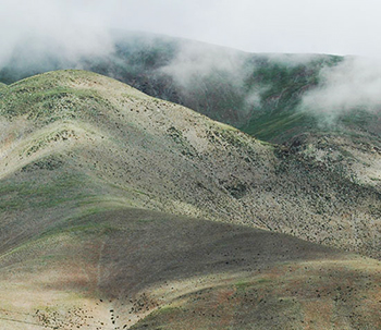
Qinghai’s main claim to fame is its wonderful scenery and diverse landscapes. In the north, the snowy Altun and Qilian mountains rise up and form a protective barrier along the sparsely populated northern border. The magnificent Kunlun Mountains strike through the centre of the province while the Tanggula Mountains in the south represent the point where the Yangtze River begins. So be sure to pack your hiking boots, or you’ll end up with some pretty sore feet!

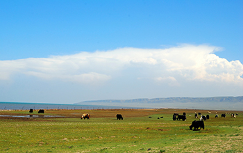
The province is home to the headwaters of three major rivers: the Yellow, Yangtze, and Mekong rivers. Qinghai is thus renowned as a paradise of rolling hills, snowy mountains, verdant grasslands, and rushing waters. Over 250 of its animal species are under national protection, including the wild camel, Tibetan antelope, white-lipped deer, snow leopard, and yak.

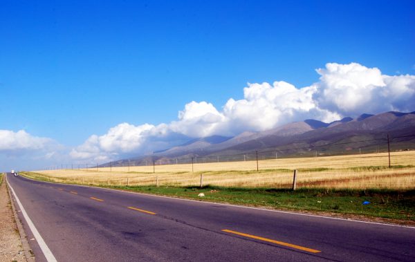
Since Qinghai rests at a relatively high altitude compared to other provinces, it experiences cold winters, mild summers, and huge variations in daily temperature. In January, temperatures can plummet to between −7 and −18 °C (19 to 0 °F), while in July they raise to a modest 15 to 21 °C (59 to 70 °F). From February to April, the region is plagued by heavy winds that blow in sandstorms from the Gobi Desert, so avoid this season unless you want to end up looking like Lawrence of Arabia!

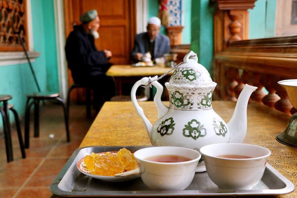
During summer, domestic tourists flock to the provincial capital of Xining to enjoy the temperate and balmy weather. The comfortable temperatures throughout July and August, coupled with the relative lack of humidity, make Xining an ideal summer retreat. It’s also home to the Dongguan Mosque, which has been continuously operating since 1380 and is the largest mosque in the province.

That being said, the province’s star attraction is undoubtedly Qinghai or “Cyan Sea” Lake, which is surrounded by misty mountains, lush meadows, and communities of fascinating Tibetan people. There are several islands on the lake that are open to tourists, including Bird Island, Haixin Mountain, and Sand Island. For nature lovers, the Sanjiangyuan National Nature Reserve and the Kekexili State Nature Reserve are idyllic locations divorced from man’s influence. The former is the location of the headwaters for the Yellow, Yangtze, and Mekong rivers, while the latter is home to a large community of precious Tibetan antelope.

In terms of Qinghai’s religious significance, the Kumbum Monastery in Huangzhong City was founded in 1583 and is the most prestigious “gompa” or Buddhist university monastery after the “great three” gompa of Tibet; Drepung Monastery, Ganden Monastery, and Sera Monastery. The Gyanak Mani Temple just outside of Yushu City boasts the country’s largest collection of carved prayer stones, with over 2 billion of the stones neatly stacked in an area of just 1 square kilometre (0.4 sq. mi). In a place this sacred, be sure to expect a stony silence!

Shilin

The silent Stone Forest of Yunnan, with its rocks jutting out of the ground like petrified trees, is an ancient wonder unmatched throughout the world. Its history stretches back over 230 million years, when it was once a vast uninhabited ocean. As the water drained away, giant rocks appeared in its wake and slowly eroded over time, forming the alien shapes that we see today. There’s an old local saying in Yunnan that goes “if you have visited Kunming without visiting the Stone Forest, you have wasted your time” and, blunt though it may be, it speaks to how important this site is to the people of the province. Everyone sees something different in this stony wonderland. You may find these fanciful rocks look like animals, plants, people, or even deities! Or they may just look like rocks.

The Stone Forest, or Shilin (石林) in Chinese, is about 90 kilometres (56 mi) away from the provincial capital of Kunming. The site is divided into seven areas known as the Greater and Lesser Stone Forests, the Naigu Stone Forest, Zhiyun Cave, Lake Chang, Lake Yue, Dadie Waterfall, and Qifeng Cave. Each of these scenic areas has its own peculiar charm. As soon as you enter the Stone Forest, you’ll be met with a plethora of rocks looming over a crystal clear lake. Just beyond the lake, you’ll find the Lion Pool, where a huge boulder resembling a squatting lion stands guard.

This is the entrance to the Greater and Lesser Stone Forests, which are full of fantastically shaped rocks that are sure to spark your imagination. From the ethereal sounding “Lotus Peak” and “Pinnacles Propping up the Sky” to the rather more amusing “Stone Singing Praises of Plums” and “Rhinoceros Admiring the Moon”, we’re sure you’ll delight in learning the names of these many formations and perhaps inventing a few names of your own! In Zhiyun Cave, you’ll find a spectacular and rather spooky subterranean version of the stone forests outside. This miniature, underground forest is illuminated by coloured lights, giving it an otherworldly appearance, and it is said that no matter which rock you knock on, each one has a different voice.

Like Zhiyun Cave, Lake Chang boasts a small rocky forest of its own. In this 3-kilometre-long (2 mi) lake there are numerous underwater stalagmites that give the pool the appearance of an aquatic labyrinth. The lake is so massive that there’s even an island at its centre! Not far from all these karst delights, you’ll find the Qifeng or “Strange Wind” Cave. From August to November every year, gales lasting two to three minutes in length burst out of the cave at 30 minute intervals. No one knows the precise nature of this natural phenomenon, but witnessing this “strange wind” first-hand is both a shocking and delightful experience.

If you take a walk through these extraordinary labyrinths, you may even come upon the protected zone, where you’ll find ancient frescos painted on the stone walls. These “cave paintings”, so to speak, date all the way back to the Neolithic Period and were made using a mixture of animal blood and minerals. They are one of the few remaining links to our evolutionary ancestors and the sight of them, in their humble glory, is truly breath-taking. Alongside the many fossils and paintings that are part of this protected zone, it’s hard not to feel as though you have returned to your primal beginnings. That is, until you return to your tour bus and wonder how our ancient ancestors ever got by without air-conditioning!

Perhaps the most famous karst formation in the Stone Forest is that of the mythical Ashima. According to legend, Ashima was a kind, intelligent, hard-working and beautiful girl from the Sani branch of the Yi ethnic minority. In some variations of the story, she falls in love with an orphaned shepherd named Ahei, whilst in other variations Ahei is her loving brother. Ashima’s happy life takes a turn for the worse when she catches the eye of Azhi, the son of a wealthy landowner. When she refuses his offer of marriage, Azhi arranges to have her kidnapped and brought to his fortress. On discovering his beloved is missing, Ahei rushes to confront Azhi and engages him in a riddle-singing contest. After three solid days of singing, Ahei won the contest and rescued Ashima. Tragically, as they are rode away from the fortress, the nefarious Azhi opened the floodgates and diverted the river into the valley.

Ahei survived, but Ashima tragically drowned. When the immortals heard Ahei’s anguished cries, in an effort to comfort him they transformed Ashima’s body into stone. She now stands in the Stone Forest as a symbol of hope and freedom to choose who you wish to marry. Every year, on June 24th according to the Chinese lunar calendar, members of the Sani branch gather at the stone statue of Ashima and celebrate the Torch Festival. They take part in traditional performances, such as wrestling, bull fighting, pole-climbing, dragon-dancing, lion-dancing and the A-xi Moon Dance, and pay homage to their heroine. The story of Ashima was first transcribed in the 1940s and performed in Kunming. Nowadays, it is considered one of the top Chinese dance dramas and has been translated into eight different languages, enjoying performances across the globe.

The Stone Forest can be easily reached from Kunming via the numerous tour buses that shuttle between the city and the scenic area, which take approximately 3 hours. There are a handful of hostels and hotels near the Stone Forest and, if you’re feeling particularly adventurous, you can even rough it in one of the designated camp sites within the scenic area. Although there are not many restaurants in the area and many of the dishes there are quite simple, we feel this only adds to the rustic charm of the site. Just don’t get too used to living like a caveman, or you might become one!

Kekexili State Nature Reserve

Hoh Xil, also known as Kekexili, is an isolated region situated in the northwest part of the Qinghai-Tibet Plateau and its main claim to fame is that it’s the third least populated area in the world. So if you’re not a people person, Kekexili is the place to be! The region stretches across a colossal 83,000 square kilometres (32,000 sq. mi) and sits at an average elevation of 4,800 metres (15,700 ft.). That makes it larger than Scotland and nearly four times higher than Ben Nevis!

It rests between the Tanggula and Kunlun Mountains and borders the Tibet Autonomous Region in the southwest, and Qinghai and Xinjiang in the northwest. Divorced from mankind and surrounded by snow-capped mountains, the verdant grasslands and dense forests that populate this region have become a safe haven for a variety of animal species. This truly unspoiled wilderness is a wonder to behold and, in an effort to preserve it, 45,000 square kilometres (17,400 sq. mi) of it was carved out to form the Kekexili State Nature Reserve in 1995.

The nature reserve is located at the border between Zhiduo County and Qumalai County in Qinghai. Its rushing waters, shimmering lakes, and rolling meadows are home to 16 species of mammal, 30 species of bird, and 210 species of plant, of which 18 animal species and 84 plant species are endemic to the region.

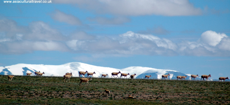
The preserve is home to many animals that are currently under national protection, such as snow leopards, Tibetan antelope, golden eagles, and brown bears. Thus the region is precious not only for its natural beauty, but for the many endangered species that inhabit its plains. Unlike other mountainous areas in China, the region is densely covered with lakes, such as Kekexili Lake, Sun Lake and Xuelian Lake, meaning that its animal residents are never too far away from a good drink and a good meal. Unfortunately, if you’re a cuddly little plateau pika[1], that means you’re on the brown bear’s menu!

The region has become so beloved that there was even a film made about it in 2004 called Kekexili: Mountain Patrol, which detailed the struggle of several noble locals trying to protect the rare Tibetan antelope from poachers. This helped highlight the current endangerment of several animal species in Kekexili and, in an effort to further raise awareness, the Tibetan antelope or chiru was made into one of the five mascots of the 2008 Summer Olympics in Beijing. The mascot’s name, Ying Ying (迎迎), literally means “Welcome! Welcome!” and, with the chiru’s adorably fluffy face, you couldn’t ask for a warmer one!

[1] Plateau Pika: A small burrowing rodent with tan-coloured fur.

Astana Cemetery

Buried deep beneath the earth, with only small heaps of sand to designate them, the Astana Cemetery is perhaps one of the humblest burial sites you’ll find in China. Amongst the colossal mausoleums, forests of steles[1], and entire clay armies dedicated to China’s many emperors, the rulers of Gaochang opted for a more modest way to inter their remains. Had it not been for the efforts of numerous archaeologists, we may still not know that these tombs even existed! They rest about 37 kilometres (23 mi) southeast of Turpan and 6 kilometres (4 mi) north of the Gaochang Ruins.

This was once a public cemetery, where both aristocrats and commoners from the ancient city of Gaochang were buried. Of the 1,000 tombs that make up the complex, a staggering 456 have been excavated since its discovery, but none belonging to Gaochang’s rulers have as yet been found. Books found within the tombs suggest that the complex was established in 273, during the Jin Dynasty (265-420), and was abandoned around about 778, during the Tang Dynasty (618-907). After being used for over 500 years with no foreseeable retirement, you can see why the Astana Tombs chose to bury their heads in the sand!

During the start of the 20th century, famed archaeologists such as Sergey Oldenburg, Albert von Le Coq, and Aurel Stein descended on the area and each vied for a chance to excavate the tombs. This mayhem led to many of the precious relics being stolen by said archaeologists and shipped back to their home countries for exhibition in their national museums. Talk about taking advantage of a country’s hospitality! It wasn’t until 1959 that Chinese archaeologists undertook excavations at Astana and Gaochang, and they miraculously managed to recover over 10,000 cultural relics, most of which are on display within Xinjiang Museum in Ürümqi.

The tomb complex itself stretches for 5 kilometres (3 mi) from east to west and 2 kilometres (1 mi) from north to south. Simple gravel boundaries have been used to separate the tombs, which typically each belong to one family. Generally speaking husband and wife were buried together, although in some cases a few lotharios have been found accompanied by up to two or three women!

A sloping passageway leads down to the tombs, which are each marked by a rock-cut entrance. They are only about 2 metres (6.5 ft.) high and some of them contain one or two antechambers that feature stone statues or “guardian beasts”. The bodies are often placed at the back of the room on a simple earthen or wooden bed, without any kind of coffin. They are normally clothed in silk, linen, or cotton, and have their heads resting on pillows, a cloth over their face, and a piece of wood clasped between their hands. Several of them were found with coins placed in their mouths, although the origin of this tradition is unclear.

Next to each body was placed a funeral brick, which has the person’s name and information inscribed upon it. These bricks have been invaluable to researchers in terms of identifying the remains and finding out about the lifestyles of these ancient peoples. Around the remains are miniature replicas of carts, horses, musical instruments, chess sets, pens, and anything that could be deemed useful to the dead. The remains of real foodstuffs, desiccated but identifiable, have also been found, including grapes, pears, wheat, meat, and even jam tarts!

阿斯塔纳陶盘Traditionally the Chinese believe that the afterlife is much like life on earth and that you can carry worldly goods with you, so these replicas were designed to provide the deceased with ample supplies on their arrival to the netherworld. For easy reference, a written inventory was placed next to the dead listing all of the items that had been left in the tomb, just in case they forgot anything! Each tomb was equipped with a funerary banner detailing how the mythological figures Fuxi and Nüwa created the world. In honour of these deities, a large statue of them was built outside of the tomb complex after it was rediscovered.

Some of the chambers feature stunning murals of people, animals, mountains, rivers, and other natural scenes. Thanks to the arid climate in the Turpan region, these relics, murals and mummies have been beautifully well-preserved. While DNA-testing has shown that many of the people within the tomb are Han Chinese, several of them are of Turkic, Mongolian, and even Caucasian descent. This suggests that, at some point in its history, Gaochang was a multi-ethnic city where all ethnicities enjoyed relative equality.

Nowadays, only three of the tombs are open to the public and, of these three, only one of them houses actual mummies. While these two mummies can be found encased in glass, the other two tombs yield stunningly well-preserved murals on their chamber walls. The tomb’s proximity to the Gaochang Ruins and the Bezeklik Thousand Buddha Grottoes means that it makes for an interesting pit stop on a tour of the Turpan area. That is, so long as you’re not scared of mummies!

[1] Stele: An upright stone slab or pillar that bears an inscription and usually marks a burial site, like a tombstone.

Emin Minaret

The Emin Minaret is located just 2 kilometres (1 mi) east of Turpan’s city centre and, towering in at 44 metres (144 ft.) in height, it is the tallest minaret in China. Surrounded by willowy trees, dusty fields, and the ancient ruins of the city, it serves as a reminder of the country’s ancient past and the vital historical connections Turpan once had with Central Asia. Those who visit the minaret tend to have mixed feelings about it, with some describing it as a unique combination of architectural styles and others saying it looks like an industrial chimney! Yet this tower’s significance lies perhaps not in its outer beauty, but in the touching story behind its construction.

During the 1750s, a subgroup of Mongolian people known as the Dzungars occupied large parts of Xinjiang and decided to openly rebel against the Qing Empire (1644-1912). The Uyghurs, who had long been at odds with the Dzungars, joined forces with the imperial government and helped defeat them. This coalition was led by a Uyghur general named Emin Khoja, who was subsequently promoted to governor inheritable of Turpan as a reward for his allegiance.

He was an illustrious figure in Turpan’s history and was one of the few local Muslims to have made a successful pilgrimage to Mecca. On his death, his son Suleman succeeded him as governor and used his own money to build the Emin Minaret in honour of his father. Construction of the tower was completed in 1778 and its Chinese name, Sugong Ta, literally means “Governor Su’s Tower”. So if you thought you were a good son remember, Suleman built his father an entire tower!

Emin Minaret 02The minaret rests at the northeast corner of a rectangular mosque, which is in turn divided into an inner and outer hall. The outer hall is for use during the warmer months and is made of thin wooden pillars that support an exposed timber frame, making it large and spacious. The inner hall is predominantly used in winter and is thus fully enclosed, meaning it is far smaller.

Perhaps the most interesting aspect of this minaret is the intermingling of features from different styles of architecture. Since the area surrounding Turpan was once the site of several major trading cities along the Silk Road, it also acted as a conduit between Central Asian and Chinese culture. The outer decoration of the Emin Minaret incorporates geometric patterns, which were typical of Middle Eastern Islamic architecture, but also includes floral patterns and waves, which were commonly used in Chinese architecture. The Uyghur people who built these structures had been influenced by these two cultures in equal measure, which is part of what makes their constructions so unique.

These craftsmen used locally sourced materials, so the minaret is predominantly made of wood and sundried mud-bricks. The tower visibly tapers as it rises upwards, with a diameter of just over 14 metres (46 ft.) at the base and approximately 3 metres (10 ft.) at the top. Long, narrow windows are placed at random intervals to provide light and ventilation, and there are no storeys within the structure, only a 72-step spiral staircase leading to a platform at the top. So if you thought your weekly session on the Stairmaster was bad, imagine climbing this tower every morning to perform the call to prayer!

The entrance is flanked by two steles[1]: one with an inscription in Chinese that explains the purpose of the minaret and its connection to the Qing Dynasty, and one in the Uyghur language that extols Emin Khoja and contains excerpts from the Quran. Visitors are no longer allowed to climb the minaret, but are welcome to explore the accompanying mosque.

[1] Stele: An upright stone slab or pillar that bears an inscription and usually marks a burial site, like a tombstone.

Make your dream trip to The Emin Minaret come true on our travel: Explore the Silk Road in China

Kashgar

The vibrant oasis city of Kashgar rests at China’s westernmost point and is located near the border with Tajikistan and Kyrgyzstan. It lies on a fertile stretch of land at the base of the Pamir Mountains, towards the western end of the Tarim Basin. Its population of just 500,000 people is made up predominantly of the Uyghur ethnic minority, whose culture largely dominates the city. So be prepared for bustling markets, colourful silks, and noisy livestock ambling through the streets!

The city’s location means the climate in the area is extremely arid. Average temperatures range from a mild −6 °C (21 °F) in January to a sweltering 26 °C (79 °F) in July, with an average precipitation of just 77 millimetres (3 in) per year. To put that into perspective, good old foggy London receives about 594 millimetres (23 in) of rainfall per year, over seven times that of Kashgar. So be sure to buy plenty of bottled water and forgo packing your umbrella!

It was once a major trade hub along the Silk Road, serving as the meeting point where its northern and southern branches finally met. The earliest mention of the city dates back to the Han Dynasty (206 BC–220 AD), when an imperial envoy travelled along the Northern Silk Road in order to explore the unknown lands to the west. The Chinese first took control of the area from the Yuezhi people in the 2nd century BC, but the Yuezhi swiftly reoccupied the area during the 1st century BC. This short-lived conquest would be characteristic of the region, as it would change hands many times!

The Chinese weren’t able to recover the territory until the late 7th and early 8th century, during the Tang Dynasty (618-907), but soon lost it once again in 752. Talk about unlucky! From then on, it was successfully occupied by the Turks in the 10th century, the Uyghurs in the 11th century, the Kara Khitans in the 12th century, and finally the Mongols in 1219. Under these rulers, trade between China and Central Asia flourished as it never had done before.

Unfortunately the city suffered greatly throughout the 14th century due to numerous wars and wasn’t reoccupied until 1755, during the Qing Dynasty (1644-1912). Yet peace wouldn’t grace Kashgar for long, as it was soon the centre for two Muslim rebellions. This social and political unrest lasted until 1943, when the city was finally restored to the Chinese government’s control.

The old part of the city has long been revered as one of the most well-preserved examples of a traditional Muslim city. Its characteristic mud-brick houses, though slightly dilapidated, still make for a stunning panorama when viewed from above. Gazing out over this ancient city, with the sun beating down on you and the Silk Road before you, one could even fancy themselves as a sort of modern-day Lawrence of Arabia!

Nowadays the city’s greatest draw is its lively Sunday market, which attracts thousands of merchants and tourists each week. Though the livestock market only functions on Sundays, the ordinary market continues throughout the week and is the ideal place to pick up a few locally made handicrafts, such as carpets, wooden jewellery boxes, and copper teapots. On market-day the city is alive with the sound of merchants from across China and Central Asia, just as it once was thousands of years ago. There are currently 20 large-scale bazaars operating in Kashgar, of which the largest is the one located near the East Gate. From the rich fragrance of meaty kebabs to the soft touch of hand-woven silk, the market is a real awakening of the senses.

Nestled within the heart of the city, Id Kah Mosque is the largest mosque in China and was originally built in 1442, although it has undergone major expansions and restorations since then. It’s a beautiful example of traditional Uyghur-style architecture and its religious significance only adds to its prestige. Yet it is tragically dwarfed in importance by the Tomb of Afaq Khoja just 5 kilometres (3 mi) northeast of the city centre, which is widely considered the holiest Muslim site in Xinjiang.

The tomb was built in 1640 and contains the remains of the religious and political leader Afaq Khoja, along with those of five generations of his family. He is regarded by several Muslim communities as a great Saint or Auliya. However, the greatest draw for many domestic tourists is the tomb of Xiang Fei, which rests within the complex. She was the only Uyghur woman to be taken as a concubine by a Chinese emperor and is occasionally referred to as the “Fragrant Concubine”, as it was rumoured she had a naturally enchanting aroma.

About 191 kilometres (120 mi) outside of the city, the spectacular Karakuri Lake stretches out at the foot of Mount Muztagata and marks a refreshing change from the typically barren landscape of Xinjiang. It looks like a crystal clear mirror, reflecting the surrounding grasslands, snow-covered mountains, and azure sky in its watery expanse.

Shuhe Town

shuhe

While Baisha Village was the birthplace of the Mu clan and Dayan Town (modern-day Lijiang Old Town) was the metropolis where they guided the ethnic Naxi people to prosperity, Shuhe Town trumps them both as the first known settlement of Naxi people in Lijiang County. It is unsurprising that, like its two historic cousins, Shuhe Town was included by UNESCO as a World Heritage Site. This sleepy little town rests in the idyllic countryside about 4 kilometres northwest of Lijiang Old Town and sits at the foot of the Jade Dragon Snow Mountain, which is pretty apt considering the Naxi word “shuhe” literally means “a village at the foot of a peak”! Though it may lack the bustling lifestyle of Lijiang Old Town or the abundant cultural artefacts of Baisha Village, its charm lies in its peaceful rural simplicity.

The town is made up of 1,000 households, each built using rocks that were harvested from the nearby mountains, and its 3,000 residents make a humble living from farming, tourism and leatherworking. Like Lijiang Old Town and Baisha Village, it was once an important trade hub on the ancient Tea-Horse Road. However, Shuhe’s originality lies in its history, as the town perfectly exhibits how the ancient Naxi people made the transition from an agricultural civilization to a commercial culture. While Lijiang Old Town and Baisha both effectively started out as trading centres of the Mu clan, Shuhe was transformed from a humble farming village into an instrumental transportation centre. This is evidenced not in grand murals or historic epics but in the architecture of the town itself, which slowly developed from simple wooden dwellings to elaborately decorated stone mansions.

Qinglong Bridge is just one of these stone structures and dates back to the Ming Dynasty (1368-1644). This 400-year-old bridge is about 25 metres long and its worn flagstones serve as a reminder of the many thousand feet that have tread its length over the years. It is considered to be the first old stone bridge built in Lijiang County but, in spite of its age, it has yet to retire!

shuhe ancient town 01Shuhe is sometimes referred to as Longquan or “Dragon Spring” Village because of the sacred spring at the end of its main street. This bubbling spring, known as Jiuding Dragon Pool, can supposedly be heard from miles away and the local Naxi people believe the fish that reside in this pool are the spirits of gods. That being said, eating the fish will not give you godlike powers so don’t go fishing in the pool or you’ll be chased out of the village! The spring was considered so sacred that a temple, known as Beiquan or “North Spring” Temple, was built just behind it. The locals still pray here and the majestic Sansheng Palace, the most architecturally unique part of the temple, is decorated with art handcrafted by Shuhe’s master leatherworkers.

The town is wonderfully tranquil, but take a trip to the square on market day and you’ll be met with a cacophony of footsteps, laughter, and the shouts of vendors plying their wares. It’s the perfect opportunity to embed yourself in the daily life of the Naxi people and peruse the local stalls, where you may pick up a few souvenirs. Though your suitcase may be weighted down with handcrafted leather bracelets and Naxi embroidered silk portraits, your wallet will certainly end up a little lighter!

Along the main waterway, there are a number of restaurants serving Naxi and Western-style food. With the verdant mountains above you and the trickling streams below, be sure not to get too carried away admiring the landscape or your food might go cold! The peak tourist season in Shuhe is between May and October but, if you have the chance, we recommend visiting the town outside of peak season to avoid the crowds.

Shaxi

Shaxi ancient town 01

The sleepy town of Shaxi near the Heihui River is a far cry from what it once was. However, go there any given Friday and you’ll be met with the bustling local market, the last remnant of a trading culture that has all but disappeared in modern-day China. Like Dali Ancient Town and Shuhe Town, Shaxi once prospered thanks to the ancient Tea-Horse Road but, unlike its local counterparts, it has not yet suffered from the commercialisation that tourist towns inevitably succumb to. Though Shaxi boasts a few Western-style restaurants and boutique hotels, its relative inaccessibility compared to many of the other ancient towns in Yunnan means it does not receive the hordes of tourists that can make these spots a little less magical.

During the Tang Dynasty (618-907), Shaxi became one of the focal trade hubs along the Tea-Horse Road and by the Ming (1368-1644) and Qing (1644-1912) dynasties it had flourished into one of the most affluent towns in Yunnan. Shaxi’s success largely arose from the salt wells that were dug near the town. It soon became the salt trade capital and, with salt being one of the most valuable commodities at the time, it prospered far beyond expectation. Revenge may be sweet, but success is evidently salty! This allowed the town to expand and many of the elaborate buildings found throughout Shaxi were erected during this time.

The town is largely inhabited by the Bai ethnic minority and many of its old buildings follow the Bai-style of “three rooms and one wall screening”. The house will usually consist of one main room, two side rooms and a “shining wall” that faces west so as to reflect light back into the house at sunset. The houses normally have three storeys in total and nine rooms, as nine is an auspicious number in Bai culture. The ground floor usually consists of one large sitting room flanked by two bedrooms, while the upper floors are used for storage with a special room set aside for the ancestral shrine.

Life in Shaxi mainly revolves around Square Street, the town’s central square. This ancient plaza is covered in red sand bricks and has two Chinese scholar trees standing at its centre that are each centuries old. It is still fully functioning on market day and is surrounded by a number of small temples, shops, teahouses and restaurants. It is flanked on its east side by an ancient stage and on its west by the 600-year-old Xingjiao Temple. The many ancient alleyways that branch out from Square Street are the backbone of Shaxi and provide access to its outer reaches. They lead to the village gates and pass by ancient caravansaries, eventually heading out towards Dali, Tibet and the salt wells.

The ancient stage is widely considered to be the heart and soul of Shaxi. The craftsmanship with which it was made is palpable in its many intricate carvings. It was built during the Qing Dynasty and is part of the three-storey Kuixing Pavilion. If you pay 10 yuan (about £1), you can ascend the ancient stage and head up to an exhibition of locally excavated cultural relics on the pavilion’s second storey. Just don’t linger too long on the stage, or the locals might expect a performance from you!

If you fancy getting in touch with the town’s history, you should certainly take a trip to Ouyang House. It was one of the original caravansaries and has been home to generations of muleteers over a period of one hundred years. In the early 1900s, the Ouyang family opened their house to passing caravans and offered food, lodgings and entertainment. They swiftly became the leading innkeepers in Shaxi and their substantial income enabled them to renovate and extend their inn. Nowadays, you can pay just 5 yuan (about 50p) to take a tour of the house and marvel at its ancient stables, guest quarters, kitchen, and ancestral shrine.

In spite of all these visual wonders, the must-see attraction in Shaxi is the town market, which has supposedly been held weekly since 1415. Although it started as a small affair, it has now become an all-consuming venture that billows out from the town square and floods the streets of Shaxi every week. From 10am till 5pm every Friday, goods ranging from washing machines to embroidered shoes and exotic fruits can be purchased at this eclectic market. It is a living remnant of Shaxi’s history as a trading post and is a spectacle of vibrancy, colour and animation that should not be missed.

Not far from the town you’ll find Mount Shibao, which is a mountain that has been delicately engraved with Buddhist carvings that date back to the 7th century. These 1,300-year-old carvings, punctuated by small temples along the mountainside, are truly stunning and make for a wonderful day out. If you decide to cycle out of the town, there are many small Bai and Yi villages in the Shaxi Valley that are only a short distance away and each boast their own unique attractions, from the renovated Pear Orchard Temple in Diantou Village to the Kuixing Pavilion of Changle Village.

If possible, we recommend you aim to catch the Temple Fair of Prince Shakyamuni, which takes place on the 8th day of the 2nd month according to the Chinese lunar calendar. During this festival, locals in colourful traditional clothes gather at Xingjiao Temple and parade through the streets carrying statues of Shakyamuni[1], while a team of people beat gongs and drums to liven up the procession. Performances will take place on the ancient stage throughout the festival and the celebrations carry on late into the night, electrifying the town square with bright lights, lively music and joyous dancing.

[1] Shakyamuni: One of the titles of Gautama Buddha, the central figure of the Buddhist faith. It is derived from the name Sakya, which is where he was born.

Ping’an Village

Ping'an Village 01

Ping’an Village has become by far one of the most famous locations to witness and hike up the magnificent Longji Rice Terraces of Longsheng County. It is located about 100 kilometres (62 miles) away from Guilin city and is home to over 50 families, with a population of about 200 people in total. The vast majority of people living in Ping’an are of the Zhuang ethnic minority and so it is sometimes referred to as Ping’an Zhuang Village. These Zhuang locals have been living in this area for over 600 years and their ancestors built the Longji Rice Terraces that are still in use today. These rice terraces stretch up the mountain, from 300 metres up to 1,100 metres above the sea level, and were first built during the Yuan Dynasty (1271-1368), although they were not finished until the early Qing Dynasty (1644-1911).

The rice terraces near Ping’an are considered to be the earliest and most developed in the Longji Scenic Area, which is why Ping’an is the most popular village for tourists. This has both its advantages and its pitfalls. Since Ping’an is far more tourist oriented than the other villages, there are plenty of guesthouses, restaurants and other modern amenities available there that the other villages simply aren’t equipped with. That being said, the downside of this is that Ping’an is far more crowded than the other villages so, if you want a more rugged, remote tour of the rice terraces, perhaps Ping’an is not the place for you.

The village of Ping’an is characterised by its 80 households, which are three-storey stilted wooden houses that have lasted for over 100 years. Like the Miao ethnic minority, the Zhuang people also refer to these houses as Diaojiaolou, although the architectural style greatly differs from that of its Miao counterpart. The Zhuang Diaojiaolou are built on flat ground, unlike those of the Miao people, and each of the three storeys will have a hemp railing. The top two storeys are supported by the large wooden pillars below and are used mainly as living spaces. The bottom or ground floor is used as a stable for domestic animals. All of these little homes, stacked next to one another in neat wooden piles, make the village of Ping’an look rather quaint and adorable.

The Zhuang people living in Ping’an still maintain many of their ethnic customs, so Ping’an is also a wonderful place to experience the daily life of the Zhuang ethnic minority. The men wear hand woven long sleeved shirts and trousers whilst the women wear white shirts, black pants and colourful cloths or wraps atop their heads. This traditional dress is far simpler than many other ethnic minorities and reflects the humble, industrious lifestyle of the Zhuang people. As you walk through the streets of Ping’an, you’ll notice that village life has remained largely the same for decades. The adults still diligently farm the fields, the children still play with their modest toys, and the elderly still sit on their doorsteps, chatting or snacking on sunflower seeds. With the backdrop of the golden rice terraces in the distance, Ping’an is truly a rural paradise.

The two main attractions in the village are the two scenic spots known as “Seven Stars Surrounding the Moon” and “Nine Dragons and Five Tigers”. “Seven Stars Surrounding the Moon” consists of seven small piles that stand separately in the middle of seven rice paddies. These seven piles are remnants from the construction of the rice paddies. There is another, empty rice paddy in the centre and, when it is filled with water, it is said to look like a small moon with the seven piles surrounding it resembling the stars. “Nine Dragons and Five Tigers” are nine ridges that have branched off from the main terrace and five nearby piles leftover from their construction. The nine ridges look like nine dragons winding their way towards the Jinsha River to drink and the five piles resemble five tigers guarding the dragons and the land. These two scenic spots provide a perfect birds-eye view from which to admire and take photographs of the rice terraces billowing out across the mountains.

From Ping’an, there are many hiking trails along the Longji Rice Terraces, the shortest of which will normally take about 2 hours. You can also hike from Ping’an to Longji Village, which takes about 2 hours, and, if you’re feeling particularly adventurous, you can hike from Ping’an to Dazhai, which takes 5 to 6 hours. In this case, it is advisable that you stay overnight in either Ping’an or Dazhai. These hikes are a wonderful way to exercise, enjoy the fresh mountain air, and wander through the terraced fields at your own pace. These rice terraces look particularly beautiful at sunrise and sunset, meaning any traveller would benefit from an overnight stay in Ping’an.

Accommodation

Since Ping’an has been developed as a tourist site, the facilities and hotels in the region are much better than in other villages. The village boasts about 80 hostels and hotels, which are all of a good standard. Li An Lodge, a four-storied hotel located on top of the rice terraces near to the “Seven Stars Surrounding the Moon” scenic area, is considered to be the best hotel in the area. The stunning views from its balconies and its beautifully decorated rooms have made it exceedingly popular with tourists. However, the hotel only has 20 rooms and they can be quite expensive so it is important to book well in advance.

Dining

There are plenty of lovely restaurants in Ping’an that offer a variety of home-cooked, local cuisine. The most popular local dish is called Bamboo Rice and consists of roasted meat, rice, taro or pumpkin and spices that have been stuffed into a fresh bamboo tube. The bamboo tube is then filled with a small amount of water and sealed using a corn cob. The tube is roasted on an open fire until the bamboo has turned black and the ingredients are thoroughly cooked. The soft roasted rice absorbs the tender flavours of the bamboo and spices, giving this dish its distinctive flavour. Other local dishes include a kind of locally cured and preserved bacon and a spicy sauce known as Longji Spicy Chilli Sauce that is made from locally sourced chillies.

How To Get There

Ping’an is the most accessible village in the Longji Rice Terrace Scenic Area. First you need to take the express bus from Guilin to Longsheng County Town, which takes about 2 hours. The buses between Guilin and Longsheng are very regular and usually run at 15-minute intervals. In Longsheng you’ll need to purchase your tickets for the rice terraces. From Longsheng, you’ll have to take another bus to Ping’an Parking Lot, which should only take you about an hour. The parking lot is not actually in Ping’an so you’ll need to walk about another 20 minutes to get into the village proper. If you are only taking a day trip to Ping’an, you’ll need to arrive and leave early. The last bus from Ping’an to Longsheng departs at 4.30pm every day, so be sure not to miss it!

We recommend you bring some warmer clothes with you and a raincoat, as the rice terraces will get cooler as you ascend them and the wind makes it difficult to carry an umbrella if it rains. Please also remember to ask permission of any of the locals before taking photos of them.

Shangri-La County

Like its counterpart in James Hilton’s novel The Lost Horizon, Shangri-La (Xamgyi’nyilha) County in northwestern Yunnan is an isolated paradise awash with snow-capped mountains, colourful flowers, sparkling lakes, and lush pine forests. It was originally named Zhongdian but was renamed in 2001 in an effort to boost foreign tourism in the area. Yet, in spite of the mystical name change, the area is still relatively quiet and provides a welcome break from the thronging tourist crowds of Lijiang and Dali. The county rests on the border where Yunnan, Tibet and Sichuan meet and is home mainly to the Tibetan ethnic minority, who still refer to it by its traditional name of Gyalthang or Gyaitang, meaning “Royal Plains”. With names as grand as these, the county has a hefty reputation that it nonetheless manages to live up to.

While the county city, aptly named Shangri-La, is split between the Han and Tibetan ethnic groups, the county also plays host to a smattering of 13 of China’s ethnic minorities, including communities of the Naxi, Bai, Yi and Lisu people, and the surrounding countryside is entirely dominated by Tibetan villages. Thus it’s the ideal place to learn about Tibetan culture and experience life in a Tibetan village first-hand. In the southeast section of the city, you’ll find Dukezong or Dorkhar Old Town, a small Tibetan town that has thrived for over 1,300 years. Tragically large parts of the old town were destroyed during a fire in 2014 but, thanks to evacuation efforts and extensive rebuilding, no one was harmed and the district is still open for tourism.

Thankfully Guishan Temple was not damaged in the fire and is still home to a handful of Buddhist monks who perform daily morning prayers. Alongside the temple you’ll find the ancient Zhuangjin Tong, a 21 metre-high (69 ft.) prayer wheel that contains 100,000 smaller wheels. To put that into perspective, it’s seven times the size of an African Elephant! It is considered to be the largest of its kind in the world and takes six people just to spin it. So next time you’re in the supermarket and you’re pondering how difficult it is to push your trolley around, remember those poor weary monks pushing that colossal wheel.

Just an hour’s walk north of Dukezong, the Gandan Sumtseling Monastery has garnered great fame as the largest of the 24 Tibetan monasteries in Diqing Prefecture. The temple complex is home to over 600 Buddhist monks and is the ideal place for visitors to learn more about this ancient, mysterious religion. Yet it is once you leave the urban areas of Shangri-La that you begin to appreciate its true beauty. The county is home to three of the most famous mountains in Yunnan, known as Meili, Baimang, and Haba Snow Mountain, and the Tibetan people consider Meili Mountain so sacred that it is one of only eight mountains they actively worship. Thus climbing it is both sacrilegious and illegal but, with its tallest peak Kawagarbo reaching a whopping 6,740 metres above sea level, we sincerely doubt there are many mountaineers itching for this virtually insurmountable challenge!

Both Meili and Haba Snow Mountain make up part of the Three Parallel Rivers National Park and the Haba Mountain also makes up one side of Tiger Leaping Gorge. The county is full to bursting with some of the greatest natural tourist attractions in China but, if you fancy avoiding the dizzying altitudes of these mountain parks, the Pudacuo National Park is a more forgiving place where tourists can marvel at the rich biodiversity of the region without having to worry about passing out! It was the first national park in China to meet the IUCN’s[1] standards and is home to over 20% of the country’s plant species and one-third of its mammal and bird species, with almost 100 of these being currently endangered. Throughout spring and summer the park is covered in a blanket of orchids, camellias, azaleas and numerous multi-coloured flowers that make its meadows appear almost ethereal.

We recommend visiting Shangri-La between March and October since frequent snowstorms cause the area to practically shut down during the winter months. Throughout mid to late June a horse-racing festival is held in the city of Shangri-La and, although the festivities are heavily crowded, it’s a wonderful way to connect with the local culture and witness some traditional dancing, singing, and of course horse-racing!

[1] IUCN: The International Union for Conservation of Nature