The Tian Shan Mountains

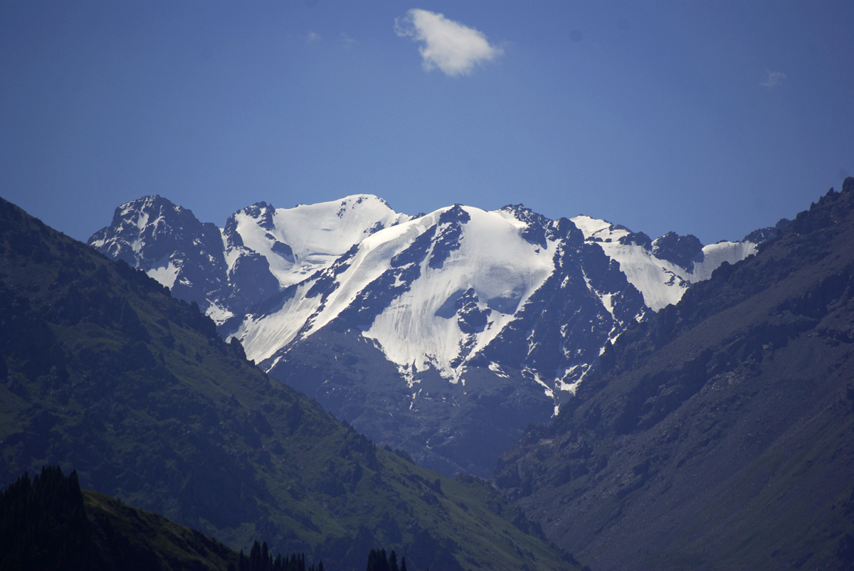
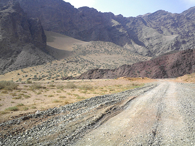
In Chinese, “Tian Shan” literally translates to mean “Heavenly Mountain” or “Mountain of Heaven”. With its glittering snow-capped peaks, sparkling lakes, and emerald-hued forests, this mountain range certainly lives up to its name! Stretching for over 2,500 kilometres (1,500 mi) across Central Asia, it crosses the countries of China, Kazakhstan, Kyrgyzstan, and Uzbekistan. Its diverse landscape, rich biodiversity, and cultural significance meant it was inscribed by UNESCO as a World Heritage Site in 2013.

According to the folk religion of Tengrism, the mountain range is a profoundly sacred place and its second highest peak, the 7,010-metre (23,000 ft.) high Khan Tengri, literally means “King of the Heavens”. Its highest point, known as Jengish Chokusu or “Victory Peak”, towers in at a height of 7,439 metres (24,406 ft.), meaning it is just 1,406 metres (4,613 ft.) shy of Mount Everest and the 60th tallest mountain the world. Together they are classed as the two most northerly peaks over 7,000 metres (23,000 ft.) in the world. It might not be the greatest claim to fame, but they will forever be the Kings in the North!

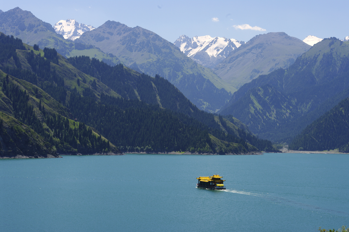
Since the mountain range is one of the longest in Central Asia, it is often separated into a number of smaller ranges for the purpose of ease, including the Barkol Mountains near the city of Hami and the Borohoro Mountains just south of Ürümqi. Within China, it is bounded by the Dzungarian Basin to the north and the Tarim Basin to the south, meaning it forms a natural dividing line within the region of Xinjiang. The mountain range is home to one of Xinjiang’s most popular and celebrated attractions: Tianchi or Heavenly Lake. Resting within a valley on the northern slope of Bogda Peak, this alpine lake is formed from melted snow trickling down from the icy tips of the mountains. Its crystal clear waters reflect the snow-capped peaks above it and the emerald-hued spruces that surround it, creating a breath-taking tableau.

The mountain range’s ethereal beauty is reflected in the many legends about it, as it is rumoured to be the home of the peach tree of immortality, which is fiercely guarded by the Chinese folk deity Xiwangmu or “Queen Mother of the West”. Magical peaches may be the stuff of myth, but the lower slopes are blanked in ancient forests formed of wild walnut, pistachio, apricot, and apple trees. While you may not discover the secret to everlasting life, a trip to the Tian Shan Mountains is sure to be fruitful!

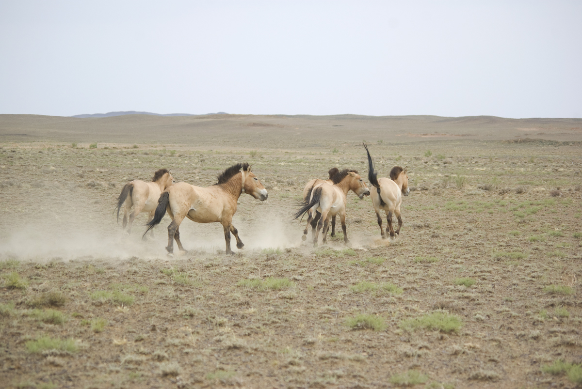
Depending on the altitude, the forests alternate between hardy steppes and lush meadows, with dense clutches of maple trees, junipers, aspens, birches, poplars, and numerous other species. Mixed grasses and wildflowers blanket the alpine meadows on the northern slopes, while the southern slopes are characterised by much sparser vegetation. Wolves, bears, wild boars, foxes, ermines, badgers, mountain goats, deer, and mountain sheep all roam these forests, but the range’s prized inhabitant is far more elusive: the rare and critically endangered snow leopard. Mountaineers who work as guides on the mountain range say they’re lucky to catch a glimpse of this mysterious creature even once in a lifetime!

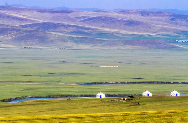
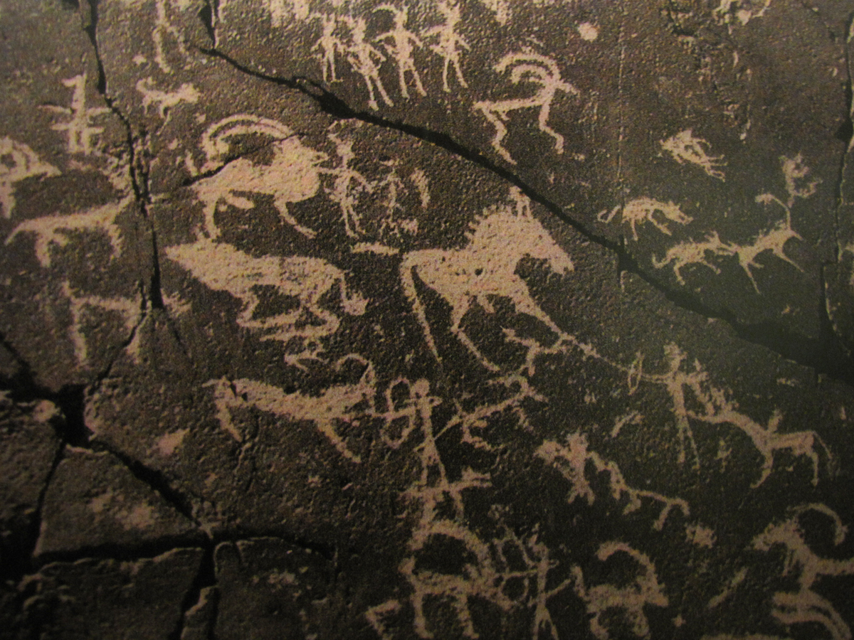
A myriad of China’s ethnic minorities inhabit the region surrounding the Tian Shan Mountains, including the Uyghurs, the Kyrgyz, the Kazakhs, the Mongols, and the Uzbeks. Alongside the majesty of the mountains, many of the Uyghur, Kyrgyz, and Kazakh settlements have become tourist attractions in of themselves, with crowds of visitors flocking there every year to witness traditional festivals, sample local cuisine, and enjoy their unique cultures. From lively horse races to outdoor lamb roasts, a trip to the Tian Shan Mountains would be simply incomplete without a stay in one of these vibrant settlements.

We will meet the the Tian Shan Mountains on the travel: Explore the Silk Road in China

The Helan Mountains

Flanked by unforgiving desert to the west and irrigated farmland known as the Yinchuan Plain to the east, the Helan Mountains form the border between Inner Mongolia and Ningxia. This colossal mountain range stretches for approximately 200 kilometres (124 mi) from north to south, with the Yellow River flowing northward parallel to it. While it averages at about 2,000 metres (6,562 ft.) in altitude, its highest peak is a staggering 3,556 metres (11,667 ft.) tall. To put that into perspective, it’s nearly three times the size of Ben Nevis in Scotland!

Yet the range’s spectacular height is not its only claim to fame. Over 10,000 rock carvings dating from the Neolithic Period (c. 8500-2100 BC) to the Zhou Dynasty (c. 1045-256 BC) are scattered throughout the mountains, many of which are over 3,000 to 10,000 years old! The main concentration of carvings can be found at Helankou, a cavernous gorge that cuts north-west through the mountain chain. While the Helan Mountains acted as natural boundary between the nomadic pastoralists in the north and the sedentary farmers to the south, Helankou represented one of the view places where their diverse lifestyles met.

Mount Helan 02The Helankou Rock Engravings Park and the nearby Yinchuan World Rock Art Museum are the ideal place to discover how these ancient peoples used rock carvings to celebrate and immortalise their simple way of life. The park is the only place where the public is allowed to view the rock carvings, which are usually concentrated in clusters about 10 metres (33 ft.) above the valley base. The engravings themselves are separated into three types: human figures, animals, and symbols.

The human figures typically portray scenes of daily life, such as hunting, herding, making sacrificial offerings to deities, battling, dancing, and procreation. The animal engravings depict creatures that these ancient people either farmed or came across, including tigers, leopards, sika deer, sheep, cattle, horses, and camels. They have provided researchers with invaluable insight into the kind of animal species that once populated the mountains. The symbols tend to be much more complicated and are mainly mask-like faces imbued with a deeper meaning, the most obvious of which is a sun-shaped mask representing the Sun God.

That being said, while the rock carvings may be simple in design, the explanation behind them is relatively speculative. Many historians believe that they may have held some kind of shamanic[1] significance, particularly with regards to the symbols, while others posit that they are of a less spiritual and more documentary nature. Regardless of their origins, these fascinating carvings allow visitors to engage with ancient history in a meaningful and palpable way. Other nearby attractions include the Suyukou Forest Reserve, a vast woodland area filled with unusual rock formations, and Gunzhong Pass  (Rolling Bell Pass), a delightful summer resort designed for the avid hiker.

After all that hiking and sightseeing, you’re bound to be a little thirsty. Fortunately, the Helan Mountains are one of the main centres for the production of wine! Since wines from Ningxia have gained a certain prestige and popularity in China, companies are monopolising on the opportunity by setting up wineries on the mountain range’s eastern base. Whether it’s a robust red or a dry white, your trip to the Helan Mountains is sure to leave you wining!

[1] Shamanism: The practice of attempting to reach altered states of consciousness in order to communicate with the spirit world and channel energy from it into the real world. This can only be done by specialist practitioners known as shaman.

Lake Poyang

Lake Poyang03

Fed by the rippling Gan River that cuts through Jiangxi province, Lake Poyang is the largest freshwater lake in China. Or at least most of the time it is! In fact, the “lake” is actually a system of lakes and swamps that are subject to change throughout the seasons, fluctuating in size dramatically depending on the weather conditions. In winter, the entire area transforms into a dense marsh, crisscrossed with waterways and speckled with verdant hills. In summer, when the region floods due to heavy rain, these hills become islands and the lake swells to its full grandeur.

Tragically, its size has drastically decreased in recent years due to drought and the construction of the Three Gorges Dam. To put it into perspective, the provincial capital of Nanchang once rested on the shores of the lake, but is now 24 kilometres (15 mi) away from it! In spite of this unfortunate change, the lake remains an important habitat for migratory birds and over half a million birds take refuge on its shores every year.

During winter, it becomes home to over 90% of the planet’s Siberian crane population. The Siberian crane is one of the most critically endangered species in the world, with their population dwindling to approximately 3,000 individuals. Since they mate for life and typically live for upwards of 30 years, they have become symbols of longevity and prosperity in Chinese culture. With their pure white feathers and elegant long legs, it’s unsurprising that these delicate creatures draw crowds of bird-watchers to Lake Poyang every year.

Lake Poyang01Researchers have surmised that the lake was formed sometime around the year 400, when the Yangtze River switched to a more southerly course, causing the Gan River to back up and form Lake Poyang. Tragically this triggered mass flooding in Poyang County and Haihun County, forcing innumerable people to abandon their homes and relocate to Wucheng Township (modern-day Yongxiu County). However, as the old saying goes, every cloud has a silver lining! Thanks to this sudden influx of people, Wucheng grew to become one of the wealthiest and most prominent townships in Jiangxi province, which spawned the local phrase: “Drowning Haihun County gives rise to Wucheng Township”.

Yet this isn’t the lake’s only historical claim to fame. It was also the site of the epic Battle of Lake Poyang, which represented one of the greatest naval battles in Chinese history. On the fall of the Yuan Dynasty (1271-1368), numerous rebel groups sought to seize control of the throne, the most powerful of which were the Ming, the Han, and the Wu. In 1363, the Han leader Chen Youliang besieged the city of Nanchang with his formidable navy of tower ships.

In response, the Ming leader Zhu Yuanzhang sent his naval forces, which were smaller but also more nimble. After six harrowing days of fighting on the lake, the Ming achieved a glorious victory, which all but cemented their position as the leading rebel group. Five years later, Zhu finally took power and established the Ming Dynasty (1368-1644) under the title the Hongwu Emperor.

Alongside these historical events, legends abound regarding the lake and its many scenic spots. One such legend recounts why Dagu Hill, a small island nestled in the lake’s clear blue waters, resembles a giant shoe. Many years ago, it’s said that a young fisherman named Hu Qing lived on the hill. One day, he was fishing on the lake when he came across a box containing a beautiful pearl. On his way home that day, he saw a young girl dressed in green, who was softly weeping. He asked her what was wrong, and she told him that she had lost her precious pearl. Without a second thought, he returned the pearl to her and went on his way.

Lake Poyang 02The next day, Hu was once again fishing on the lake when a huge storm eclipsed the shore. He knew he was in grave danger. As he fought the storm, he suddenly saw a maiden dressed in green holding a glowing pearl. Using the light of the pearl, he was able to navigate his way safely back to shore. The girl explained that she was actually a fairy named Da Gu, but she had been exiled to earth because she had violated the holy rules of heaven. As with all good fairy-tales, Hu and Da Gu fell madly in love and got married. However, it seems happily ever after wasn’t in the cards for them!

The Jade Emperor learned that Da Gu had married a mortal man and sent his army to capture her. Meanwhile, a vicious overlord named Sheng Tai had become captivated by Da Gu’s beauty and wanted to make her his own. As the Jade Emperor’s army captured Da Gu and began carrying her back to heaven, she looked down and saw her husband being tortured by Sheng and his cronies. In a desperate attempt to save him, she slipped off one of her shoes. As it fell to earth, it transformed into a huge piece of rock, crushing Sheng’s men and saving Hu. This rock supposedly forms the shoe-like cliff that makes Dagu Hill so unique!

Nowadays, the hill is a popular tourist spot, offering panoramic views of the glistening lake and boasting the magnificent Heaven Flower Palace. That being said, the mystical forces at play on Lake Poyang aren’t always quite so benevolent! Known as China’s “Bermuda Triangle”, the waters surrounding Laoye Temple on the lake’s northern shore are notorious as a place of supernatural activity. On April 16th 1945, a Japanese troop ship and its 20 sailors vanished without a trace while sailing on the lake. Over a period of 30 years, more than 200 boats have mysteriously sunk in these waters, never to be seen again. So, if you’re taking a trip to the temple, be sure to stay on the shore!


The Tarim Basin

The Tarim Basin may seem like a simple geographical phenomenon, but there’s more to it than meets the eye. Covering an area of approximately 1,020,000 square kilometres (390,000 sq. mi), it stretches over more than half of Xinjiang’s territory and is often referred to as Nanjiang or “Southern Xinjiang”, with the northern half of the region being known as Dzungaria or Beijiang. To put that into perspective, it is nearly twice the size of Spain and three times the size of Germany! Its northern boundary is marked by the Tian Shan Mountains, its southern boundary is skirted by the Kunlun Mountains, and its centre is dominated by the hostile Taklamakan Desert.

Historically, the region was known as Altishahr, which translates to “Six Cities” in the language of the Uyghur people. This was in reference to ancient oasis cities such as Kashgar and Turpan, which rested on the outskirts of the Tarim Basin and played a focal role as trading hubs along the Silk Road. The area may seem inhospitable now, but a startling archaeological discovery proved that it was once a cradle of civilisation. At the beginning of the 20th century, famed explorers such as Sven Hedin, Albert von Le Coq, and Aurel Stein ventured into the basin and recounted how, in their quest to unearth historical relics, they’d uncovered a number of desiccated bodies. They would soon come to be known as the Tarim Mummies, and would play an invaluable role in discovering the history of the region.

tarim xiaoheThe vast majority of the mummies were found either on the eastern end or the southern edge of the Tarim Basin. The oldest date back to approximately 1800 BC and, more fascinating still, they are of Caucasoid origin. The extremely arid climate of the desert means the bodies have been beautifully preserved. For example, the famed “Cherchen Man” still boasts his locks of luscious red hair, in spite of having died over 3,000 years ago; the “Witches of Subeshi”, who passed away sometime between the 4th or 3rd century BC, can still be seen with their black felt conical hats; another body found in Subeshi betrays the first potential signs of surgery, as an incision in his abdomen has been sewn up with horsehair; and several bodies have clearly visible tattoos.

The mummies share a number of physical features, including elongated bodies, angular faces, recessed eyes, and blond, brown, or red hair, which are all associated with the Caucasian ethnic group. Modern-day genetic testing appears to confirm this conclusion, since many of the ethnic groups that are native to Xinjiang, such as the Uyghurs, Kazakhs, and Kyrgyz, exhibit both East Asian and Caucasian DNA. Many researchers have speculated that the Tarim Mummies may belong to the Tocharian ethnic group, which were described as having full beards, red or blond hair, deep-set blue or green eyes, and long, aquiline noses. While many of the mummies are now displayed in museums throughout Xinjiang, the mystery they leave behind continues to both plague and delight historians.

In its time, the Tarim Basin has fostered the growth of numerous ancient kingdoms, including the Loulan, the Kucha, and the Khotan. Alongside the Silk Road, it was these multifarious kingdoms that facilitated the dissemination of culture from Central Asia and India into China, most notably the introduction of Buddhism and Islam. Unfortunately the native rivers were deeply temperamental and changes to their course would cause lakes to move, which in turn would necessitate alterations in the routes of the Silk Road. Imagine trying to navigate all of those road closures without a satnav!

The greatest example of this was the desertion of the middle route, which was established during the Han Dynasty (206 BC–220 AD) and ran through the centre of the Tarim Basin towards the lake of Lop Nur. The gradual desiccation of the lake led to the decline of the oasis city Loulan and the collapse of the Loulan Kingdom, which in turn forced travellers to abandon this route from the 6th century onwards. The Tarim Basin was a place of blessing and curse, simultaneously welcoming certain ethnic groups and causing devastation to others.

From the 7th century until the late 8th century, it was a hotly contested region, frequently changing hands between the Tang Dynasty (618-907) and the rival Tibetan Empire (618–842). With so many valuable trade routes, it seemed everyone wanted a piece of the Tarim Basin! By the 9th century, the collapse of the Uyghur Khaganate (744–840) resulted in hundreds of Uyghur immigrants flooding into the region. While researchers believe the Uyghurs were still predominantly Buddhist at this point, Islam was introduced and became the dominant religion when the Muslim Turkic peoples of the Kara-Khanid Khanate (840–1212) conquered the western Tarim Basin at the start of the 11th century. It wasn’t until 1884, under the Qing Dynasty (1644-1912), that Dzungaria and the Tarim Basin were finally combined to form Xinjiang. To this day, they remain two distinct regions with their own cultures, histories, and unique personalities!

Wudalianchi Global Geopark

Wudalianchi 01

Imagine, hundreds of years ago, hearing a thunderous crack rend the air and watching in horror as ash plumed into the sky, blocking out the sun. This was the terrifying reality for the people of Wudalianchi County in Heilongjiang province when, from 1719 to 1721, a sequence of volcanic eruptions sent shockwaves throughout this otherwise peaceful region. As lava rushed up to the surface and snaked its way across the land, it formed two large volcanoes: Mount Laohei and Mount Huoshao. In the process, hardened lava blocked a section of the nearby Amur River, forming a series of five interconnected lakes.

Wudalianchi 03The beauty of these lakes, coupled with the fourteen volcanoes and countless volcanic landforms nearby, meant it was designated by UNESCO as a Global Geopark in 2004. In fact, this scenic area is so integral to the region that its name and the county’s name of “Wudalianchi” literally translates to mean the “Five Conjoined Pools”. While most natural disasters leave behind a trail of destruction and devastation, these volcanic eruptions ended up producing one of the finest natural attractions in China!

The five great lakes, known as Lotus Lake, Yan Mountain Lake, White Dragon Lake, Crane Chirping Lake, and Ruyi Lake, have names equally matching their grandeur. Among them are littered frozen lava cascades, surreal lava stalactites, eerie lava passages, belching fumaroles[1], strangely shaped lapilli[2], and smooth volcanic bombs[3]. These bizarre formations were all produced over millions of years as a result of volcanic activity. After all, with fourteen volcanoes in the vicinity, things are bound to get a little heated! Mount Laohei remains the most popular of the volcanoes and, at a staggering 516 metres (1693 ft.) in height, is also the largest. Evidently sometimes size does matter!

With its shimmering lakes, towering volcanoes, and bizarre lava formations, you’d think Wudalianchi Global Geopark would be a haven for geologists and hikers. Yet many of its visitors are after more than just a glimpse at its natural beauty. According to local legend, over one hundred years ago a young herder from the Daur ethnic minority named Galasangbaiyin lived near Wudalianchi. As with all good folktales, he fell madly in love with a slave girl called Aqimeige. However, when the herd owner discovered their secret affair, he thrashed Galasangbaiyin and locked him in the stables. In a fit of desperation, Aqimeige stole a horse, placed her unconscious lover on its back, and attempted to make her escape.

As she rode away, the herd owner shot her with a poisoned arrow and she fell from the horse, dragging Galasangbaiyin with her. Together they both plunged into a nearby spring and found, to their surprise, that the cool water miraculously cured their wounds. To mark this unbelievable event, Galasangbaiyin inscribed the words “medical spring” on the rock beside it, and Daur herders would swarm to it to take advantage of its healing powers. No one knows exactly which spring is the fabled “medical spring”, but nowadays South Spring, North Spring, South Washing Spring, and Bubbling Spring are all celebrated for their supposed healing properties. Thousands of tourists flock here every year in order to drink or bathe in their waters, hoping to cure whatever ails them.

After some physical healing, you may be in the mood for some spiritual healing. Believe it or not, this volcanic territory, rich with fire and brimstone, is home to a Buddhist temple! If being surrounded by volcanoes wasn’t unique enough, Zhongling Temple is actually nestled deep within Mount Yaoquan’s once fiery volcanic crater. So prepare to get lost on a scenic ride through the lava fields, feel revitalised in the healing springs, or discover more about volcanic landforms at the Wudalianchi Global Geopark Museum. This natural wonderland is simply erupting with tempting possibilities!

[1] Fumarole: An opening in or near a volcano through which hot sulphurous gases emerge.

[2] Lapilli: Lapilli are rock fragments that have been ejected from a volcano during an eruption.

[3] Volcanic bomb: A volcanic bomb is a mass of molten rock that is ejected from a volcanic during an eruption and cools into a solid fragment before it hits the ground. They are typically over 64 millimetres (2.5 in) in diameter.

The Gurbantünggüt Desert

Gurbantünggüt Desert

Ranking behind the expansive Taklamakan Desert, the Gurbantünggüt Desert is the second largest desert in China. It spreads over a colossal area of 50,000 square kilometres (19,000 sq. mi), making it nearly four times the size of Death Valley in the USA! Resting within the Dzungarian Basin in the northern reaches of Xinjiang, it is located to the east of the Manasi River and to the south of the Ulungur River. Throughout the barren sands are interspersed deep oases where over 100 different desert plant species flourish, including magnificent virgin forests made up of desert poplars and saxaul trees. These hardy plants are only provided with rainwater once per year, when the annual snow falls in winter and melts in spring. They add a touch of greenery to the hostile landscape and provide grazing for the wild Mongolian gazelles.

A chain of cities, the largest of which is Xinjiang’s capital of Ürümqi, forms a well-populated strip along the southern edge of the desert. These cities were once major trading hubs along the ancient Silk Road and were able to survive thanks to glacier-fed streams flowing down from the Tian Shan Mountains. At its northwestern edge, the desert is skirted by the Irtysh–Karamay–Ürümqi Canal, an ingenious system that is currently being constructed with the aim of transferring water from the Irtysh River to the arid regions of northern and central Xinjiang. The eastern branch of the canal runs directly across the centre of the desert until it finally reaches the Tian Shan Mountains.

Gurbantünggüt Desert02The western part of the desert was once dominated by salt lakes, although tragically many have disappeared due to the impact of human activities. While the Ailik Lake remains, the Manas Lake dried up long ago. Water is of paramount importance in this scorched desert, particularly when you consider that it is the remotest point of land from any sea or ocean on earth! At its centremost point, it is over 2,600 kilometres (1,600 mi) from the nearest coastline. To put that into perspective, that is nearly twice the length of the United Kingdom!

In spite of its location, the climate of the desert is markedly temperate compared to China’s other sandy behemoths, such as the inhospitable Taklamakan Desert. It is mainly made up of fixed and semi-fixed sand ridges but, unlike other deserts in the region, it does not boast any mega-dunes or dunes of notable height. Instead, it stretches out endlessly towards the horizon, the sands rippling and undulating like some great heaving beast in the sweltering sun.


Mount Emei

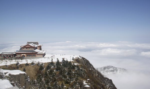
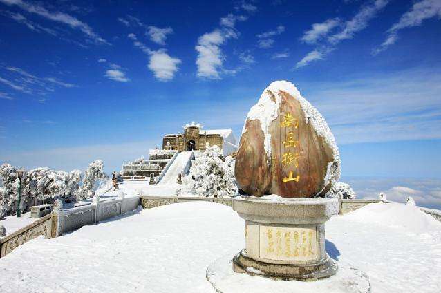
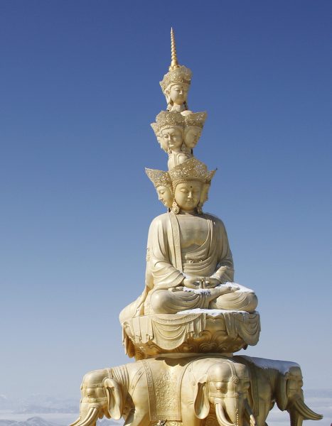
Mount Emei, or “Delicate Eyebrow Mountain”, is so-named because its two major peaks face one another and supposedly resemble the lofty brows of a classical Chinese beauty. The name itself may raise a few eyebrows, but Mount Emei’s unparalleled natural beauty is sure to win the admiration of even the most sceptical tourist! It is classed as one of the Four Sacred Mountains of Chinese Buddhism and its cultural significance, coupled with its spectacular scenery, meant it was designated a UNESCO World Heritage Site in 1996, along with the nearby Leshan Giant Buddha. Reaching a staggering elevation of 3,099 metres (10,167 ft.) at its peak, it is the tallest of the Four Sacred Mountains.

Archaeological evidence indicates that the slopes of Mount Emei may have been settled as early as 10,000 years ago, although the first temple wasn’t built there until the 1st century AD. Originally it was a Taoist retreat, but sometime around the 3rd century it became known as a sacred Buddhist mountain and was the first place in China where a Buddhist temple was built. It is traditionally believed to be the bodhimaṇḍa, or place of enlightenment, of the bodhisattva[1] Samantabhadra, known in Chinese as “Puxian”. For over 2,000 years, this misty mountain has been regarded as a special and intensely holy place.

As time went on, numerous temples and other religious buildings were erected across the mountain’s vast expanse. Nowadays it boasts over 30 temples, ten of which are of particular historical note. However, it seems Mount Emei might be directly facing some serious competition! On a hillside opposite the mountain, the Leshan Giant Buddha looms over the confluence the Minjiang, Dadu, and Qingyi rivers. At a colossal 71 metres (233 ft.) in height, it is the tallest pre-modern statue in the world and is nearly twice the size of Christ the Redeemer in Brazil!

This Buddha may be big, but it’s not quite big enough to completely overshadow its mountainous neighbour. Blanketed in a diverse range of vegetation, from subtropical to subalpine forests, Mount Emei is undoubtedly a feast for the eyes. Some of its trees are over 1,000 years old, matched in age only by its ancient temples. These temples blend seamlessly into their natural surroundings, demonstrating the perfect marriage between man and nature. The most famous of these are Baoguo Temple, Wannian Temple, Qingyin Pavilion, and the Golden Summit.

Baoguo Temple was built during the 16th century, and is widely regarded as the centre of Buddhist activities on the mountain. It is perhaps most famous for the engraved stone slab that hangs above its gate, on which its name was written by the Kangxi Emperor of the Qing Dynasty (1644-1912). However, other major highlights of the temple include its serene gardens, library of sutras[2], and decorative porcelain statue of Buddha.

Unfortunately this statue somewhat pales in comparison to the 7.85 metre-high (26 ft.) bronze statue of Samantabhadra  riding  an elephant that can be found in Wannian Temple, which weighs a stunning 62 tons. In a bizarre twist of fate, it actually weighs over 8 times as much as an actual African elephant! It was commissioned on imperial order during the Song Dynasty (960-1279), although the temple itself was founded sometime during the 4th century. To this day, no one knows exactly how such a hefty statue was transported up the mountain.

Located in the middle section of the mountain, Qingyin Pavilion is a complex of pavilions, towers, and platforms that date from the 6th century onwards. It is crisscrossed by the rushing Black Dragon River and White Dragon River, so-named because their waters are dark green and ivory white respectively. The complex’s architecture is particularly breath-taking, but tragically not enough to make Qingyin Pavilion the mountain’s star attraction. That accolade is solely reserved for the Golden Summit.

The Golden Summit rests at an elevation of 3,077 metres (10,095 ft.) and its name is derived from the small bronze temple at its peak. As if that wasn’t impressive enough, there is also a 48-metre (157 ft.) tall bronze statue of Samantabhadra near the temple, which weighs over 600 tons! While this may not be the mountain’s actual summit, it’s the ideal place to soak in the scenery and experience the Four Great Spectacles of Mount Emei: the sunrise, the sea of clouds, the rays of Buddha, and the sacred lamps. While the sunrise and the sea of clouds are reasonably self-explanatory, the last two natural phenomena are unique features of Mount Emei.

The rays of Buddha occur about 14 times every year and can only be seen when the area is thick with clouds. If you look out into the clouds at the right moment, the refracting light will make it appear as though your shadow is surrounded by a circle of colourful light, much like a rainbow. Similarly, on some dark nights at the summit after it has been raining, you might see flashing lights in the mountain valleys, providing there is no moon in the sky. These fabulous illuminations have been nicknamed the sacred lamps. However, even without these flashing lights, a trip to Mount Emei is sure to dazzle you!

[1] Bodhisattva: The term literally means “one whose goal is awakening”. It refers to a person who seeks enlightenment and is thus on the path to becoming a Buddha. It can be applied to anyone, from a newly inducted Buddhist to a veteran or “celestial” bodhisattva who has achieved supernatural powers through their training.

[2] Sutra: One of the sermons of the historical Buddha.

The Hulunbuir Grasslands

As one of the largest prairies in China, the Hulunbuir Grasslands represent some of the finest patches of untouched wilderness in the country. With over 3,000 rivers, 500 lakes, countless woodlands, and vast meadows making up its expanse, the grasslands are a treasure trove of natural beauty and wonder. Aside from the Greater Khingan Mountains stretching from its north to its south, the area is markedly flat and provides virtually endless views of its lush greenery. Many diverse ethnic groups call this verdant paradise home, from the Mongolians and the Han Chinese to the Manchu and the Daur people.

The grasslands themselves are named after two lakes that lie at their centre: Lake Hulun in the north; and Lake Buir in the south. Lake Hulun is the larger of the two, while Lake Buir lies partially within Inner Mongolia but predominantly in Mongolia proper. A dazzling local legend recounts the origin of these two lakes. There once was a brave Mongolian tribe who boasted a famous couple: a beautiful girl named Hulun, who was renowned for her skill at singing and dancing; and a strong boy named Buir, who was celebrated for his talent at riding and shooting a bow.

One day, a demon came to the prairie and threatened the safety of their tribe. The couple fought against the demon until the girl, realising they could not defeat it in combat, transformed into a lake and drowned the demon. By sacrificing herself, she saved the entire tribe. The boy Buir was so distraught at the loss of his love that he too turned into a lake. In short, rather than crying a river, he wept a lake! This is how the two matching lakes of Hulun and Buir came to be.

Pearl white yurts are dotted throughout the jade-hued grasslands, where farmers while away their leisure hours in the serenity of nature. Nowadays, while the grasslands and lakes continue to be popular tourist attractions, they are mainly used for grazing livestock and farming. Their vast fields abound in horses, sheep, cattle, cashmere goats, and even camels! In fact, the grasslands are held in such high esteem that any produce from the region, such as meat, milk, leather, or wool, is highly sought after. The low level of pollution in the area means that many Chinese people regard animal products from Hulunbuir as “purer” than those from anywhere else.

The region’s northerly location makes it warm and pleasant in the summer, but cold and snowy in the winter. During the summer, the grass looks as green as emeralds and the meadows are awash with a blanket of multi-coloured wildflowers. Visitors can spend blissful days galloping across the plains on horseback, riding camels, taking a tour on a horse-drawn cart, or paddling a boat out into one of the lakes. On festivals or special occasions, wrestling, archery, and horse racing competitions are held throughout the day. In the evening, the smell of traditional roasted lamb wafts on the air and people gather around crackling bonfires as the sun goes down. Even in ancient times, this place was renowned for its beauty and was immortalised in a Chinese poem, which describes it thusly: “The sky is blue, and the grass is boundless; when the long grass bows in the wind, suddenly the horses and sheep will appear”.

The Kumtag Desert (Shanshan)

Located just one kilometre (0.6 mi) from the city of Shanshan, the Kumtag Desert is the closest desert to any city in the world. In spite of widespread desertification across northwestern China, this city has miraculously been spared, as it does not lie in the path of the powerful winds that shift the ever-encroaching sand onto the plains. In 2002, it was established as a national park, making it the ideal place for any visitor who’s ever dreamt of adventuring out into the wilderness like Indiana Jones! It originally covered just 1,880 square kilometres (726 sq. mi), but was expanded to include the 1,000-square kilometre (386 sq. mi) Kanas Geological Park in 2007.

Scientific exploration and sight-seeing may be the park’s main draws, but it is also renowned as a place of healing. Sand treatment, which involves burying affected body parts in warm sand for extended periods of time, is rumoured to cure rheumatism, pelvic problems, backaches, and a variety of other disorders. The sands of time may bring the ailments of old age, but the sands of the Kumtag Desert are sure to heal them!

Mount Heng

Mount Heng 02

With its 72 peaks jutting majestically into the sky, Mount Heng[1] creates a striking tableau in the countryside of Hunan province. Its beauty has earned it the status of “Nanyue” or “South Mountain”, marking it as one of the Five Great Mountains of China. The mountain range itself stretches for a colossal 150 kilometres (93 mi), with Huiyan Peak at its southernmost point and Yuelu Mountain at its northern tip. At a staggering 1,300 metres (4,266 ft.) in height, Zhurong Peak is its highest elevation. Although its natural scenery and cultural significance has attracted a number of visitors, it is probably the least-visited of the Five Great Mountains and makes for an enjoyable hike if you want to escape the tourist crowds.

Many of the forests that blanket its peaks are primeval, with trees averaging at an age of 300 to 400 years and some that are over 1,000 years old. Bent-double and covered in lichen, they somewhat resemble elderly men hunched over from the pain of old age! From rolling clouds to meadows resplendent with colourful flowers, Mount Heng is full of stunning panoramic views. Its spectacular scenery during the four seasons is often described as the “four oceans”: an ocean of flowers, an ocean of trees, an ocean of clouds, and an ocean of snow.

Mount Heng 01The city of Hengyang acts as a gateway to the mountain, although the town at its base is eponymously named Nanyue. Since it is regarded as a sacred mountain, its expanse is littered with marvellous temple complexes and ancient inscriptions. Hidden among the dense pine forests and lush canyons, they have remained as a testament to mankind’s fascination with the mountain. Evidence suggests that scholars and members of the imperial family were visiting Mount Heng as early as 2,000 years ago, leaving stone inscriptions of poetry in their wake.

During the Han Dynasty (206 BC–220 AD), Taoism made its way to the mountain and Taoists designated various “blessed spots” where they would practice their faith. By the Tang Dynasty (618-907), ten large Taoist temples and eight hundred bamboo houses had cropped up to accommodate the influx of Taoist priests. About 200 years after Taoism’s arrival, Buddhism was introduced to Mount Heng. During the Northern and Southern Dynasties Period (420-589), a large group of accomplished Buddhist monks settled there and gradually formed their own religious sects, the most influential of which was the Tiantai Sect. Many of the philosophies that these monks expounded ended up significantly affecting Buddhist religious practices not only in China, but also in Japan and Southeast Asia.

At the foot of the mountain, you’ll find the largest temple complex in southern China, the Grand Temple of Mount Heng. Although its founding year is technically unknown, records indicate that it was built in the year 725. Throughout the Song (960-1279), Yuan (1271-1368), Ming (1368-1644), and Qing (1644-1912) dynasties, it suffered through six fires and underwent 16 large-scale renovations. In 1882, it had to be almost completely rebuilt after being burned down, and it was constructed following the layout of the Forbidden City in Beijing. This earned it the nickname “Little Palace in South China”. As a testimony to the mountain’s multi-religious nature, the temple’s eastern wing is made up of the Eight Temples of Taoism and its western wing hosts the Eight Temples of Buddhism.

However, the highlight of any trip to Mount Heng is undoubtedly seeing its Four Wonders: Zhurong Peak, Water Curtain Cave, Fangguang Temple, and the Sutra[2] Collection Hall. These are famed for their height, oddity, spiritual depth, and architectural elegance respectively. Three may be the magic number, but four is evidently the most wonderful!


[1] This is not to be confused with Mount Heng in Shanxi province, which is also one of China’s Five Great Mountains.

[2] Sutra: One of the sermons of the historical Buddha.